Countries/Territories
Updated 2021-01-12 18:58:07
The names of countries/territories of the world are taught in English and Chinese. This collection of precious dry lands that shares the whole mankind includes not only the world's independent countries, but also specific areas that are not a UNUnited Nations: We the peoples...A stronger UN for a better world. member. Please visit the table of male and female genders of country names in French.
Countries/locations Close
21
id
Country
Country
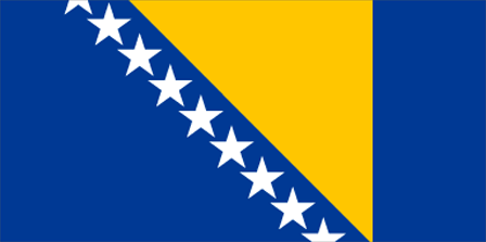
Bosnia and Herzegovina
Country in French
Bosnie-Herzégovine
countryucasefr
BOSNIE-HERZEGOVINE
Country in Chinese
Country in Spanish
Bosnia-bosnia-Herzegovina
Country in Italian
Bosnia-bosnia-Herzegovina
Country in Portuguese
Bósnia-bosnia-Herzegovina
Country in Germain
Bosnien-Bosnia-Herzegovina
countrypy
bo1 si1 ni2 ya4 he2 hei1 se4 ge1 wei2 na4
countrylocal
Bosna i Hercegovina
countryfull
Bosnia and Herzegovina
countrynm
Bosnia and Herzegovina
ISO2
BA
ISO3
BIH
countrycodeisono
070
countrycodevehicle
BIH
countrycodeolympic
BIH
countrycodeirs
BK
countrycodeirsfr
BK
countrycodeirsmixt
BK
♀Female
9
6
180
languagesfr
Bosniaque, Croate, Serbe
18
currency
convertible mark
currencyfr
mark convertible
currencyisocode
BAM
currencyisocodefull
BAM 977
currencypxcode
BAM
currencysymbol
KM
currencysubdivision
100 fennig
currencyregime
Euro (1.95583)
nationalityfr
Bosniaque
Capital
Sarajevo
capitalfr
Sarajevo
Phone Prefix
387
Area km2
51 129
arealand
51 129
landarablerate
0.098
landforestrate
0.446
coastline
20
summit
Maglic 2 386 m.
boundarycountries
Yougoslavie, Croatie
timezonedeltabegin
1
flaglink
maplink
bk-map.gif
outlinemaplink
ba.gif
visapassenger
-1
maincities
Zenica, Tuzla, Gorazde, Bihac, Livno, Siroki, Brijeg, Mostar, Banjaluka
largestcity
Sarajevo
largestcitypopulation
465 000
rankpopulation
119
Population
4 140 000
rankgdp
104
gdp
6973000000
rankgdpppp
92
gdpppp
24703000000
rankgni
109
gni
6352000000
rankincomeorigin
122
rankincome
134
income
1530
rankincomeppp
101
incomeppp
6250
lifeexpectation
72.57
natalityrate
0.01256
mortalityrate
0.00833
mortalityrateinfantile
0.02188
hdi
0.777
urbanization
0.434
nationalevent
National Day
nationaleventfr
Jour National
nationalholiday
25 November (1943)
Birthday yyyy-mm-dd
1943-11-25 00:00:00
10
8
location
Southeastern Europe, bordering the Adriatic Sea and Croatia
terrain
mountains and valleys
naturalresources
coal, iron, bauxite, manganese, forests, copper, c
7
Web
rgbback
16777215
todate
1
22
id
Country
Country
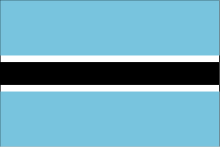
Botswana
Country in French
Botswana
countryucasefr
BOTSWANA
Country in Chinese
Country in Spanish
Botswana
Country in Italian
Il Botswana
Country in Portuguese
Botswana
Country in Germain
Botswana
countrypy
bo2 ci2 wa3 na4
countrylocal
Botswana
countryfull
Botswana
countrynm
Botswana
ISO2
BW
ISO3
BWA
countrycodeisono
072
countrycodevehicle
BW
countrycodeolympic
BOT
countrycodeirs
BC
countrycodeirsfr
BC
countrycodeirsmixt
BC
♂Male
16
6
51
languagesfr
Anglais
19
currency
pula
currencyfr
pula
currencyisocode
BWP
currencyisocodefull
BWP 072
currencypxcode
BWP
currencysymbol
P
currencysubdivision
100 thebe
currencyregime
composite
currencyvalue
0.1795
nationalityfr
Botswanaise
Capital
Gaborone
capitalfr
Gaberone
Phone Prefix
267
Area km2
600 372
arealand
585 370
areawater
15 000
landarablerate
0.0061
landforestrate
0.219
summit
Tsodilo Hill 1 489 m.
boundarycountries
Afrique du Sud, Namibie, Zambie, Zimbabwe.
timezonedeltabegin
2
flaglink
maplink
bwcolor.gif
outlinemaplink
bwout.gif
visapassenger
-1
maincities
Francistown, Lobatsi, Serowe, Selebi-Pikwe, Tutume, Bobonong.
largestcity
Gaborone
largestcitypopulation
182 000
rankpopulation
144
Population
1 722 000
rankgdp
101
gdp
7530000000
rankgdpppp
106
gdpppp
15010000000
rankgni
112
gni
6075000000
rankincomeorigin
86
rankincome
95
income
3530
rankincomeppp
83
incomeppp
8370
lifeexpectation
30.76
alphabetizationrate
0.7885
natalityrate
0.02471
mortalityrate
0.03363
mortalityrateinfantile
0.06998
hdi
0.614
nationalevent
Independence Day (Botswana Day)
nationaleventfr
Jour de l'Indépendance (Jour de Botswana)
nationalholiday
30 September (1966)
Birthday yyyy-mm-dd
1966-09-30 00:00:00
3
7
location
Southern Africa, north of South Africa
terrain
predominantly flat to gently rolling tableland; Kalahari Desert in southwest
naturalresources
diamonds, copper, nickel, salt, soda ash, potash,
9
Web
rgbback
16777215
todate
1
23
id
Country
Country
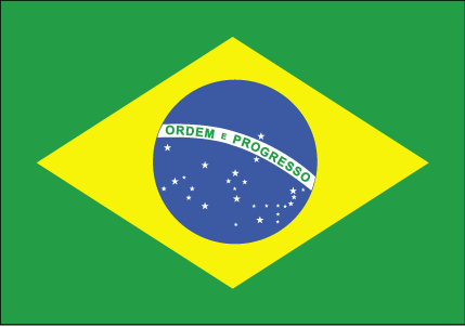
Brazil
Country in French
Brésil
countryucasefr
BRESIL
Country in Chinese
Country in Spanish
El Brasil
Country in Italian
Il Brasile
Country in Portuguese
Brasil
Country in Germain
Brasilien
countrypy
ba1 xi1
countrylocal
Brasil
countryfull
Brazil
countrynm
Brazil
ISO2
BR
ISO3
BRA
countrycodeisono
076
countrycodevehicle
BR
countrycodeolympic
BRA
countrycodeirs
BR
countrycodeirsfr
BR
countrycodeirsmixt
BR
countrycode
55
♂Male
17
6
114
languagesfr
Portugais
21
currency
real
currencyfr
real
currencyisocode
BRL
currencyisocodefull
BRL 986
currencypxcode
BRL
currencysymbol
R$
currencysubdivision
100 centavos
currencyregime
float
currencyvalue
0.4091
nationalityfr
Brésilienne
Capital
Brasilia
capitalfr
Brasilia
Phone Prefix
55
Area km2
8 511 965
arealand
8 456 510
areawater
55 455
landarablerate
0.063
landforestrate
0.643
coastline
7491
summit
Pico de Neblina 3 014 m.
boundarycountries
Uruguay, Argentine, Bolivie, Paraguay, Pérou, Colombie, Vénézuéla, Guyane.
timezonedeltabegin
-2
timezonedeltaend
-5
flaglink
maplink
brcolor.gif
outlinemaplink
br.gif
visapassenger
-1
maincities
Sao Paulo, Rio de Janeiro, Belo Horizonte, Salvador, Fortaleza, Nova Iguaçu, Recife, Curitiba, Pôrto Alegre, Belém, Goiâna, Campinas.
largestcity
Sao Paulo
largestcitypopulation
16 533 000
rankpopulation
5
Population
176 596 000
rankgdp
15
gdp
492338000000
rankgdpppp
9
gdpppp
1375756000000
rankgni
13
gni
479515000000
rankincomeorigin
95
rankincome
105
income
2720
rankincomeppp
86
incomeppp
7510
lifeexpectation
71.41
alphabetizationrate
0.86
natalityrate
0.01725
mortalityrate
0.00614
mortalityrateinfantile
0.03066
hdi
0.777
nationalevent
Independence Day
nationaleventfr
Jour de l'Indépendance
nationalholiday
7 September (1822)
Birthday yyyy-mm-dd
1822-09-07 00:00:00
9
7
location
Eastern South America, bordering the Atlantic Ocean
terrain
mostly flat to rolling lowlands in north; some plains, hills, mountains, and narrow coastal belt
naturalresources
bauxite, gold, iron ore, manganese, nickel, phosph
cooking
Football + Cuisine Epicée.
9
Web
rgbback
16777215
todate
1
Notes
Football + Cuisine Epicée.
24
id
Country
Country
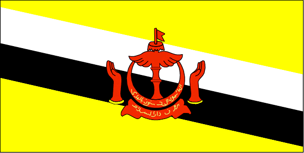
Brunei
Country in French
Brunei
countryucasefr
BRUNEI
Country in Chinese
Country in Spanish
Brunei
Country in Italian
Brunei
Country in Portuguese
Brunei
Country in Germain
Brunei
countrypy
wen2 lai2 da2 lu3 sa4 lan2 guo2
countrylocal
Negara Brunei Darussalam
countryfull
Brunei
countrynm
Brunei
ISO2
BN
ISO3
BRN
countrycodeisono
096
countrycodevehicle
BRU
countrycodeolympic
BRU
countrycodeirs
BX
countrycodeirsfr
BX
countrycodeirsmixt
BX
♂Male
12
3
100
languagesfr
Malais
23
currency
ringgit (a.k.a. Bruneian dollar)
currencyfr
dollar de Brunei
currencyisocode
BND
currencyisocodefull
BND 096
currencypxcode
BND
currencysymbol
B$
currencysubdivision
100 sen (a.k.a. 100 cents)
currencyregime
S$ (1.0)
currencyvalue
0.602
Capital
Bandar Seri Begawan
capitalfr
Bandar Seri Begawan
Phone Prefix
673
Area km2
5 765
arealand
5 270
areawater
500
landarablerate
0.0057
coastline
161
summit
Gunung Pâgon Periok 1 850 m.
boundarycountries
Malaisie
timezonedeltabegin
8
flaglink
maplink
bncolor.gif
outlinemaplink
bnout.gif
visapassenger
-1
maincities
Seria, Kuala Belait, Lumut.
largestcity
Bandar Seri Begawan
rankpopulation
168
Population
356 000
rankgni
96
gni
7960000000
rankincomeorigin
19
rankincome
22
income
22743
lifeexpectation
74.54
alphabetizationrate
0.9135
natalityrate
0.01933
fecondity
2.48
mortalityrate
0.0034
mortalityrateinfantile
0.01305
hdi
0.872
urbanization
0.728
nationalevent
National Day
nationaleventfr
Jour National
nationalholiday
23 February (1984)
Birthday yyyy-mm-dd
1984-02-23 00:00:00
1
1
location
Southeastern Asia, bordering the South China Sea and Malaysia
terrain
flat coastal plain rises to mountains in east; hilly lowland in west
naturalresources
petroleum, natural gas, timber
9
rgbback
16777215
todate
1
25
id
Country
Country
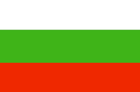
Bulgaria
Country in French
Bulgarie
countryucasefr
BULGARIE
Country in Chinese
Country in Spanish
Bulgaria
Country in Italian
La Bulgaria
Country in Portuguese
Bulgária
Country in Germain
Bulgarien
countrypy
bao3 jia1 li4 ya4
countrylocal
Bulgaria
countryfull
Bulgaria
countrynm
Bulgaria
ISO2
BG
ISO3
BGR
countrycodeisono
100
countrycodevehicle
BG
countrycodeolympic
BUL
countrycodeirs
BU
countrycodeirsfr
BU
countrycodeirsmixt
BU
♀Female
18
6
29
languagesfr
Bulgare
20
currency
new lev
currencyfr
lev
currencyisocode
BGN
currencyisocodefull
BGN 975
currencypxcode
BGL
currencysymbol
Lv
currencysubdivision
100 stotinki
currencyregime
Euro (1.95583)
currencyvalue
0.6252
nationalityfr
Bulgare
Capital
Sofia
capitalfr
Sofia
Phone Prefix
359
Area km2
111 000
arealand
110 550
areawater
360
landarablerate
0.39
landforestrate
0.334
coastline
354
summit
Musala 2 925 m.
boundarycountries
Yougoslavie, Macédoine, Turquie, Roumanie, Grèce
timezonedeltabegin
2
flaglink
maplink
bu-map.gif
outlinemaplink
bg.gif
visapassenger
-1
maincities
Plovdiv, Varna, Burgas, Ruse, Stara Zagora, Pleven, Tolbukhin, Sliven, Shumen
largestcity
Sofia
largestcitypopulation
1 188 000
rankpopulation
90
Population
7 823 000
rankgdp
70
gdp
19860000000
rankgdpppp
63
gdpppp
60483000000
rankgni
76
gni
16637000000
rankincomeorigin
107
rankincome
117
income
2130
rankincomeppp
85
incomeppp
7540
lifeexpectation
71.75
alphabetizationrate
0.98
natalityrate
0.00965
mortalityrate
0.01425
mortalityrateinfantile
0.02131
hdi
0.795
urbanization
0.674
nationalevent
Liberation Day
nationaleventfr
Jour de la Libération
nationalholiday
3 March (1878)
Birthday yyyy-mm-dd
1878-03-03 00:00:00
5
3
location
Southeastern Europe, bordering the Black Sea, between Romania and Turkey
terrain
mostly mountains with lowlands in north and southeast
naturalresources
bauxite, copper, lead, zinc, coal, timber, arable
7
Web
rgbback
16777215
todate
1
26
id
Country
Country
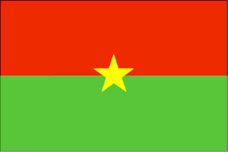
Burkina Faso
Country in French
Burkina Faso
countryucasefr
BURKINA FASO
Country in Chinese
Country in Spanish
Burkino Faso
Country in Italian
Burkino Faso
Country in Portuguese
Burkino Faso
Country in Germain
Burkino Faso
countrypy
bu4 ji1 na4 fa3 suo3
countrylocal
Burkina Faso
countryfull
Burkina Faso
countrynm
Burkina Faso
ISO2
BF
ISO3
BFA
countrycodeisono
854
countrycodevehicle
BF
countrycodeolympic
BUR
countrycodeirs
UV
countrycodeirsfr
UV
countrycodeirsmixt
UV
♂Male
16
4
57
languagesfr
Français
119
currency
franc
currencyfr
franc C.F.A.
currencyisocode
XOF
currencyisocodefull
XOF 952
currencypxcode
XOF
currencysymbol
CFAF
currencysubdivision
100 centimes
currencyregime
Euro (655.957)
currencyvalue
0.00186
Capital
Ouagadougou
capitalfr
Ouagadougou
Phone Prefix
226
Area km2
274 200
arealand
273 800
areawater
400
landarablerate
0.1243
landforestrate
0.259
summit
Tena Kourou 749 m.
boundarycountries
Côte d'Ivoire, Mali, Bénin, Togo, Ghana.
flaglink
maplink
bfcolor.gif
outlinemaplink
bfout.gif
visapassenger
-1
maincities
Bobo Dioulasso, Koudougou, Ouahigouya, Banfora, Kaya.
largestcity
Ouagadougou
largestcitypopulation
824 000
rankpopulation
65
Population
12 109 000
rankgdp
126
gdp
4182000000
rankgdpppp
110
gdpppp
14218000000
rankgni
135
gni
3587000000
rankincomeorigin
183
rankincome
197
income
300
rankincomeppp
183
incomeppp
1170
lifeexpectation
53.8
alphabetizationrate
0.2585
natalityrate
0.04478
mortalityrate
0.01876
mortalityrateinfantile
0.09978
hdi
0.33
nationalevent
Republic Day
nationaleventfr
Jour de la République
nationalholiday
11 December (1958)
Birthday yyyy-mm-dd
1958-12-11 00:00:00
5
11
location
Western Africa, north of Ghana
terrain
mostly flat to dissected, undulating plains; hills in west and southeast
naturalresources
manganese, limestone, marble; small deposits of go
9
Web
rgbback
16777215
todate
1
27
id
Country
Country
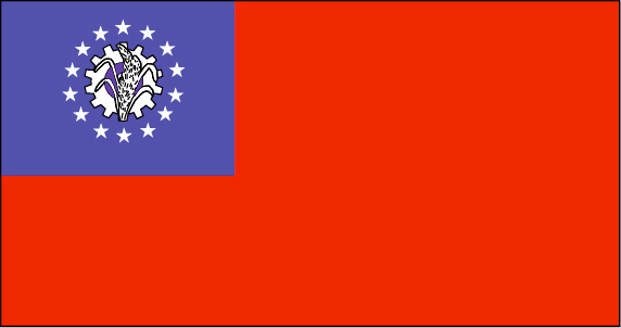
Myanmar
Country in French
Birmanie
countryucasefr
BIRMANIE
Country in Chinese
Country in Spanish
Birmania
Country in Italian
La Birmania
Country in Portuguese
Burma
Country in Germain
Birma
countrypy
mian3 dian4
countrylocal
Myanma Naingngandaw
countryfull
Burma
countrynm
Burma
ISO2
MM
ISO3
MMR
countrycodeisono
104
countrycodevehicle
BUR
countrycodeolympic
MYA
countrycodeirs
BM
countrycodeirsfr
BM
countrycodeirsmixt
BM
♀Female
2
1
30
languagesfr
Birman
120
currency
kyat
currencyfr
kyat
currencyisocode
MMK
currencyisocodefull
MMK 104
currencypxcode
MMK
currencysymbol
K
currencysubdivision
100 pyas
currencyregime
US-$ (5.86of, 200-300bm)
currencyvalue
0.1599
Capital
Rangoon
capitalfr
Rangoon
Phone Prefix
95
Area km2
676 552
arealand
657 740
areawater
20 760
landarablerate
0.1453
landforestrate
0.523
coastline
1930
summit
Hkakabo Razi 5 881 m.
boundarycountries
Bangladesh, Inde, Tibet, Chine, Laos, Thaïlande.
timezonedeltabegin
6.5
flaglink
maplink
mmcolor.gif
outlinemaplink
mmout.gif
visapassenger
-1
maincities
Mandalay, Moulmein, Pegu, Bassein, Akyab, Myeik.
largestcity
Yangon
largestcitypopulation
3 873 000
rankpopulation
24
Population
49 363 000
rankgni
38
gni
92900000000
rankincomeorigin
117
rankincome
126
income
1896
lifeexpectation
55.79
alphabetizationrate
0.806
natalityrate
0.01915
mortalityrate
0.01217
mortalityrateinfantile
0.07035
precipitation
2681
nationalevent
Independence Day
nationaleventfr
Jour de l'Indépendance
nationalholiday
4 January (1948)
Birthday yyyy-mm-dd
1948-01-04 00:00:00
4
12
location
Southeastern Asia, bordering the Andaman Sea and the Bay of Bengal, between Bangladesh and Thailand
terrain
central lowlands ringed by steep, rugged highlands
naturalresources
petroleum, timber, tin, antimony, zinc, copper, tu
9
rgbback
16777215
todate
1
28
id
Country
Country
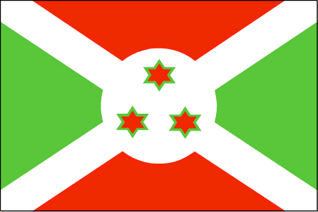
Burundi
Country in French
Burundi
countryucasefr
BURUNDI
Country in Chinese
Country in Spanish
Burundi
Country in Italian
Il Burundi
Country in Portuguese
Burundi
Country in Germain
Burundi
countrypy
pu2 long2 di4
countrylocal
Burundi
countryfull
Burundi
countrynm
Burundi
ISO2
BI
ISO3
BDI
countrycodeisono
108
countrycodevehicle
RU
countrycodeolympic
BDI
countrycodeirs
BY
countrycodeirsfr
BY
countrycodeirsmixt
BY
♂Male
15
2
57
languagesfr
Français
131
currency
franc
currencyfr
franc de Burundi
currencyisocode
BIF
currencyisocodefull
BIF 108
currencypxcode
BIF
currencysymbol
FBu
currencysubdivision
100 centimes [*]
currencyregime
composite
currencyvalue
0.00097
Capital
Bujumbura
capitalfr
Bujumbura
Phone Prefix
257
Area km2
27 834
arealand
25 650
areawater
2 180
landarablerate
0.2998
landforestrate
0.037
summit
Mont Heha 2 760 m.
boundarycountries
Congo démocratique, Rwanda, Tanzanie.
timezonedeltabegin
2
flaglink
maplink
bicolor.gif
outlinemaplink
biout.gif
visapassenger
-1
maincities
Gitega, Bururi, Rumonge, Ngozi.
largestcity
Bujumbura
largestcitypopulation
278 000
rankpopulation
92
Population
7 206 000
rankgdp
167
gdp
595000000
rankgdpppp
142
gdpppp
4668000000
rankgni
186
gni
628000000
rankincomeorigin
207
rankincome
220
income
90
rankincomeppp
205
incomeppp
630
lifeexpectation
43.36
alphabetizationrate
0.507
natalityrate
0.03968
mortalityrate
0.01761
mortalityrateinfantile
0.0704
hdi
0.37
urbanization
0.093
nationalevent
Independence Day
nationaleventfr
Jour de l'Indépendance
nationalholiday
1 July (1962)
Birthday yyyy-mm-dd
1962-07-01 00:00:00
9
3
location
Central Africa, east of Democratic Republic of the Congo
terrain
hilly and mountainous, dropping to a plateau in east, some plains
naturalresources
nickel, uranium, rare earth oxides, peat, cobalt,
9
Web
rgbback
16777215
todate
1
29
id
Country
Country
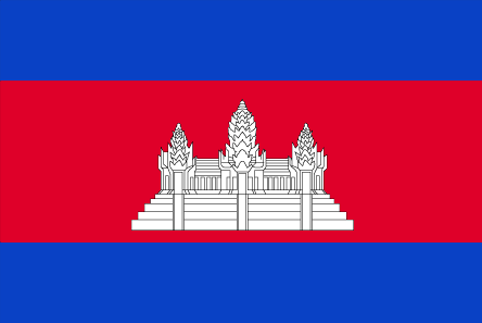
Cambodia
Country in French
Cambodge
countryucasefr
CAMBODGE
Country in Chinese
Country in Spanish
Camboya
Country in Italian
La Cambogia
Country in Portuguese
Cambodia
Country in Germain
Kambodscha
countrypy
jian3 pu3 zhai4
countrylocal
Kampuchea
countryfull
Cambodia
countrynm
Cambodia
ISO2
KH
ISO3
KHM
countrycodeisono
116
countrycodevehicle
K
countrycodeolympic
CAM
countrycodeirs
CB
countrycodeirsfr
CB
countrycodeirsmixt
CB
♂Male
14
4
89
languagesfr
Khmer
24
currency
new riel
currencyfr
riel
currencyisocode
KHR
currencyisocodefull
KHR 116
currencypxcode
KHR
currencysymbol
CR
currencysubdivision
100 sen
currencyregime
m.float
currencyvalue
0.00025
nationalityfr
Cambodgienne
Capital
Phnum Penh
capitalfr
Phnom Penh
Phone Prefix
855
Area km2
181 035
arealand
176 520
areawater
4 520
landarablerate
0.2096
landforestrate
0.529
coastline
443
summit
Phnum Aôral 1 813 m.
boundarycountries
Thaïlande, Laos, Vietnam.
timezonedeltabegin
7
flaglink
maplink
khcolor.gif
outlinemaplink
khout.gif
visapassenger
-1
maincities
Battambang, Pursat, Kompong Cham, Kampot, Siem Reap, Kratie, Kompong Chhnang.
largestcity
Phnum Penh
largestcitypopulation
429 000
rankpopulation
61
Population
13 404 000
rankgdp
125
gdp
4228000000
rankgdpppp
89
gdpppp
27856000000
rankgni
126
gni
4088000000
rankincomeorigin
183
rankincome
197
income
300
rankincomeppp
160
incomeppp
2000
lifeexpectation
57.92
alphabetizationrate
0.673
natalityrate
0.02728
mortalityrate
0.00926
mortalityrateinfantile
0.07594
nationalevent
Independence Day
nationaleventfr
Jour de l'Indépendance
nationalholiday
9 November (1953)
Birthday yyyy-mm-dd
1953-11-09 00:00:00
10
6
location
Southeastern Asia, bordering the Gulf of Thailand, between Thailand, Vietnam, and Laos
terrain
mostly low, flat plains; mountains in southwest and north
naturalresources
timber, gemstones, some iron ore, manganese, phosp
cooking
Riz.
9
rgbback
16777215
todate
1
Notes
Riz.
30
id
Country
Country
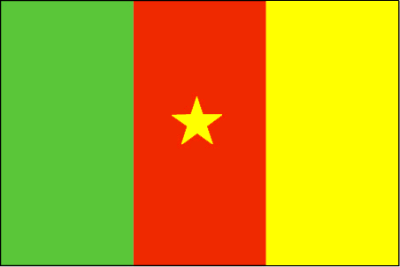
Cameroon
Country in French
Cameroun
countryucasefr
CAMEROUN
Country in Chinese
Country in Spanish
Camerún
Country in Italian
Il Cameroon
Country in Portuguese
Cameroon
Country in Germain
Cameroon
countrypy
ka4 mai4 long2
countrylocal
Cameroon
countryfull
Cameroon
countrynm
Cameroon
ISO2
CM
ISO3
CMR
countrycodeisono
120
countrycodevehicle
CAM
countrycodeolympic
CMR
countrycodeirs
CM
countrycodeirsfr
CM
countrycodeirsmixt
CM
♂Male
15
4
57
languagesfr
Français
119
currency
franc
currencyfr
franc C.F.A.
currencyisocode
XAF
currencyisocodefull
XAF 950
currencypxcode
XAF
currencysymbol
CFAF
currencysubdivision
100 centimes
currencyregime
Euro (655.957)
currencyvalue
0.00186
nationalityfr
Camerounaise
Capital
Yaounde
capitalfr
Yaoundé
Phone Prefix
237
Area km2
475 439
arealand
469 440
areawater
6 000
landarablerate
0.1281
landforestrate
0.513
coastline
402
summit
Fako 4 095 m.
boundarycountries
Nigeria, Tchad, Centrafrique, Congo, Guinée équatoriale, Gabon.
timezonedeltabegin
1
flaglink
maplink
cmcolor.gif
outlinemaplink
cmout.gif
visapassenger
-1
maincities
Douala, N'kongsamba, Maroua, Garoua, Bafoussam, Kumba, Bamenda, Foumban.
largestcity
Douala
largestcitypopulation
1 320 000
rankpopulation
57
Population
16 087 000
rankgdp
86
gdp
12491000000
rankgdpppp
79
gdpppp
34077000000
rankgni
92
gni
10139000000
rankincomeorigin
154
rankincome
168
income
630
rankincomeppp
161
incomeppp
1990
lifeexpectation
48.05
alphabetizationrate
0.541
natalityrate
0.03549
mortalityrate
0.0153
mortalityrateinfantile
0.07012
hdi
0.528
nationalevent
Republic Day (National Day)
nationaleventfr
Jour de la République (Jour National)
nationalholiday
20 May (1972)
Birthday yyyy-mm-dd
1972-05-20 00:00:00
9
1
location
Western Africa, bordering the Bight of Biafra, between Equatorial Guinea and Nigeria
terrain
diverse, with coastal plain in southwest, dissected plateau in center, mountains in west, plains in north
naturalresources
petroleum, bauxite, iron ore, timber, hydropower
cooking
Magnoc.
9
Web
rgbback
16777215
todate
1
Notes
Magnoc.
| Countries/Territories | Regions of China | Provinces of China | Regions in France | French Departments | States/Provinces | Cities/Towns | Locations | World Continents | French AOP Wines
Give us feedback (1)
1. Visitor *.*.214.* - 2021-09-24 05:33:15
This is the first time I've ever heard that these countries aren't members of the UN. Thanks for the info and contact us in Chandler if you need the most reliable tree removal service.

Asia Home™ Store Bosnia and Herzegovina 波斯尼亚和黑塞哥维那 => Countries/Territories General Sales Conditions Returns and refunding Privacy Policy FAQ
Popup Window Close