Pays/Territoires
Mise à jour 2021-01-12 18:58:07
Les noms des pays/territoires du monde sont donnés en Français et Chinois. Cette collection des précieuses terres fermes du monde que toute l'humanité partage inclut non seulement les pays indépendants, mais aussi des régions spécifiques qui ne sont pas membre de l'ONUOrganisation des Nations Unies: Nous, peuples des Nations Unies ... Une ONU plus forte pour un monde meilleur. Veuillez aussi consulter les noms des pays en masculin et féminin en Français.
GéoPays Fermer
11
id
Pays
Pays en Anglais
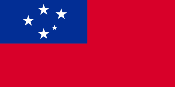
Samoa
Pays
Samoa Occidental
countryucasefr
SAMOA OCCIDENTAL
Pays en Chinois
Pays en Espagnol
Samoa (Occidental)
Pays en Italien
La Samoa (Occidentale)
Pays en Portugais
Samoa (Ocidental)
Pays en Allemand
Samoa-Inseln (Westlich)
countrypy
sa4 mo2 ya4
countrylocal
Samoa
countryfull
Samoa
countrynm
Samoa
ISO2
WS
ISO3
WSM
countrycodeisono
882
countrycodevehicle
WS
countrycodeolympic
SAM
countrycodeirs
WS
countrycodeirsfr
WS
countrycodeirsmixt
WS
♂Masulin
12
6
185
languagesfr
Samoan, Anglais
117
currency
tala
currencyfr
dollar des Samoa
currencyisocode
WST
currencyisocodefull
WST 882
currencypxcode
WST
currencysymbol
WS$
currencysubdivision
100 sene
currencyregime
composite
currencyvalue
0.367
Capitale
Apia
capitalfr
Apia
Préfixe Tél.
685
Superficie km2
2 860
arealand
2 934
areawater
10
landarablerate
0.1943
landforestrate
0.372
coastline
403
summit
Mauga Silisili 1 857 m.
timezonedeltabegin
-11
flaglink
maplink
wscolor.gif
outlinemaplink
ws.gif
visapassenger
-1
maincities
Satupaitea, Tuasivi, Salaiula, Siumu
largestcity
Apia
largestcitypopulation
33 000
rankpopulation
178
Population
178 000
rankgdp
176
gdp
268000000
rankgdpppp
156
gdpppp
1042000000
rankgni
199
gni
257000000
rankincomeorigin
124
rankincome
136
income
1440
rankincomeppp
108
incomeppp
5780
lifeexpectation
70.41
alphabetizationrate
0.9965
natalityrate
0.01569
fecondity
4.12
mortalityrate
0.00647
mortalityrateinfantile
0.02872
hdi
0.775
urbanization
0.377
nationalevent
Independence Day Celebration
nationaleventfr
Jour de l'Indépendance
nationalholiday
1 June (1962)
Date de naissance aaaa-mm-jj
1962-06-01 00:00:00
9
3
location
Oceania, group of islands in the South Pacific Ocean, about one-half of the way from Hawaii to New Zealand
terrain
narrow coastal plain with volcanic, rocky, rugged mountains in interior
naturalresources
hardwood forests, fish, hydropower
9
rgbback
16777215
todate
1
12
id
Pays
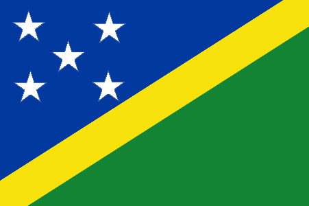
Pays en Anglais
Solomon Islands
Pays
Salomon
countryucasefr
SALOMON
Pays en Chinois
Pays en Espagnol
Islas De Solomon
Pays en Italien
Isole Di Solomon
Pays en Portugais
Consoles De Solomon
Pays en Allemand
Inseln Solomon
countryfull
Solomon Islands
countrynm
Solomon Islands
ISO2
SB
ISO3
SLB
countrycodeisono
090
countrycodeolympic
SOL
countrycodeirs
BP
countrycodeirsfr
BP
countrycodeirsmixt
BP
18
6
51
languagesfr
Anglais
94
currency
dollar
currencyfr
dollar des Salomon
currencyisocode
SBD
currencyisocodefull
SBD 090
currencypxcode
SBD
currencysymbol
SI$
currencysubdivision
100 cents
currencyregime
composite
currencyvalue
0.1358
Capitale
Honiara
capitalfr
Honiara
Préfixe Tél.
677
Superficie km2
28 450
arealand
27 540
areawater
910
landarablerate
0.015
landforestrate
0.888
coastline
5313
summit
Mount Makarakomburu 2 447 m.
timezonedeltabegin
11
flaglink
maplink
sbcolor.gif
outlinemaplink
sb.gif
visapassenger
-1
maincities
Kirakira, Auki, Tangarare, Gizo, Gateri.
largestcity
Honiara
largestcitypopulation
53 000
rankpopulation
163
Population
457 000
rankgdp
178
gdp
253000000
rankgdpppp
161
gdpppp
800000000
rankgni
200
gni
255000000
rankincomeorigin
158
rankincome
172
income
560
rankincomeppp
174
incomeppp
1710
lifeexpectation
72.38
alphabetizationrate
0.77
natalityrate
0.0316
fecondity
4.42
mortalityrate
0.00404
mortalityrateinfantile
0.02209
growthrate
0.02756
hdi
0.632
urbanization
0.202
precipitation
3290
nationalevent
Independence Day
nationaleventfr
Jour de l'Indépendance
nationalholiday
7 July (1978)
Date de naissance aaaa-mm-jj
1978-07-07 00:00:00
5
7
location
Oceania, group of islands in the South Pacific Ocean, east of Papua New Guinea
terrain
mostly rugged mountains with some low coral atolls
naturalresources
fish, forests, gold, bauxite, phosphates, lead, zi
9
rgbback
16777215
todate
1
13
id
Pays
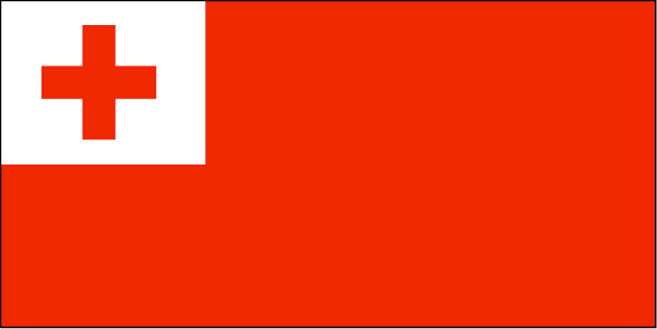
Pays en Anglais
Tonga
Pays
Tonga
countryucasefr
TONGA
Pays en Chinois
Pays en Espagnol
Tonga
Pays en Italien
La Tonga
Pays en Portugais
Tonga
Pays en Allemand
Tonga
countryfull
Tonga
countrynm
Tonga
ISO2
TO
ISO3
TON
countrycodeisono
776
countrycodeolympic
TGA
countrycodeirs
TN
countrycodeirsfr
TN
countrycodeirsmixt
TN
♀Féminin
12
4
202
languagesfr
Tongan, Anglais
160
currency
pa'anga
currencyfr
paanga
currencyisocode
TOP
currencyisocodefull
TOP 776
currencypxcode
TOP
currencysymbol
PT or T$
currencysubdivision
100 seniti
currencyregime
composite
currencyvalue
0.5262
Capitale
Nuku'alofa
capitalfr
Nukualofa
Préfixe Tél.
676
Superficie km2
748
arealand
718
areawater
30
landarablerate
0.2361
landforestrate
0.055
coastline
419
summit
1 033 m.
timezonedeltabegin
13
flaglink
maplink
tocolor.gif
outlinemaplink
to.gif
visapassenger
-1
maincities
Neiafu, Pangai.
largestcity
Nuku' alofa
largestcitypopulation
40 000
rankpopulation
188
Population
102 000
rankgdp
181
gdp
163000000
rankgdpppp
162
gdpppp
710000000
rankgni
204
gni
152000000
rankincomeorigin
123
rankincome
135
income
1490
rankincomeppp
91
incomeppp
6910
lifeexpectation
69.2
natalityrate
0.02487
fecondity
3.71
mortalityrate
0.00545
mortalityrateinfantile
0.01299
growthrate
0.011
urbanization
0.53
nationalevent
Independence Day
nationaleventfr
Jour de l'Indépendance
nationalholiday
4 June (1970)
Date de naissance aaaa-mm-jj
1970-06-04 00:00:00
7
11
location
Oceania, archipelago in the South Pacific Ocean, about two-thirds of the way from Hawaii to New Zealand
terrain
most islands have limestone base formed from uplifted coral formation; others have limestone overlying volcanic base
naturalresources
fish, fertile soil
9
rgbback
16777215
todate
1
14
id
Pays
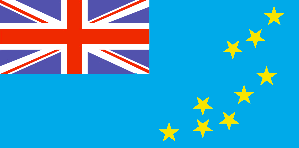
Pays en Anglais
Tuvalu
Pays
Tuvalu
countryucasefr
TUVALU
Pays en Chinois
Pays en Espagnol
Tuvalu
Pays en Italien
Tuvalu
Pays en Portugais
Tuvalu
Pays en Allemand
Tuvalu
countrypy
tu3 wa3 lu3
countryfull
Tuvalu
countrynm
Tuvalu
ISO2
TV
ISO3
TUV
countrycodeisono
798
countrycodeolympic
TUV
countrycodeirs
TV
countrycodeirsfr
TV
countrycodeirsmixt
TV
♂Masulin
12
6
51
languagesfr
Anglais
10
currency
dollar
currencyfr
dollar australien
currencyisocode
AUD
currencyisocodefull
AUD 036
currencypxcode
AUD
currencysymbol
A$
currencysubdivision
100 cents
currencyregime
float
currencyvalue
0.7485
Capitale
Funafuti
capitalfr
Funafuti
Préfixe Tél.
688
Superficie km2
26
arealand
26
coastline
24
summit
5 m.
timezonedeltabegin
12
flaglink
maplink
tvcolor.gif
outlinemaplink
tv.gif
visapassenger
-1
largestcity
Funafuti
rankpopulation
221
Population
10 838
rankgni
216
gni
20000000
rankincomeorigin
120
rankincome
129
income
1818
lifeexpectation
67.66
alphabetizationrate
0.55
natalityrate
0.02163
mortalityrate
0.00724
mortalityrateinfantile
0.02069
urbanization
0.532
nationalevent
Independence Day
nationaleventfr
Jour de l'Indépendance
nationalholiday
1 October (1978)
Date de naissance aaaa-mm-jj
1978-10-01 00:00:00
5
7
president
Reine Elisabeth II
location
Oceania, island group consisting of nine coral atolls in the South Pacific Ocean, about one-half of the way from Hawaii to Australia
terrain
very low-lying and narrow coral atolls
naturalresources
fish
9
rgbback
16777215
todate
1
15
id
Pays
Pays en Anglais
Vanuatu
Pays
Vanuatu
countryucasefr
VANUATU
Pays en Chinois
Pays en Espagnol
Vanuatu
Pays en Italien
Vanuatu
Pays en Portugais
Vanuatu
Pays en Allemand
Vanuatu
countrypy
wa3 nu3 a1 tu2
countrylocal
Vanuatu
countryfull
Vanuatu
countrynm
Vanuatu
ISO2
VU
ISO3
VUT
countrycodeisono
548
countrycodeolympic
VAN
countrycodeirs
NH
countrycodeirsfr
NH
countrycodeirsmixt
NH
♂Masulin
16
6
51
languagesfr
Anglais, Français
116
currency
vatu
currencyfr
vatu
currencyisocode
VUV
currencyisocodefull
VUV 548
currencypxcode
VUV
currencysymbol
VT
currencysubdivision
100 centimes
currencyregime
composite
currencyvalue
0.00917
Capitale
Port-Vila
capitalfr
Port-Vila
Préfixe Tél.
678
Superficie km2
14 763
arealand
12 200
landarablerate
0.0246
landforestrate
0.367
coastline
2528
summit
Mount Tabwemasana 1 880 m.
timezonedeltabegin
11
flaglink
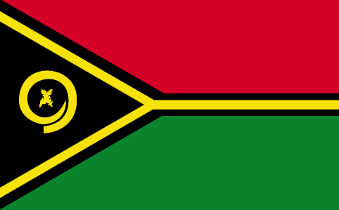
maplink
vucolor.gif
outlinemaplink
vu.gif
visapassenger
-1
maincities
Santo, Norsupo, Lamap, Isangel
largestcity
Port Vila
largestcitypopulation
23 000
rankpopulation
177
Population
210 000
rankgdp
175
gdp
283000000
rankgdpppp
164
gdpppp
619000000
rankgni
201
gni
248000000
rankincomeorigin
129
rankincome
141
income
1180
rankincomeppp
145
incomeppp
2900
lifeexpectation
62.1
alphabetizationrate
0.525
natalityrate
0.02367
fecondity
4.13
mortalityrate
0.00802
mortalityrateinfantile
0.05663
growthrate
0.01566
hdi
0.568
urbanization
0.247
nationalevent
Independence Day
nationaleventfr
Jour de l'Indépendance
nationalholiday
30 July (1980)
Date de naissance aaaa-mm-jj
1980-07-30 00:00:00
7
9
location
Oceania, group of islands in the South Pacific Ocean, about three-quarters of the way from Hawaii to Australia
terrain
mostly mountains of volcanic origin; narrow coastal plains
naturalresources
manganese, hardwood forests, fish
9
Web
rgbback
16777215
todate
1
16
id
Pays
Pays en Anglais
Palau
Pays
Palaos
countryucasefr
PALAOS
Pays en Chinois
countryfull
Palau
countrynm
Palau
ISO2
PW
ISO3
PLW
countrycodeisono
585
countrycodeolympic
PLW
countrycodeirs
PW
countrycodeirsfr
PW
countrycodeirsmixt
PW
♂Masulin
19
6
51
languagesfr
Anglais
6
currency
dollar
currencyfr
Dollar
currencyisocode
USD
currencyisocodefull
USD 840
currencypxcode
USD
currencysymbol
$
currencysubdivision
100 cents
currencyregime
float
currencyvalue
1
Capitale
Koror
capitalfr
Koror
Préfixe Tél.
680
Superficie km2
494
arealand
458
landarablerate
0.2174
landforestrate
0.761
coastline
1519
summit
Mount Ngerchelchauus 242 m.
boundarycountries
Anies.
timezonedeltabegin
9
flaglink
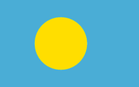
maplink
palau.jpg
maincities
Anies
largestcity
Koror
largestcitypopulation
12 000
rankpopulation
207
Population
20 000
rankgdp
182
gdp
126000000
rankgni
206
gni
130000000
rankincomeorigin
66
rankincome
73
income
6500
nationalevent
Constitution Day
nationaleventfr
Jour de la Constitution
nationalholiday
9 July (1979)
Date de naissance aaaa-mm-jj
1979-07-09 00:00:00
6
8
location
Oceania, group of islands in the North Pacific Ocean, southeast of the Philippines
terrain
varying geologically from the high, mountainous main island of Babelthuap to low, coral islands usually fringed by large barrier reefs
naturalresources
forests, minerals (especially gold), marine produc
9
rgbback
16777215
todate
1
| Pays/Territoires | Régions en Chine | Provinces de Chine | Régions en France | Départements de France | Provinces du Monde | Villes/Villages | Localités | Continents du Monde | Vins AOP
