Pays/Territoires
Mise à jour 2021-01-12 18:58:07
Les noms des pays/territoires du monde sont donnés en Français et Chinois. Cette collection des précieuses terres fermes du monde que toute l'humanité partage inclut non seulement les pays indépendants, mais aussi des régions spécifiques qui ne sont pas membre de l'ONUOrganisation des Nations Unies: Nous, peuples des Nations Unies ... Une ONU plus forte pour un monde meilleur. Veuillez aussi consulter les noms des pays en masculin et féminin en Français.
GéoPays Fermer
11
id
Pays
Pays en Anglais
Cote d'Ivory
Pays
Côte d'Ivoire
countryucasefr
COTE D'IVOIRE
Pays en Chinois
Pays en Espagnol
Cote D'Ivoire (Costa de Marfil)
Pays en Italien
Cote D'Ivoire (Costa D'avorio)
Pays en Portugais
Cote D'Ivoire (Costa De Marfim)
Pays en Allemand
Cote D'Ivoire (Die Elfenbeinküste)
countrypy
ke1 te4 di2 wa3
countrylocal
Cote d'Ivoire
countryfull
Cote d'Ivoire
countrynm
Cote d'Ivoire
ISO2
CI
ISO3
CIV
countrycodeisono
384
countrycodevehicle
CI
countrycodeolympic
CIV
countrycodeirs
IV
countrycodeirsfr
IV
countrycodeirsmixt
IV
countrycode
225
♀Féminin
15
4
57
languagesfr
Français
119
currency
franc
currencyfr
franc C.F.A.
currencyisocode
XOF
currencyisocodefull
XOF 952
currencypxcode
XOF
currencysymbol
CFAF
currencysubdivision
100 centimes
currencyregime
Euro (655.957)
currencyvalue
0.00186
nationality
Côte d'Ivoire
nationalityfr
Ivoirienne
Capitale
Yamoussoukro
capitalfr
Yamoussoukro
Préfixe Tél.
225
Superficie km2
322 462
arealand
318 000
areawater
4 460
landarablerate
0.0928
landforestrate
0.224
coastline
515
summit
Mont Nimba 1 752 m.
boundarycountries
Burkina Faso, Liberia, Guinée, Mali, Ghana.
flaglink

maplink
cicolor.gif
outlinemaplink
ciout.gif
visapassenger
-1
maincities
Abidjan, Bouaké, Daloa, Man, Danané, Korhogo, Gagnoa.
largestcity
Yamoussoukro
largestcitypopulation
2 793 000
rankpopulation
55
Population
16 835 000
rankgdp
83
gdp
13734000000
rankgdpppp
91
gdpppp
24857000000
rankgni
86
gni
11124000000
rankincomeorigin
152
rankincome
166
income
660
rankincomeppp
180
incomeppp
1400
lifeexpectation
44.72
alphabetizationrate
0.538
natalityrate
0.03999
mortalityrate
0.01674
mortalityrateinfantile
0.09223
nationalevent
Independence Day
nationaleventfr
Jour de l'Indépendance
nationalholiday
7 August (1960)
Date de naissance aaaa-mm-jj
1960-08-07 00:00:00
7
1
location
Western Africa, bordering the North Atlantic Ocean, between Ghana and Liberia
terrain
mostly flat to undulating plains; mountains in northwest
naturalresources
petroleum, natural gas, diamonds, manganese, iron
cooking
Fruits Tropicaux.
9
Web
rgbback
16777215
todate
1
Notes
Fruits Tropicaux. Capital noted is official, Abidjan (de facto)
12
id
Pays
Pays en Anglais
Egypt
Pays
Egypte
countryucasefr
EGYPTE
Pays en Chinois
Pays en Espagnol
Egipto
Pays en Italien
L'Egitto
Pays en Portugais
Egipto
Pays en Allemand
Ägypten
countrypy
ai1 ji2
countrylocal
Misr
countryfull
Egypt
countrynm
Egypt
ISO2
EG
ISO3
EGY
countrycodeisono
818
countrycodevehicle
ET
countrycodeolympic
EGY
countrycodeirs
EG
countrycodeirsfr
EG
countrycodeirsmixt
EG
countrycode
20
♀Féminin
15
4
3
languagesfr
Arabe
36
currency
pound
currencyfr
livre égyptienne
currencyisocode
EGP
currencyisocodefull
EGP 818
currencypxcode
EGP
currencysymbol
£E
currencysubdivision
100 piasters or 1,000 milliemes
currencyregime
m.float
currencyvalue
0.173
nationalityfr
Egyptienne
Capitale
Cairo
capitalfr
Le Caire
Préfixe Tél.
20
Superficie km2
1 001 449
arealand
995 450
areawater
6 000
landarablerate
0.0285
landforestrate
0.001
coastline
2450
summit
Jabal Katrînah 2 642 m
boundarycountries
Libye, Israël, Palestine, Soudan.
timezonedeltabegin
2
flaglink
maplink
egcolor.gif
outlinemaplink
egout.gif
visapassenger
-1
maincities
Alexandrie, Ismaïlia, Gîza, Port Saïd, Assiout, Helwân, Tanta, El Mahlla el Kubra, Zagazig, El Mansoura, Suez, Assouan.
largestcity
Cairo
largestcitypopulation
9 690 000
rankpopulation
17
Population
67 559 000
rankgdp
42
gdp
82427000000
rankgdpppp
29
gdpppp
266853000000
rankgni
38
gni
93850000000
rankincomeorigin
126
rankincome
138
income
1390
rankincomeppp
132
incomeppp
3940
lifeexpectation
70.41
alphabetizationrate
0.484
natalityrate
0.02436
mortalityrate
0.00535
mortalityrateinfantile
0.03526
nationalevent
Revolution Day
nationaleventfr
Jour de le Révolution
nationalholiday
23 July (1952)
Date de naissance aaaa-mm-jj
1952-07-23 00:00:00
9
5
location
Northern Africa, bordering the Mediterranean Sea, between Libya and the Gaza Strip, and the Red Sea north of Sudan, and includes the Asian Sinai Peninsula
terrain
vast desert plateau interrupted by Nile valley and delta
naturalresources
petroleum, natural gas, iron ore, phosphates, mang
9
Web
rgbback
16777215
todate
1
13
id
Pays
Pays en Anglais
Equatorial Guinea
Pays
Guinée équatoriale
countryucasefr
GUINEE EQUATORIALE
Pays en Chinois
Pays en Espagnol
Guinea Ecuatorial
Pays en Italien
Guinea Equatoriale
Pays en Portugais
Guinea Equatorial
Pays en Allemand
Äquatoriale Guine
countrypy
chi4 dao4 ji3 nei4 ya4
countrylocal
Guinea Ecuatorial
countryfull
Equatorial Guinea
countrynm
Equatorial Guinea
ISO2
GQ
ISO3
GNQ
countrycodeisono
226
countrycodeolympic
GEQ
countrycodeirs
EK
countrycodeirsfr
EK
countrycodeirsmixt
EK
♀Féminin
15
4
131
languagesfr
Espagnol
119
currency
franc
currencyfr
franc C.F.A.
currencyisocode
GQE
currencyisocodefull
GQE 226
currencypxcode
GQE
currencysymbol
CFAF
currencysubdivision
100 centimos
currencyregime
Euro (655.957)
nationalityfr
Guinéenne
Capitale
Malabo
capitalfr
Malabo
Préfixe Tél.
240
Superficie km2
28 051
arealand
28 051
landarablerate
0.0463
landforestrate
0.625
coastline
296
summit
Pico de Santa Isabel 3 008 m.
boundarycountries
Cameroun, Gabon.
timezonedeltabegin
1
flaglink
maplink
gqcolor.gif
outlinemaplink
gqout.gif
visapassenger
-1
maincities
Bata, Luba, Mbini, Evinayong, Ebebiyin, Mongono.
largestcity
Malabo
largestcitypopulation
30 000
rankpopulation
161
Population
494 000
rankgdp
135
gdp
2915000000
rankgdpppp
128
gdpppp
8988000000
rankgni
195
gni
327000000
rankincomeorigin
150
rankincome
165
income
700
rankincomeppp
116
incomeppp
5100
lifeexpectation
55.15
alphabetizationrate
0.85
natalityrate
0.03656
mortalityrate
0.01227
mortalityrateinfantile
0.08708
hdi
0.664
urbanization
0.493
nationalevent
Independence Day
nationaleventfr
Jour de l'Indépendance
nationalholiday
12 October (1968)
Date de naissance aaaa-mm-jj
1968-10-12 00:00:00
5
9
location
Western Africa, bordering the Bight of Biafra, between Cameroon and Gabon
terrain
coastal plains rise to interior hills; islands are volcanic
naturalresources
oil, petroleum, timber, small unexploited deposits
9
Web
rgbback
16777215
todate
1
14
id
Pays
Pays en Anglais
Eritrea
Pays
Erythrée
countryucasefr
ERYTHREE
Pays en Chinois
Pays en Espagnol
Eritrea
Pays en Italien
Eritrea
Pays en Portugais
Eritrea
Pays en Allemand
Eritrea
countrypy
e4 li4 te4 li3 ya4
countrylocal
Hagere Ertra
countryfull
Eritrea
countrynm
Eritrea
ISO2
ER
ISO3
ERI
countrycodeisono
232
countrycodeolympic
ERI
countrycodeirs
ER
countrycodeirsfr
ER
countrycodeirsmixt
ER
♀Féminin
7
1
3
languagesfr
Tigrinya, Arabe
134
currency
nakfa
currencyisocode
ERN
currencyisocodefull
ERN 232
currencypxcode
ERN
currencysymbol
Nfa
currencysubdivision
100 cents
Capitale
Asmara
capitalfr
Asmara
Préfixe Tél.
291
Superficie km2
121 320
arealand
121 320
landarablerate
0.0387
landforestrate
0.135
coastline
2234
summit
Soira 3 013 m.
boundarycountries
Djibouti, Ethiopie, Soudan.
timezonedeltabegin
3
flaglink
maplink
ercolor.gif
outlinemaplink
erout.gif
visapassenger
-1
maincities
Massawa, Aseb.
largestcity
Asmara
largestcitypopulation
431 000
rankpopulation
116
Population
4 390 000
rankgdp
160
gdp
751000000
rankgdpppp
147
gdpppp
3727000000
rankgni
175
gni
851000000
rankincomeorigin
198
rankincome
212
income
190
rankincomeppp
190
incomeppp
1020
lifeexpectation
52.7
alphabetizationrate
0.578
natalityrate
0.03903
mortalityrate
0.01336
mortalityrateinfantile
0.07559
hdi
0.446
urbanization
0.191
nationalevent
Independence Day
nationaleventfr
Jour de l'Indépendance
nationalholiday
24 May (1993)
Date de naissance aaaa-mm-jj
1993-05-24 00:00:00
10
10
location
Eastern Africa, bordering the Red Sea, between Djibouti and Sudan
terrain
dominated by extension of Ethiopian north-south trending highlands, descending on the east to a coastal desert plain, on the northwest to hilly terrain and on the southwest to flat-to-rolling plains
naturalresources
gold, potash, zinc, copper, salt, possibly oil and
9
rgbback
16777215
todate
1
15
id
Pays
Pays en Anglais
Ethiopia
Pays
Ethiopie
countryucasefr
ETHIOPIE
Pays en Chinois
Pays en Espagnol
Etiopía
Pays en Italien
L'Etiopia
Pays en Portugais
Etiópia
Pays en Allemand
Äthiopien
countrypy
ai3 sai4 e2 bi3 ya4
countrylocal
Ityop'iya
countryfull
Ethiopia
countrynm
Ethiopia
ISO2
ET
ISO3
ETH
countrycodeisono
231
countrycodevehicle
ETH
countrycodeolympic
ETH
countrycodeirs
ET
countrycodeirsfr
ET
countrycodeirsmixt
ET
♀Féminin
4
181
languagesfr
Amharique
135
currency
birr
currencyfr
Birr
currencyisocode
ETB
currencyisocodefull
ETB 230
currencypxcode
ETB
currencysymbol
Br
currencysubdivision
100 cents
currencyregime
float
currencyvalue
0.1154
nationalityfr
Ethiopienne
Capitale
Addis Abeba
capitalfr
Addis Abeba
Préfixe Tél.
251
Superficie km2
1 127 127
arealand
1 119 683
areawater
7 444
landarablerate
0.099
landforestrate
0.042
summit
Ras Dashen Terara 4 620 m.
boundarycountries
Soudan, Erythrée, Djibouti, Somalie, Somaliland, Kenya.
timezonedeltabegin
3
flaglink
maplink
etcolor.gif
outlinemaplink
etout.gif
visapassenger
-1
maincities
Gonder, Dire Dawa, Dessié, Jimma, A Nazret, Harar, Mak'alé, Bahir Dar.
largestcity
Addis Abeba
largestcitypopulation
2 431 000
rankpopulation
16
Population
68 613 000
rankgdp
106
gdp
6652000000
rankgdpppp
68
gdpppp
48780000000
rankgni
108
gni
6355000000
rankincomeorigin
207
rankincome
220
income
90
rankincomeppp
201
incomeppp
710
lifeexpectation
41.24
alphabetizationrate
0.2766
natalityrate
0.03981
mortalityrate
0.02017
mortalityrateinfantile
0.10322
nationalevent
National Day (defeat of MENGISTU regime)
nationaleventfr
Jour National
nationalholiday
28 May (1991)
Date de naissance aaaa-mm-jj
1991-05-28 00:00:00
8
8
location
Eastern Africa, west of Somalia
terrain
high plateau with central mountain range divided by Great Rift Valley
naturalresources
small reserves of gold, platinum, copper, potash,
9
Web
rgbback
16777215
todate
1
16
id
Pays
Pays en Anglais
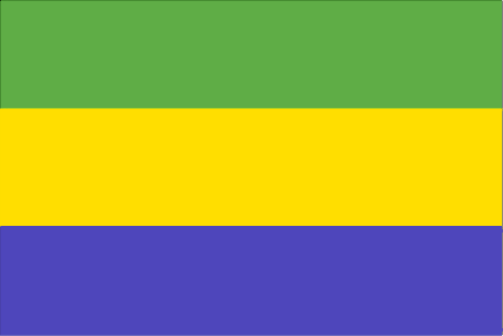
Gabon
Pays
Gabon
countryucasefr
GABON
Pays en Chinois
Pays en Espagnol
Gabón
Pays en Italien
Il Gabon
Pays en Portugais
Gabon
Pays en Allemand
Gabun
countrypy
jia1 peng2
countrylocal
Gabon
countryfull
Gabon
countrynm
Gabon
ISO2
GA
ISO3
GAB
countrycodeisono
266
countrycodevehicle
G
countrycodeolympic
GAB
countrycodeirs
GB
countrycodeirsfr
GB
countrycodeirsmixt
GB
♂Masulin
15
4
57
languagesfr
Français
119
currency
franc
currencyfr
franc C.F.A.
currencyisocode
XAF
currencyisocodefull
XAF 950
currencypxcode
XAF
currencysymbol
CFAF
currencysubdivision
100 centimes [*]
currencyregime
Euro (655.957)
currencyvalue
0.00186
nationalityfr
Française
Capitale
Libreville
capitalfr
Libreville
Préfixe Tél.
241
Superficie km2
267 667
arealand
257 667
areawater
10 000
landarablerate
0.0126
landforestrate
0.847
coastline
885
summit
Mont Iboudji 1 580 m.
boundarycountries
Guinée équatoriale, Cameroun, Congo.
timezonedeltabegin
1
flaglink
maplink
gacolor.gif
outlinemaplink
gaout.gif
visapassenger
-1
maincities
Port Gentil, Lambarené, Mouila, Tchibanga, Oyem.
largestcity
Libreville
largestcitypopulation
419 000
rankpopulation
148
Population
1 344 000
rankgdp
111
gdp
6057000000
rankgdpppp
131
gdpppp
8600000000
rankgni
124
gni
4489000000
rankincomeorigin
89
rankincome
99
income
3340
rankincomeppp
110
incomeppp
5500
lifeexpectation
56.46
alphabetizationrate
0.71
natalityrate
0.0364
mortalityrate
0.01143
mortalityrateinfantile
0.05434
hdi
0.653
urbanization
0.823
precipitation
2841
nationalevent
Founding of the Gabonese Democratic Party (PDG)
nationaleventfr
Création du Parti Démocratique Gabonais
nationalholiday
12 March (1968)
Date de naissance aaaa-mm-jj
1968-03-12 00:00:00
5
9
location
Western Africa, bordering the Atlantic Ocean at the Equator, between Republic of the Congo and Equatorial Guinea
terrain
narrow coastal plain; hilly interior; savanna in east and south
naturalresources
petroleum, manganese, uranium, gold, timber, iron
9
Web
rgbback
16777215
todate
1
17
id
Pays
Pays en Anglais
Gambia, The
Pays
Gambie
countryucasefr
GAMBIE
Pays en Chinois
Pays en Espagnol
Gambia
Pays en Italien
La Gambia
Pays en Portugais
Gambia
Pays en Allemand
Gambia
countrypy
gang1 bi3 ya4
countrylocal
The Gambia
countryfull
Gambia, The
countrynm
Gambia, The
ISO2
GM
ISO3
GMB
countrycodeisono
270
countrycodevehicle
WAG
countrycodeolympic
GAM
countrycodeirs
GA
countrycodeirsfr
GA
countrycodeirsmixt
GA
♀Féminin
15
4
51
languagesfr
Anglais
136
currency
dalasi
currencyfr
Dalasi
currencyisocode
GMD
currencyisocodefull
GMD 270
currencypxcode
GMD
currencysymbol
D
currencysubdivision
100 butut
currencyregime
float
currencyvalue
0.03663
nationalityfr
Gambienne
Capitale
Banjul
capitalfr
Banjul
Préfixe Tél.
220
Superficie km2
11 295
arealand
10 000
areawater
1 300
landarablerate
0.195
landforestrate
0.481
coastline
80
summit
53 m.
boundarycountries
Sénégal.
flaglink

maplink
gmcolor.gif
outlinemaplink
gmout.gif
visapassenger
-1
maincities
Serrekunda, Brikama, Bakau, Farafenni, Guntur, Sukuta.
largestcity
Banjul
largestcitypopulation
186 000
rankpopulation
146
Population
1 421 000
rankgdp
170
gdp
395000000
rankgdpppp
151
gdpppp
2641000000
rankgni
191
gni
387000000
rankincomeorigin
189
rankincome
203
income
270
rankincomeppp
169
incomeppp
1740
lifeexpectation
54.79
alphabetizationrate
0.3905
natalityrate
0.0403
mortalityrate
0.01208
mortalityrateinfantile
0.07348
hdi
0.463
urbanization
0.536
nationalevent
Independence Day
nationaleventfr
Jour de l'Indépendance
nationalholiday
18 February (1965)
Date de naissance aaaa-mm-jj
1965-02-18 00:00:00
2
6
location
Western Africa, bordering the North Atlantic Ocean and Senegal
terrain
flood plain of the Gambia River flanked by some low hills
naturalresources
fish
9
Web
rgbback
16777215
todate
1
18
id
Pays
Pays en Anglais
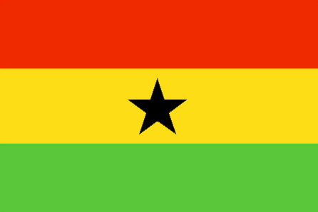
Ghana
Pays
Ghana
countryucasefr
GHANA
Pays en Chinois
Pays en Espagnol
Ghana
Pays en Italien
Il Ghana
Pays en Portugais
Ghana
Pays en Allemand
Ghana
countrypy
jia1 na4
countrylocal
Ghana
countryfull
Ghana
countrynm
Ghana
ISO2
GH
ISO3
GHA
countrycodeisono
288
countrycodevehicle
GH
countrycodeolympic
GHA
countrycodeirs
GH
countrycodeirsfr
GH
countrycodeirsmixt
GH
♂Masulin
19
6
51
languagesfr
Anglais
41
currency
new cedi
currencyfr
cedi
currencyisocode
GHC
currencyisocodefull
GHC 288
currencypxcode
GHC
currencysymbol
¢
currencysubdivision
100 psewas
currencyregime
float
currencyvalue
0.00011
Capitale
Accra
capitalfr
Accra
Préfixe Tél.
233
Superficie km2
238 538
arealand
230 940
areawater
8 520
landarablerate
0.1582
landforestrate
0.278
coastline
539
summit
Afadjoto 885 m.
boundarycountries
Côte d'Ivoire, Togo, Burkina Faso.
flaglink
maplink
ghcolor.gif
outlinemaplink
ghout.gif
visapassenger
-1
maincities
Kumasi, Tamale, Tema, Secondi-Takoradi, Cape Coast, Koforidua, Sunyani, Ho.
largestcity
Accra
largestcitypopulation
1 673 000
rankpopulation
48
Population
20 669 000
rankgdp
100
gdp
7624000000
rankgdpppp
70
gdpppp
46253000000
rankgni
107
gni
6548000000
rankincomeorigin
181
rankincome
195
income
320
rankincomeppp
155
incomeppp
2190
lifeexpectation
56.53
alphabetizationrate
0.603
natalityrate
0.02584
mortalityrate
0.01053
mortalityrateinfantile
0.05302
hdi
0.548
nationalevent
Independence Day
nationaleventfr
Jour de l'Indépendance
nationalholiday
6 March (1957)
Date de naissance aaaa-mm-jj
1957-03-06 00:00:00
4
10
location
Western Africa, bordering the Gulf of Guinea, between Cote d'Ivoire and Togo
terrain
mostly low plains with dissected plateau in south-central area
naturalresources
gold, timber, industrial diamonds, bauxite, mangan
cooking
Fruits de Mer
9
Web
rgbback
16777215
todate
1
Notes
Fruits de Mer
19
id
Pays
Pays en Anglais
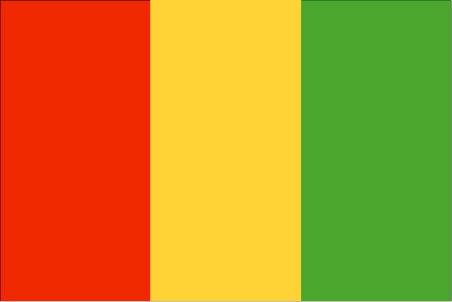
Guinea
Pays
Guinée
countryucasefr
GUINEE
Pays en Chinois
Pays en Espagnol
Guinea
Pays en Italien
Guinea
Pays en Portugais
Guinea
Pays en Allemand
Guine
countrypy
ji1 nei4 ya4
countrylocal
Guinee
countryfull
Guinea
countrynm
Guinea
ISO2
GN
ISO3
GIN
countrycodeisono
324
countrycodevehicle
RG
countrycodeolympic
GUI
countrycodeirs
GV
countrycodeirsfr
GV
countrycodeirsmixt
GV
♀Féminin
15
4
57
languagesfr
Français
138
currency
syli
currencyfr
franc guinéen
currencyisocode
GNS
currencyisocodefull
GNS 324
currencypxcode
GNF
currencysymbol
FG
currencysubdivision
10 francs, 1 franc = 100 centimes
currencyregime
m.float
currencyvalue
0.0003
nationalityfr
Guinéenne
Capitale
Conakry
capitalfr
Gonakry
Préfixe Tél.
224
Superficie km2
245 860
arealand
245 857
landarablerate
0.036
landforestrate
0.282
coastline
320
summit
Mont Nimba 1 752 m.
boundarycountries
Guinée Bissau, Côte d'Ivoire, Sénégal, Mali, Libéria, Sierra Leone.
flaglink
maplink
gncolor.gif
outlinemaplink
gnout.gif
visapassenger
-1
maincities
Kankan, Labé, Nzerékoré.
largestcity
Conakry
largestcitypopulation
1 558 000
rankpopulation
89
Population
7 909 000
rankgdp
129
gdp
3630000000
rankgdpppp
105
gdpppp
16582000000
rankgni
138
gni
3384000000
rankincomeorigin
171
rankincome
185
income
430
rankincomeppp
158
incomeppp
2080
lifeexpectation
49.7
alphabetizationrate
0.4105
natalityrate
0.04226
mortalityrate
0.01553
mortalityrateinfantile
0.09182
hdi
0.425
urbanization
0.279
precipitation
3784
nationalevent
Independence Day
nationaleventfr
Jour de l'Indépendance
nationalholiday
2 October (1958)
Date de naissance aaaa-mm-jj
1958-10-02 00:00:00
5
11
location
Western Africa, bordering the North Atlantic Ocean, between Guinea-Bissau and Sierra Leone
terrain
generally flat coastal plain, hilly to mountainous interior
naturalresources
bauxite, iron ore, diamonds, gold, uranium, hydrop
9
Web
rgbback
16777215
todate
1
20
id
Pays
Pays en Anglais
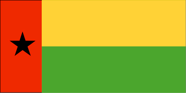
Guinea-Bissau
Pays
Guinée-Bissau
countryucasefr
GUINEE-BISSAU
Pays en Chinois
Pays en Espagnol
Guinea-Bissau
Pays en Italien
La Guinea-Bissau
Pays en Portugais
Guiné-Bissau
Pays en Allemand
Guinea-Bissau
countryfull
Guinea-Bissau
countrynm
Guinea-Bissau
ISO2
GW
ISO3
GNB
countrycodeisono
624
countrycodeolympic
GBS
countrycodeirs
PU
countrycodeirsfr
PU
countrycodeirsmixt
PU
♀Féminin
15
6
114
languagesfr
Portugais
139
currency
franc
currencyfr
peso
currencyisocode
XOF
currencyisocodefull
XOF 952
currencypxcode
XOF
currencysymbol
CFAF
currencysubdivision
100 centimes [*]
currencyregime
Euro (655.957)
currencyvalue
0.00186
nationalityfr
Guinéenne
Capitale
Bissau
capitalfr
Bissau
Préfixe Tél.
245
Superficie km2
36 120
arealand
28 000
areawater
8 120
landarablerate
0.1067
landforestrate
0.605
coastline
350
summit
300 m.
boundarycountries
Sénégal, Guinée.
flaglink
maplink
gwcolor.gif
outlinemaplink
gwout.gif
visapassenger
-1
maincities
Bafatá, Gabu, Mansôa, Catió, Canchungo, Farim.
largestcity
Bissau
largestcitypopulation
233 000
rankpopulation
145
Population
1 489 000
rankgdp
180
gdp
239000000
rankgdpppp
155
gdpppp
1058000000
rankgni
203
gni
202000000
rankincomeorigin
202
rankincome
217
income
140
rankincomeppp
202
incomeppp
680
lifeexpectation
46.98
alphabetizationrate
0.4145
natalityrate
0.03803
mortalityrate
0.01657
mortalityrateinfantile
0.10872
hdi
0.373
urbanization
0.323
nationalevent
Independence Day
nationaleventfr
Jour de l'Indépendance
nationalholiday
24 September (1973)
Date de naissance aaaa-mm-jj
1973-09-24 00:00:00
10
2
location
Western Africa, bordering the North Atlantic Ocean, between Guinea and Senegal
terrain
mostly low coastal plain rising to savanna in east
naturalresources
fish, timber, phosphates, bauxite, unexploited dep
9
Web
rgbback
16777215
todate
1
| Pays/Territoires | Régions en Chine | Provinces de Chine | Régions en France | Départements de France | Provinces du Monde | Villes/Villages | Localités | Continents du Monde | Vins AOP
Envoyez vos commentaires (1)
1. Visiteur *.*.214.* - 2021-09-24 05:33:15
This is the first time I've ever heard that these countries aren't members of the UN. Thanks for the info and contact us in Chandler if you need the most reliable tree removal service.

Asia Home™ Boutique Côte d'Ivoire 科特迪瓦 => Pays/Territoires Conditions générales de vente Retours et remboursements Clauses de Confidentialité FAQ
Fenêtre contextuelle Fermer