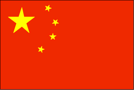
印度尼西亚 Indonesia => 一个盛产木材的国家
印度尼西亚 Indonesia => 一个盛产木材的国家
 艺人 |
 印度尼西亚家具精选 |
 小物件 |
 印度尼西亚家具演变史 |
印度尼西亚 Indonesia => 一个盛产木材的国家
最后修正 2023-11-09 09:24:11
印度尼西亚是一个地处亚洲的国家, 首都/首府是雅加达 。 它的行政划分如下: 印度尼西亚 被划分成 省, 然后又被细划分成 县 (kabupaten),市 (kota), 然后又被细划分成 区, 然后又被细划分成 乡,镇,村.
在此您可以得到世界各国和地区的法文,英文,中文名称。 这个珍贵的全人类共享的土地的集合,不仅包括世界上的独立国家, 而且也包括非联合国联合国:我联合国人民,团结起来追求更美好的世界!会员国的特殊领域。 请咨询 法语国名/地区名阴阳性详表。
1
id
国家/地区
英语国家/地区名
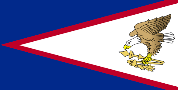
American Samoa
法语国家/地区名
Samoa Americaines
countryucasefr
SAMOA AMERICAINES
国家/地区名
西班牙语国家/地区名
Samoa Americana
意大利语国家/地区名
Le Samoa americane
葡萄牙语国家/地区名
Samoa Americanas
德语国家/地区名
Amerikanische Samoa-Inseln
countryfull
American Samoa
countrynm
American Samoa
国际编码2
AS
国际编码3
ASM
countrycodeisono
016
countrycodeolympic
ASA
countrycodeirs
AQ
countrycodeirsfr
AQ
countrycodeirsmixt
AQ
♀女性
17
6
51
languagesfr
Anglais
6
currency
dollar
currencyfr
dollar
currencyisocode
USD
currencyisocodefull
USD 840
currencypxcode
USD
currencysymbol
$
currencysubdivision
100 cents
currencyregime
float
currencyvalue
1
nationalityfr
Andorrane
首都
Pago
capitalfr
Pago
电话号码前缀
1-684
面积 km2
201
arealand
199
landarablerate
0.05
landforestrate
0.601
coastline
116
timezonedeltabegin
-11
flaglink
maplink
ascolor.gif
outlinemaplink
tutuila.gif
visapassenger
-1
largestcity
Pago
rankpopulation
198
人口
57 000
rankincome
222
nationalevent
Flag Day
nationaleventfr
Jour du Drapeau
nationalholiday
17 April (1900)
生日 年-月-日
1900-04-17 00:00:00
7
1
location
Oceania, group of islands in the South Pacific Ocean, about half way between Hawaii and New Zealand
terrain
five volcanic islands with rugged peaks and limited coastal plains, two coral atolls (Rose Island, Swains Island)
naturalresources
pumice, pumicite
9
rgbback
16777215
special
Yes
todate
1
2
id
国家/地区
英语国家/地区名
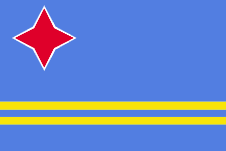
Aruba
法语国家/地区名
Aruba
countryucasefr
ARUBA
国家/地区名
西班牙语国家/地区名
Aruba
意大利语国家/地区名
Aruba
葡萄牙语国家/地区名
Aruba
德语国家/地区名
Aruba
countrypy
a1 lu2 ba1
countrylocal
Aruba
countryfull
Aruba
countrynm
Aruba
国际编码2
AW
国际编码3
ABW
countrycodeisono
533
countrycodeolympic
ARU
countrycodeirs
AA
countrycodeirsfr
AA
countrycodeirsmixt
AA
♀女性
18
6
51
9
currency
guilder (a.k.a. florin or gulden)
currencyisocode
AWG
currencyisocodefull
AWG 533
currencypxcode
AWG
currencysymbol
Afl.
currencysubdivision
100 cents
currencyregime
US-$ (1.79)
currencyvalue
0.565
首都
Oranjestad
capitalfr
Oranjestad
电话号码前缀
297
面积 km2
180
arealand
193
landarablerate
0.1053
coastline
68.5
timezonedeltabegin
-4
flaglink
maplink
awcolor.gif
outlinemaplink
aw.gif
visapassenger
-1
largestcity
Oranjestad
rankpopulation
189
人口
99 000
rankgdp
144
gdp
1875000000
rankgni
161
gni
1230000000
rankincomeorigin
46
rankincome
47
income
12300
lifeexpectation
78.98
natalityrate
0.01153
mortalityrate
0.00647
mortalityrateinfantile
0.00602
growthrate
0.0396
hdi
0.738
nationalevent
Flag Day
nationaleventfr
Jour du Drapeau
nationalholiday
18 March
生日 年-月-日
2000-03-18 00:00:00
7
5
location
Caribbean, island in the Caribbean Sea, north of Venezuela
terrain
flat with a few hills; scant vegetation
naturalresources
NEGL; white sandy beaches
9
rgbback
16777215
todate
1
3
id
国家/地区
英语国家/地区名
Ashmore and Cartier Islands
法语国家/地区名
Iles d'Ashmore & Cartier
countryucasefr
ILES D'ASHMORE & CARTIER
国家/地区名
西班牙语国家/地区名
Islas De Ashmore Y De Cartier
意大利语国家/地区名
Isole Di Cartier & Di Ashmore
葡萄牙语国家/地区名
Consoles De Ashmore & De Cartier
德语国家/地区名
Inseln Ashmore U. Cartier
countryfull
Ashmore and Cartier Islands
countrynm
Ashmore and Cartier Islands
国际编码2
AUSA
国际编码3
AUSA
countrycodeisono
036
countrycodevehicle
AUS
countrycodeolympic
AUS
countrycodeirs
AT
countrycodeirsfr
AT
countrycodeirsmixt
AT
♀女性
12
7
51
10
currencypxcode
AUD
电话号码前缀
61
面积 km2
5
arealand
5
coastline
74.1
timezonedeltabegin
8
flaglink
maplink
ashmore.jpg
visapassenger
-1
rankincome
222
president
Reine Elizabeth II
location
Southeastern Asia, islands in the Indian Ocean, northwest of Australia, south of the Indonesian half of Timor island
terrain
low with sand and coral
naturalresources
fish
9
rgbback
16777215
todate
1
4
id
国家/地区
英语国家/地区名
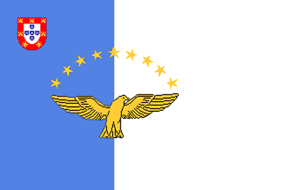
Azores
法语国家/地区名
Açores
countryucasefr
ACORES
国家/地区名
西班牙语国家/地区名
Azores
意大利语国家/地区名
Le Azzorre
葡萄牙语国家/地区名
Açores
德语国家/地区名
Azoren
countryfull
Azores
countrynm
Azores
国际编码2
PRTA
国际编码3
PRTA
countrycodeisono
620
countrycodevehicle
P
countrycodeolympic
POR
countrycodeirs
PO
countrycodeirsfr
PO
countrycodeirsmixt
ACR
♀女性
18
6
114
languagesfr
Portugais
2
currencyfr
euro
currencypxcode
EUR
currencysymbol
€
首都
Santa Cruz (Sao Miguel)
capitalfr
Santa Cruz (Sao Miguel)
电话号码前缀
351
面积 km2
2 247
summit
Peak of the volcano of Pico attains a height of 2 351 m
timezonedeltabegin
-1
flaglink
maplink
azoresne.gif
outlinemaplink
azores.gif
visapassenger
-1
largestcity
Santa Cruz (Sao Miguel)
人口
237 800
rankincome
222
cooking
The islands are São Miguel, Santa Maria, Terceira, Graciosa, São Jorge, Pico, Faial, Flores and Corvo.
7
网站
rgbback
16777215
todate
1
5
id
国家/地区
英语国家/地区名
Baker Island
法语国家/地区名
Ile Baker
countryucasefr
ILE BAKER
国家/地区名
西班牙语国家/地区名
Isla Del Panadero
意大利语国家/地区名
Isola Del Panettiere
葡萄牙语国家/地区名
Console Do Padeiro
德语国家/地区名
BäckercInsel
countryfull
Baker Island
countrynm
Baker Island
国际编码2
UMI6
国际编码3
UMI6
countrycodeisono
581
countrycodeirs
FQ
countrycodeirsfr
FQ
countrycodeirsmixt
FQ
♀女性
17
7
51
1
currencypxcode
USD
面积 km2
1.40
arealand
1.40
coastline
4.8
timezonedeltabegin
-12
flaglink
maplink
baker-island-map.gif
visapassenger
-1
rankincome
222
location
Oceania, atoll in the North Pacific Ocean, about half way between Hawaii and Australia
terrain
low, nearly level coral island surrounded by a narrow fringing reef
naturalresources
guano (deposits worked until 1891), terrestrial an
9
rgbback
16777215
todate
1
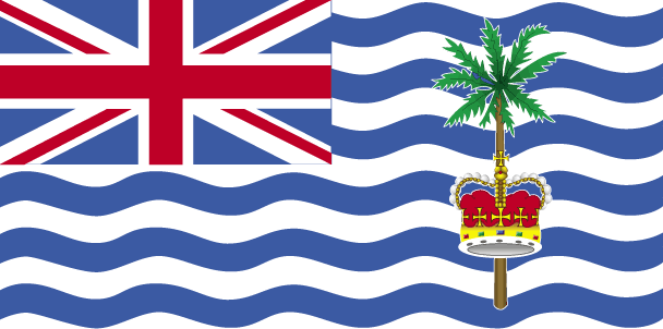
6
id
国家/地区
英语国家/地区名
British Indian Ocean Territory
法语国家/地区名
Territoire Britanique Océan Indien
countryucasefr
TERRITOIRE BRITANIQUE OCEAN INDIEN
国家/地区名
西班牙语国家/地区名
Territorio Del Océano Indio Del Br
意大利语国家/地区名
Territorio Dell'Oceano Indiano Del Br
葡萄牙语国家/地区名
Território Do Oceano Indian Do Br
德语国家/地区名
Gegend Des Indischen Ozeans Des Brs
countryfull
British Indian Ocean Territory
countrynm
British Indian Ocean Territory
国际编码2
GBRB
国际编码3
GBRB
countrycodeisono
826
countrycodeolympic
GBR
countrycodeirs
IO
countrycodeirsfr
IO
countrycodeirsmixt
IO
♂男性
12
6
51
22
currency
pound
currencyfr
livre sterling
currencyisocode
GBP
currencyisocodefull
GBP 826
currencypxcode
GBP
currencysymbol
£
currencysubdivision
100 pence
currencyregime
float
currencyvalue
1.8091
电话号码前缀
44
面积 km2
60
arealand
60
coastline
698
timezonedeltabegin
6
flaglink
maplink
biot.gif
visapassenger
-1
rankincome
222
president
Reine Elizabeth II
location
archipelago in the Indian Ocean, south of India, about one-half the way from Africa to Indonesia
terrain
flat and low (most areas do not exceed four meters in elevation)
naturalresources
coconuts, fish, sugarcane
9
rgbback
16777215
todate
1
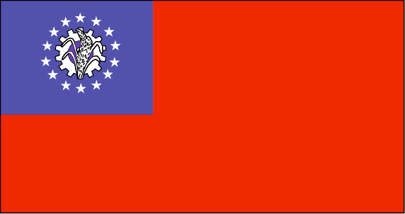
7
id
国家/地区
英语国家/地区名
Myanmar
法语国家/地区名
Birmanie
countryucasefr
BIRMANIE
国家/地区名
西班牙语国家/地区名
Birmania
意大利语国家/地区名
La Birmania
葡萄牙语国家/地区名
Burma
德语国家/地区名
Birma
countrypy
mian3 dian4
countrylocal
Myanma Naingngandaw
countryfull
Burma
countrynm
Burma
国际编码2
MM
国际编码3
MMR
countrycodeisono
104
countrycodevehicle
BUR
countrycodeolympic
MYA
countrycodeirs
BM
countrycodeirsfr
BM
countrycodeirsmixt
BM
♀女性
2
1
30
languagesfr
Birman
120
currency
kyat
currencyfr
kyat
currencyisocode
MMK
currencyisocodefull
MMK 104
currencypxcode
MMK
currencysymbol
K
currencysubdivision
100 pyas
currencyregime
US-$ (5.86of, 200-300bm)
currencyvalue
0.1599
首都
Rangoon
capitalfr
Rangoon
电话号码前缀
95
面积 km2
676 552
arealand
657 740
areawater
20 760
landarablerate
0.1453
landforestrate
0.523
coastline
1930
summit
Hkakabo Razi 5 881 m.
boundarycountries
Bangladesh, Inde, Tibet, Chine, Laos, Thaïlande.
timezonedeltabegin
6.5
flaglink
maplink
mmcolor.gif
outlinemaplink
mmout.gif
visapassenger
-1
maincities
Mandalay, Moulmein, Pegu, Bassein, Akyab, Myeik.
largestcity
Yangon
largestcitypopulation
3 873 000
rankpopulation
24
人口
49 363 000
rankgni
38
gni
92900000000
rankincomeorigin
117
rankincome
126
income
1896
lifeexpectation
55.79
alphabetizationrate
0.806
natalityrate
0.01915
mortalityrate
0.01217
mortalityrateinfantile
0.07035
precipitation
2681
nationalevent
Independence Day
nationaleventfr
Jour de l'Indépendance
nationalholiday
4 January (1948)
生日 年-月-日
1948-01-04 00:00:00
4
12
location
Southeastern Asia, bordering the Andaman Sea and the Bay of Bengal, between Bangladesh and Thailand
terrain
central lowlands ringed by steep, rugged highlands
naturalresources
petroleum, timber, tin, antimony, zinc, copper, tu
9
rgbback
16777215
todate
1
8
id
国家/地区
英语国家/地区名
Canary Islands
法语国家/地区名
Canarie (îles)
countryucasefr
CANARIE (ILES)
国家/地区名
西班牙语国家/地区名
Canarias
意大利语国家/地区名
Delle Canarie
葡萄牙语国家/地区名
Consoles Amarelos
德语国家/地区名
Kanarische Inseln
countryfull
Canary Islands
countrynm
Canary Islands
国际编码2
ESPC
国际编码3
ESPC
countrycodeisono
724
countrycodevehicle
E
countrycodeolympic
ESP
countrycodeirs
SP
countrycodeirsfr
SP
countrycodeirsmixt
CNR
♀女性
11
7
131
2
currencyfr
euro
currencypxcode
EUR
currencysymbol
€
首都
Las Palmas
capitalfr
Las Palmas
电话号码前缀
34
面积 km2
7 242
timezonedeltabegin
1
flaglink
maplink
canarynw.gif
outlinemaplink
canary.gif
visapassenger
-1
largestcity
Las Palmas
人口
1 672 689
rankincome
222
7
rgbback
16777215
todate
1
9
id
国家/地区
英语国家/地区名
Cape Verde
法语国家/地区名
Cap-Vert
countryucasefr
CAP-VERT
国家/地区名
西班牙语国家/地区名
Cabo Verde
意大利语国家/地区名
Cape Verde
葡萄牙语国家/地区名
Cape Verde
德语国家/地区名
Cape Verde
countrypy
fo2 de2 jiao3
countrylocal
Cabo Verde
countryfull
Cape Verde
countrynm
Cape Verde
国际编码2
CV
国际编码3
CPV
countrycodeisono
132
countrycodeolympic
CPV
countrycodeirs
CV
countrycodeirsfr
CV
countrycodeirsmixt
CV
♂男性
15
6
114
languagesfr
Portugais
2
currency
escudo
currencyfr
escudo du Cap Vert
currencyisocode
CVE
currencyisocodefull
CVE 132
currencypxcode
CVE
currencysymbol
C.V.Esc.
currencysubdivision
100 centavos
currencyregime
composite
currencyvalue
0.01107
首都
Praia
capitalfr
Praia
电话号码前缀
238
面积 km2
4 033
arealand
4 033
landarablerate
0.0968
landforestrate
0.211
coastline
965
summit
Pico 2 829 m.
timezonedeltabegin
-1
flaglink
maplink
cvcolor
outlinemaplink
cvout.gif
visapassenger
-1
maincities
Mindelo, Ribeira Grande, Sal, Santa Maria.
largestcity
Praia
largestcitypopulation
68 000
rankpopulation
162
人口
470 000
rankgdp
157
gdp
797000000
rankgdpppp
152
gdpppp
2449000000
rankgni
183
gni
675000000
rankincomeorigin
124
rankincome
136
income
1440
rankincomeppp
115
incomeppp
5130
lifeexpectation
70.14
alphabetizationrate
0.768
natalityrate
0.02613
fecondity
3.3
mortalityrate
0.00672
mortalityrateinfantile
0.04914
hdi
0.727
urbanization
0.635
nationalevent
Independence Day
nationaleventfr
Jour de l'Indépendance
nationalholiday
5 July (1975)
生日 年-月-日
1975-07-05 00:00:00
2
4
location
Western Africa, group of islands in the North Atlantic Ocean, west of Senegal
terrain
steep, rugged, rocky, volcanic
naturalresources
salt, basalt rock, limestone, kaolin, fish
9
网站
rgbback
16777215
todate
1
10
id
国家/地区
英语国家/地区名
Christmas Island
法语国家/地区名
Ile Christmas (Océan Indien)
countryucasefr
ILE CHRISTMASS (OCEAN INDIEN)
国家/地区名
西班牙语国家/地区名
Isla De Navidad (Océano De la India)
意大利语国家/地区名
Isola Di Natale (Oceano Dell'India)
葡萄牙语国家/地区名
Console Do Christmas (Oceano De India)
德语国家/地区名
WeihnachtscInsel (IndiencOzean)
countryfull
Christmas Island
countrynm
Christmas Island
国际编码2
CX
国际编码3
CXR
countrycodeisono
162
countrycodeirs
KT
countrycodeirsfr
KT
countrycodeirsmixt
KT
♀女性
12
6
51
10
currency
dollar
currencyisocode
AUD
currencyisocodefull
AUD 036
currencypxcode
AUD
currencysymbol
A$
currencysubdivision
100 cents
currencyregime
float
currencyvalue
0.7485
电话号码前缀
61
面积 km2
135
arealand
135
coastline
80
timezonedeltabegin
-7
flaglink
maplink
xmas.gif
visapassenger
-1
人口
1 685
rankincome
222
president
Reine Elizabeth II
location
Southeastern Asia, island in the Indian Ocean, south of Indonesia
terrain
steep cliffs along coast rise abruptly to central plateau
naturalresources
phosphate, beaches
9
rgbback
16777215
todate
1
11
id
国家/地区
英语国家/地区名
Clipperton Island
法语国家/地区名
Ile de Clipperton
countryucasefr
ILE DE CLIPPERTON
国家/地区名
西班牙语国家/地区名
Isla De Clipperton
意大利语国家/地区名
Isola Di Clipperton
葡萄牙语国家/地区名
Console De Clipperton
德语国家/地区名
Insel Clipperton
countryfull
Clipperton Island
countrynm
Clipperton Island
国际编码2
PYFC
国际编码3
PYFC
countrycodeisono
258
countrycodeirs
IP
countrycodeirsfr
IP
countrycodeirsmixt
IP
♀女性
15
6
57
2
currencypxcode
EUR
电话号码前缀
689
面积 km2
100
arealand
6
coastline
11.1
timezonedeltabegin
-8
flaglink
maplink
ip-map.gif
visapassenger
-1
rankincome
222
location
Middle America, atoll in the North Pacific Ocean, 1,120 km southwest of Mexico
terrain
coral atoll
naturalresources
fish
cooking
Middle America, atoll in the North Pacific Ocean, 1,120 km southwest of Mexico
9
rgbback
16777215
todate
1
12
id
国家/地区
英语国家/地区名
Cocos (Keeling) Islands
法语国家/地区名
Iles Cocos-Keeling
countryucasefr
ILES COCOS-KEELING
国家/地区名
西班牙语国家/地区名
Isla De Cocos (Keeling)
意大利语国家/地区名
Isola Di Cocos (Keeling)
葡萄牙语国家/地区名
Console De Cocos (Keeling)
德语国家/地区名
Insel Cocos (Keeling)
countryfull
Cocos (Keeling) Islands
countrynm
Cocos (Keeling) Islands
国际编码2
CC
国际编码3
CCK
countrycodeisono
166
countrycodeirs
CK
countrycodeirsfr
CK
countrycodeirsmixt
CK
♀女性
12
6
51
10
currency
dollar
currencyisocode
AUD
currencyisocodefull
AUD 036
currencypxcode
AUD
currencysymbol
A$
currencysubdivision
100 cents
currencyregime
float
currencyvalue
0.7485
首都
West
capitalfr
West
电话号码前缀
61
面积 km2
14.15
arealand
14
coastline
26
timezonedeltabegin
6.5
flaglink
maplink
ck-map.gif
visapassenger
-1
largestcity
West
人口
625
rankincome
222
president
Reine Elizabeth II
location
Southeastern Asia, group of islands in the Indian Ocean, southwest of Indonesia, about halfway from Australia to Sri Lanka
terrain
flat, low-lying coral atolls
naturalresources
fish
cooking
Southeastern Asia, group of islands in the Indian Ocean, southwest of Indonesia, about halfway from Australia to Sri Lanka
9
rgbback
16777215
todate
1
13
id
国家/地区
英语国家/地区名
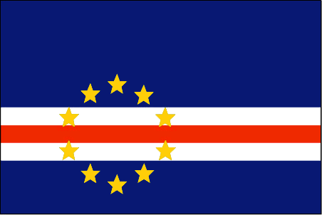
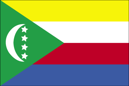
Comoros
法语国家/地区名
Comores
countryucasefr
COMORES
国家/地区名
西班牙语国家/地区名
El Comoro
意大利语国家/地区名
Le Comore
葡萄牙语国家/地区名
Cômoros
德语国家/地区名
Comoren
countryfull
Comoros
countrynm
Comoros
国际编码2
KM
国际编码3
COM
countrycodeisono
174
countrycodeolympic
COM
countrycodeirs
CN
countrycodeirsfr
CN
countrycodeirsmixt
CMR
♀女性
15
2
57
languagesfr
Français
119
currency
franc
currencyfr
franc C.F.A.
currencyisocode
KMF
currencyisocodefull
KMF 174
currencypxcode
KMF
currencysymbol
CF
currencysubdivision
-
currencyregime
Euro (491.96775)
currencyvalue
0.00257
首都
Moroni
capitalfr
Moroni
电话号码前缀
269
面积 km2
2 171
arealand
2 170
landarablerate
0.3498
landforestrate
0.043
coastline
340
summit
Kartala 2 361 m.
timezonedeltabegin
3
flaglink
maplink
kmcolor.gif
outlinemaplink
kmout.gif
visapassenger
-1
maincities
Mutsamudu, Fomboni, Mitsamiouli.
largestcity
Moroni
largestcitypopulation
36 000
rankpopulation
160
人口
600 000
rankgdp
174
gdp
323000000
rankgdpppp
157
gdpppp
1029000000
rankgni
197
gni
269000000
rankincomeorigin
169
rankincome
183
income
450
rankincomeppp
172
incomeppp
1720
lifeexpectation
61.57
alphabetizationrate
0.563
natalityrate
0.038
fecondity
4.9
mortalityrate
0.00863
mortalityrateinfantile
0.07722
hdi
0.528
urbanization
0.338
nationalevent
Independence Day
nationaleventfr
Jour de l'Indépendance
nationalholiday
6 July (1975)
生日 年-月-日
1975-07-06 00:00:00
2
4
location
Southern Africa, group of islands at the northern mouth of the Mozambique Channel, about two-thirds of the way between northern Madagascar and northern Mozambique
terrain
volcanic islands, interiors vary from steep mountains to low hills
naturalresources
NEGL
9
网站
rgbback
16777215
todate
1
14
id
国家/地区
英语国家/地区名
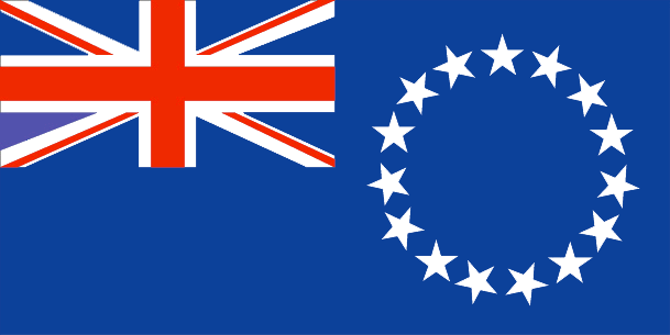
Cook Islands
法语国家/地区名
Cook (îles)
countryucasefr
COOK (ILES)
国家/地区名
西班牙语国家/地区名
Islas De Cocinero
意大利语国家/地区名
Isole Di Cuoco
葡萄牙语国家/地区名
Consoles De Cozinheiro
德语国家/地区名
KochcInseln
countryfull
Cook Islands
countrynm
Cook Islands
国际编码2
CK
国际编码3
COK
countrycodeisono
184
countrycodeolympic
COK
countrycodeirs
CW
countrycodeirsfr
CW
countrycodeirsmixt
CW
♀女性
18
6
57
75
currency
dollar
currencyisocode
NZD
currencyisocodefull
NZD 554
currencypxcode
EUR
currencysymbol
NZ$
currencysubdivision
100 cents
currencyregime
float
currencyvalue
0.6966
首都
Avarua
capitalfr
Avarua
电话号码前缀
682
面积 km2
236
arealand
240
landarablerate
0.1739
landforestrate
0.957
coastline
120
timezonedeltabegin
-10
flaglink
maplink
ckcolor.gif
outlinemaplink
ck.gif
visapassenger
-1
largestcity
Avarua
rankpopulation
214
人口
20 407
rankgni
210
gni
70000000
rankincomeorigin
94
rankincome
96
income
3500
nationalevent
Constitution Day
nationaleventfr
Jour de la Constitution
nationalholiday
First Monday in August (1965)
生日 年-月-日
1965-08-01 00:00:00
2
6
location
Oceania, group of islands in the South Pacific Ocean, about one-half of the way from Hawaii to New Zealand
terrain
low coral atolls in north; volcanic, hilly islands in south
naturalresources
NEGL
9
rgbback
16777215
todate
1
15
id
国家/地区
英语国家/地区名
Coral Sea Islands
法语国家/地区名
Iles de la Mer Corail
countryucasefr
ILES DE LA MER CORAIL
国家/地区名
西班牙语国家/地区名
Territorio De las Islas Del Mar De Cora
意大利语国家/地区名
Territorio Delle Isole Del Mare Di Cora
葡萄牙语国家/地区名
Território Dos Consoles Do Mar De Cora
德语国家/地区名
INSELCGegend Cora See
countryfull
Coral Sea Islands
countrynm
Coral Sea Islands
国际编码2
AUSC
国际编码3
AUSC
countrycodeisono
036
countrycodevehicle
AUS
countrycodeolympic
AUS
countrycodeirs
CR
countrycodeirsfr
CR
countrycodeirsmixt
CR
♀女性
12
7
51
10
currencypxcode
AUD
电话号码前缀
61
arealand
3
coastline
3095
timezonedeltabegin
11
flaglink
maplink
cr-map.gif
visapassenger
-1
rankincome
222
president
Reine Elizabeth II
location
Oceania, islands in the Coral Sea, northeast of Australia
terrain
sand and coral reefs and islands (or cays)
naturalresources
NEGL
cooking
Oceania, islands in the Coral Sea, northeast of Australia
9
rgbback
16777215
todate
1
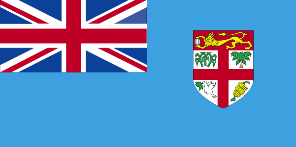
16
id
国家/地区
英语国家/地区名
Fiji
法语国家/地区名
Fidji
countryucasefr
FIDJI
国家/地区名
西班牙语国家/地区名
Las Islas Fiji
意大利语国家/地区名
Le Isole Figi
葡萄牙语国家/地区名
Consoles De Fiji
德语国家/地区名
Fidschi-Inseln
countrypy
fei3 ji4
countrylocal
Fiji
countryfull
Fiji
countrynm
Fiji
国际编码2
FJ
国际编码3
FJI
countrycodeisono
242
countrycodevehicle
FJI
countrycodeolympic
FIJ
countrycodeirs
FJ
countrycodeirsfr
FJ
countrycodeirsmixt
FJ
♀女性
15
6
51
languagesfr
Anglais
40
currency
dollar
currencyfr
dollar fidjien
currencyisocode
FJD
currencyisocodefull
FJD 242
currencypxcode
FJD
currencysymbol
F$
currencysubdivision
100 cents
currencyregime
composite
currencyvalue
0.5944
首都
Suva
capitalfr
Suva
电话号码前缀
679
面积 km2
18 270
arealand
18 270
landarablerate
0.1095
landforestrate
0.446
coastline
1129
summit
Mount Tomaniivi 1 324 m.
timezonedeltabegin
12
flaglink
maplink
fjcolor.gif
outlinemaplink
fj.gif
visapassenger
-1
maincities
Lautoka, Nadi, Lambasa, Singatoka, Nausori, Levuka.
largestcity
Suva
largestcitypopulation
166 000
rankpopulation
154
人口
835 000
rankgdp
141
gdp
2036000000
rankgdpppp
141
gdpppp
4910000000
rankgni
153
gni
1871000000
rankincomeorigin
103
rankincome
113
income
2240
rankincomeppp
109
incomeppp
5650
lifeexpectation
69.2
alphabetizationrate
0.937
natalityrate
0.02291
mortalityrate
0.00568
mortalityrateinfantile
0.01299
hdi
0.754
urbanization
0.502
nationalevent
Independence Day
nationaleventfr
Jour de l'Indépendance
nationalholiday
Second Monday of October (1970)
生日 年-月-日
1970-10-01 00:00:00
7
11
location
Oceania, island group in the South Pacific Ocean, about two-thirds of the way from Hawaii to New Zealand
terrain
mostly mountains of volcanic origin
naturalresources
timber, fish, gold, copper, offshore oil potential
cooking
Fruits de Mer
9
网站
rgbback
16777215
todate
1
小注
Fruits de Mer
17
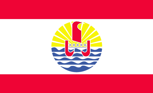
id
国家/地区
英语国家/地区名
French Polynesia
法语国家/地区名
Polynésie française
countryucasefr
POLYNESIE FRANCAISE
国家/地区名
西班牙语国家/地区名
Polinesia Francesa
意大利语国家/地区名
Polynesia Francese
葡萄牙语国家/地区名
Polynesia Francês
德语国家/地区名
Französischer Polynesia
countryfull
French Polynesia
countrynm
French Polynesia
国际编码2
PF
国际编码3
PYF
countrycodeisono
258
countrycodeirs
FP
countrycodeirsfr
FP
countrycodeirsmixt
FP
♀女性
15
6
57
2
currency
franc
currencyfr
euro
currencyisocode
XPF
currencyisocodefull
XPF 953
currencypxcode
XPF
currencysymbol
CFPF (Comp
currencysubdivision
100 centimes
currencyregime
Euro (119.253)
currencyvalue
0.01025
nationalityfr
Française
首都
Papeete
capitalfr
Papeete
电话号码前缀
689
面积 km2
3 941
arealand
3 660
areawater
507
landarablerate
0.0164
landforestrate
0.287
coastline
2525
timezonedeltabegin
-10
flaglink
maplink
pfcolor.gif
outlinemaplink
pf.gif
visapassenger
-1
largestcity
Papeete
rankpopulation
174
人口
243 000
rankgni
123
gni
4360000000
rankincomeorigin
28
rankincome
28
income
18167
lifeexpectation
75.67
alphabetizationrate
0.98
natalityrate
0.01734
mortalityrate
0.00458
mortalityrateinfantile
0.00861
urbanization
0.68
nationalevent
Bastille Day
nationaleventfr
Jour de la prise de la Bastille
nationalholiday
14 July (1789)
生日 年-月-日
1789-07-14 00:00:00
6
10
location
Oceania, archipelago in the South Pacific Ocean, about one-half of the way from South America to Australia
terrain
mixture of rugged high islands and low islands with reefs
naturalresources
timber, fish, cobalt, hydropower
cooking
Canne à sucre.
2
rgbback
16777215
todate
1
小注
Canne à sucre.
18
id
国家/地区
英语国家/地区名
French Southern and Antarctic Lands
法语国家/地区名
Terres Australes et antarctiques françaises
countryucasefr
TERRES AUSTRALES ET ANTARCTIQUES FRANCAISES
国家/地区名
西班牙语国家/地区名
Tierras Meridionales Y Antárticas Francesas
意大利语国家/地区名
Terre Del sud & Antartiche Francesi
葡萄牙语国家/地区名
Terras Do sul & Antarctic Francesas
德语国家/地区名
Französische Südliche U. Antarktische Länder
countryfull
French Southern and Antarctic Lands
countrynm
French Southern and Antarctic Lands
国际编码2
TF
国际编码3
ATF
countrycodeisono
260
countrycodeirs
FS
countrycodeirsfr
FS
countrycodeirsmixt
FS
♀女性
15
6
57
2
currencyfr
euro
currencypxcode
EUR
currencysymbol
€
nationalityfr
Française
面积 km2
7 829
arealand
7 829
coastline
1232
timezonedeltabegin
5
flaglink
maplink
fs-map.gif
visapassenger
-1
rankincome
222
location
southeast of Africa, islands in the southern Indian Ocean, about equidistant between Africa, Antarctica, and Australia; note - French Southern and Antarctic Lands include Ile Amsterdam, Ile Saint-Paul, Iles Crozet, and Iles Kerguelen in the southern India
terrain
volcanic
naturalresources
fish, crayfish
9
rgbback
16777215
todate
1
19
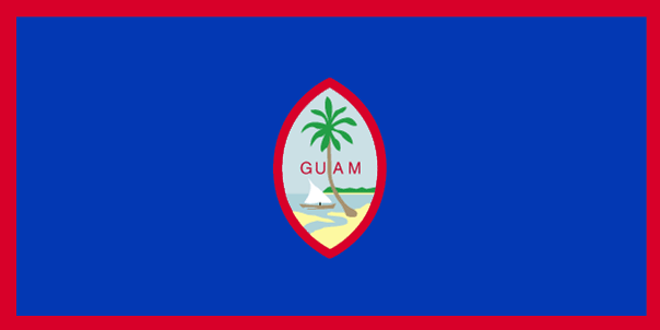
id
国家/地区
英语国家/地区名
Guam
法语国家/地区名
Guam
countryucasefr
GUAM
国家/地区名
西班牙语国家/地区名
Guam
意大利语国家/地区名
Il Guam
葡萄牙语国家/地区名
Guam
德语国家/地区名
Guam
countryfull
Guam
countrynm
Guam
国际编码2
GU
国际编码3
GUM
countrycodeisono
316
countrycodeolympic
GUM
countrycodeirs
GQ
countrycodeirsfr
GQ
countrycodeirsmixt
GQ
♂男性
17
6
51
6
currency
dollar
currencyfr
dollar
currencyisocode
USD
currencyisocodefull
USD 840
currencypxcode
USD
currencysymbol
$
currencysubdivision
100 cents
currencyregime
float
currencyvalue
1
首都
Agana
capitalfr
Agana
电话号码前缀
1-671
面积 km2
541
arealand
549
landarablerate
0.1091
landforestrate
0.382
coastline
125.5
timezonedeltabegin
10
flaglink
maplink
guam.gif
visapassenger
-1
largestcity
Agana
rankpopulation
180
人口
166 090
rankgni
155
gni
1640000000
rankincomeorigin
53
rankincome
56
income
10789
lifeexpectation
78.12
alphabetizationrate
0.9642
natalityrate
0.01931
mortalityrate
0.00435
mortalityrateinfantile
0.00715
nationalevent
Discovery Day
nationaleventfr
Jour de la Découverte
nationalholiday
First Monday in March (1521)
生日 年-月-日
1753-01-01 00:00:00
9
9
location
Oceania, island in the North Pacific Ocean, about three-quarters of the way from Hawaii to the Philippines
terrain
volcanic origin, surrounded by coral reefs; relatively flat coralline limestone plateau (source of most fresh water), with steep coastal cliffs and narrow coastal plains in north, low hills in center, mountains in south
naturalresources
fishing (largely undeveloped), tourism (especially
9
rgbback
16777215
todate
1
20
id
国家/地区
英语国家/地区名
Heard Island and McDonald Islands
法语国家/地区名
Ile Heard & Iles McDonald
countryucasefr
ILE HEARD & ILES MCDONALD
国家/地区名
西班牙语国家/地区名
Isla Y Islas Oídas De McDonald
意大利语国家/地区名
Isola & Isole Sentite Di McDonald
葡萄牙语国家/地区名
Console & Consoles Ouvidos De McDonald
德语国家/地区名
Gehörte Insel U. Inseln McDonald
countryfull
Heard Island and McDonald Islands
countrynm
Heard Island and McDonald Islands
国际编码2
HM
国际编码3
HMD
countrycodeisono
334
countrycodeirs
HM
countrycodeirsfr
HM
countrycodeirsmixt
HM
♀女性
12
7
51
10
currency
dollar
currencyisocode
AUD
currencyisocodefull
AUD 036
currencypxcode
AUD
currencysymbol
A$
currencysubdivision
100 cents
currencyregime
float
currencyvalue
0.7485
面积 km2
412
arealand
412
coastline
101.9
timezonedeltabegin
5
flaglink
maplink
heard.gif
visapassenger
-1
rankincome
222
president
Reine Elizabeth II
location
islands in the Indian Ocean, about two-thirds of the way from Madagascar to Antarctica
terrain
Heard Island - 80% ice-covered, bleak and mountainous, dominated by a large massif (Big Ben) and an active volcano (Mawson Peak); McDonald Islands - small and rocky
naturalresources
fish
9
rgbback
16777215
todate
1
21
id
国家/地区
英语国家/地区名
Howland Island
法语国家/地区名
Ile Howland
countryucasefr
ILE HOWLAND
国家/地区名
西班牙语国家/地区名
Isla De Howland
意大利语国家/地区名
Isola Di Howland
葡萄牙语国家/地区名
Console De Howland
德语国家/地区名
Insel Howland
countryfull
Howland Island
countrynm
Howland Island
国际编码2
UMI8
国际编码3
UMI8
countrycodeisono
581
countrycodeirs
HQ
countrycodeirsfr
HQ
countrycodeirsmixt
HQ
♀女性
17
7
51
1
currencypxcode
USD
面积 km2
1.84
arealand
1.60
coastline
6.4
timezonedeltabegin
-12
flaglink
maplink
howland.gif
visapassenger
-1
rankincome
222
location
Oceania, island in the North Pacific Ocean, about half way between Hawaii and Australia
terrain
low-lying, nearly level, sandy, coral island surrounded by a narrow fringing reef; depressed central area
naturalresources
guano (deposits worked until late 1800s), terrestr
cooking
Oceania, island in the North Pacific Ocean, about half way between Hawaii and Australia
9
rgbback
16777215
todate
1
22
id
国家/地区
英语国家/地区名
Johnston Atoll
法语国家/地区名
Atoll Johnston
countryucasefr
ATOLL JOHNSTON
国家/地区名
西班牙语国家/地区名
Johnston Atoll
意大利语国家/地区名
Johnston Atoll
葡萄牙语国家/地区名
Johnston Atoll
德语国家/地区名
Johnston Atoll
countryfull
Johnston Atoll
countrynm
Johnston Atoll
国际编码2
UMI7
国际编码3
UMI7
countrycodeisono
581
countrycodeirs
JQ
countrycodeirsfr
JQ
countrycodeirsmixt
JQ
♂男性
17
7
51
6
currency
dollar
currencyisocode
USD
currencyisocodefull
USD 840
currencypxcode
USD
currencysymbol
$
currencysubdivision
100 cents
currencyregime
float
currencyvalue
1
面积 km2
2.80
arealand
2.80
coastline
34
timezonedeltabegin
-10
flaglink
maplink
jq-map.gif
visapassenger
-1
rankincome
222
location
Oceania, atoll in the North Pacific Ocean 717 NM (1328 km) southwest of Honolulu, Hawaii, about one-third of the way from Hawaii to the Marshall Islands
terrain
mostly flat
naturalresources
guano deposits worked until depletion about 1890,
cooking
Oceania, atoll in the North Pacific Ocean 717 NM (1328 km) southwest of Honolulu, Hawaii, about one-third of the way from Hawaii to the Marshall Islands
9
rgbback
16777215
todate
1
23
id
国家/地区
英语国家/地区名
Kingman Reef
法语国家/地区名
Récif Kingman
countryucasefr
RECIF KINGMAN
国家/地区名
西班牙语国家/地区名
Filón De Kingman
意大利语国家/地区名
Reef Di Kingman
葡萄牙语国家/地区名
Recife De Kingman
德语国家/地区名
Reef Kingman
countryfull
Kingman Reef
countrynm
Kingman Reef
国际编码2
UMI9
国际编码3
UMI9
countrycodeisono
581
countrycodeirs
KQ
countrycodeirsfr
KQ
countrycodeirsmixt
KQ
♂男性
17
7
51
1
currencypxcode
USD
面积 km2
1
arealand
1
coastline
3
timezonedeltabegin
-11
flaglink
maplink
kq-map.gif
visapassenger
-1
rankincome
222
location
Oceania, reef in the North Pacific Ocean, about half way between Hawaii and American Samoa
terrain
low and nearly level
naturalresources
terrestrial and aquatic wildlife
cooking
Oceania, reef in the North Pacific Ocean, about half way between Hawaii and American Samoa
9
rgbback
16777215
todate
1
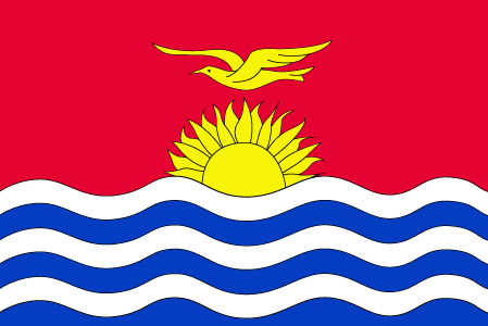
24
id
国家/地区
英语国家/地区名
Kiribati
法语国家/地区名
Kiribati
countryucasefr
KIRIBATI
国家/地区名
西班牙语国家/地区名
Kiribati
意大利语国家/地区名
Kiribati
葡萄牙语国家/地区名
Kiribati
德语国家/地区名
Kiribati
countrypy
ji2 li3 ba1 si1
countrylocal
Kiribati, Kiribas
countryfull
Kiribati
countrynm
Kiribati
国际编码2
KI
国际编码3
KIR
countrycodeisono
296
countrycodeolympic
KIR
countrycodeirs
KR
countrycodeirsfr
KR
countrycodeirsmixt
KRB
♂男性
15
6
51
languagesfr
Anglais
10
currency
dollar
currencyfr
dollar australien
currencyisocode
AUD
currencyisocodefull
AUD 036
currencypxcode
AUD
currencysymbol
A$
currencysubdivision
100 cents
currencyregime
float
currencyvalue
0.7485
首都
Tarawa
capitalfr
Tarawa
电话号码前缀
686
面积 km2
717
arealand
811
landforestrate
0.384
coastline
1143
summit
Joes Hill 81 m.
timezonedeltabegin
12
flaglink
maplink
kicolor.gif
visapassenger
-1
maincities
Ooma.
largestcity
Tarawa
rankpopulation
190
人口
96 000
rankgdp
185
gdp
55000000
rankgni
207
gni
83000000
rankincomeorigin
144
rankincome
157
income
860
lifeexpectation
61.32
natalityrate
0.03099
fecondity
3.6
mortalityrate
0.00849
mortalityrateinfantile
0.0499
growthrate
0.0225
nationalevent
Independence Day
nationaleventfr
Jour de l'Indépendance
nationalholiday
12 July (1979)
生日 年-月-日
1979-07-12 00:00:00
6
8
location
Oceania, group of 33 coral atolls in the Pacific Ocean, straddling the equator; the capital Tarawa is about one-half of the way from Hawaii to Australia; note - on 1 January 1995, Kiribati proclaimed that all of its territory lies in the same time zone as
terrain
mostly low-lying coral atolls surrounded by extensive reefs
naturalresources
phosphate (production discontinued in 1979)
9
rgbback
16777215
todate
1
25
id
国家/地区
英语国家/地区名
Marshall Islands
法语国家/地区名
Marshall (îles)
countryucasefr
MARSHALL (ILES)
国家/地区名
西班牙语国家/地区名
Forme Las Islas
意大利语国家/地区名
Ordini Le Isole
葡萄牙语国家/地区名
Marshall Consoles
德语国家/地区名
Marshall Inseln
countryfull
Marshall Islands
countrynm
Marshall Islands
国际编码2
MH
国际编码3
MHL
countrycodeisono
584
countrycodeolympic
MHL
countrycodeirs
RM
countrycodeirsfr
RM
countrycodeirsmixt
RM
♀女性
19
6
51
languagesfr
Anglais
1
currencyfr
dollar
currencysymbol
$
首都
Majuro
capitalfr
Uliga
电话号码前缀
692
面积 km2
181.30
arealand
181.30
landarablerate
0.1667
coastline
370.4
summit
10 m.
timezonedeltabegin
12
flaglink
maplink
mhcolor.gif
outlinemaplink
mh.gif
visapassenger
-1
maincities
Ebeye
largestcity
Majuro
largestcitypopulation
28 000
rankpopulation
200
人口
53 000
rankgdp
183
gdp
106000000
rankgni
205
gni
142000000
rankincomeorigin
96
rankincome
106
income
2710
lifeexpectation
70.01
alphabetizationrate
0.937
natalityrate
0.03352
fecondity
4.02
mortalityrate
0.00488
mortalityrateinfantile
0.02945
growthrate
0.02274
hdi
0.738
urbanization
0.6618
nationalevent
Constitution Day
nationaleventfr
Jour de la Constitution
nationalholiday
1 May (1979)
生日 年-月-日
1979-05-01 00:00:00
6
8
location
Oceania, group of atolls and reefs in the North Pacific Ocean, about one-half of the way from Hawaii to Australia
terrain
low coral limestone and sand islands
naturalresources
coconut products, marine products, deep seabed min
9
rgbback
16777215
todate
1
26
id
国家/地区
英语国家/地区名
Micronesia, Federated States of
法语国家/地区名
Micronésie
countryucasefr
MICRONESIE
国家/地区名
西班牙语国家/地区名
Micronesia, estados federados de
意大利语国家/地区名
La Micronesia, condizioni federated di
葡萄牙语国家/地区名
Micronesia, estados federados de
德语国家/地区名
Mikronesien, zu einem Bündnis vereingigte Zustände von
countryfull
Micronesia, Federated States of
countrynm
Micronesia, Federated States of
国际编码2
FM
国际编码3
FSM
countrycodeisono
583
countrycodeolympic
FSM
countrycodeirs
FM
countrycodeirsfr
FM
countrycodeirsmixt
FM
♀女性
19
7
51
languagesfr
Anglais
6
currency
dollar
currencyfr
dollar
currencyisocode
USD
currencyisocodefull
USD 840
currencypxcode
USD
currencysymbol
$
currencysubdivision
100 cents
currencyregime
float
currencyvalue
1
nationalityfr
Micronésienne
首都
Palikir
capitalfr
Palikir
电话号码前缀
691
面积 km2
707
arealand
702
landarablerate
0.0571
landforestrate
0.217
coastline
6112
summit
Totolom 791 m.
timezonedeltabegin
10
flaglink
maplink
fmcolor.gif
outlinemaplink
fm.gif
visapassenger
-1
maincities
Pohnpei, Yap.
largestcity
Palikir
rankpopulation
184
人口
125 000
rankgdp
179
gdp
243000000
rankgni
198
gni
258000000
rankincomeorigin
109
rankincome
119
income
2070
lifeexpectation
69.44
alphabetizationrate
0.895
natalityrate
0.0258
fecondity
3.8
mortalityrate
0.00497
mortalityrateinfantile
0.03128
urbanization
0.286
nationalevent
Constitution Day
nationaleventfr
Jour de la Constitution
nationalholiday
10 May (1979)
生日 年-月-日
1979-05-10 00:00:00
6
8
location
Oceania, island group in the North Pacific Ocean, about three-quarters of the way from Hawaii to Indonesia
terrain
islands vary geologically from high mountainous islands to low, coral atolls; volcanic outcroppings on Pohnpei, Kosrae, and Chuuk
naturalresources
forests, marine products, deep-seabed minerals
9
rgbback
16777215
todate
1
27
id
国家/地区
英语国家/地区名
Midway Islands
法语国家/地区名
Iles de Midway
countryucasefr
ILES DE MIDWAY
国家/地区名
西班牙语国家/地区名
Islas Situado a mitad del camino
意大利语国家/地区名
Isole Intermedie
葡萄牙语国家/地区名
Consoles Intermediários
德语国家/地区名
Mittlere Inseln
countryfull
Midway Islands
countrynm
Midway Islands
国际编码2
UMI3
国际编码3
UMI3
countrycodeisono
581
countrycodeirs
MQ
countrycodeirsfr
MQ
countrycodeirsmixt
MQ
♀女性
17
7
51
6
currency
dollar
currencyisocode
USD
currencyisocodefull
USD 840
currencypxcode
USD
currencysymbol
$
currencysubdivision
100 cents
currencyregime
float
currencyvalue
1
面积 km2
6.20
arealand
6.20
coastline
15
timezonedeltabegin
-10
flaglink
maplink
mq-map.gif
visapassenger
-1
rankincome
222
location
Oceania, atoll in the North Pacific Ocean, about one-third of the way from Honolulu to Tokyo
terrain
low, nearly level
naturalresources
wildlife, terrestrial and aquatic
cooking
Oceania, atoll in the North Pacific Ocean, about one-third of the way from Honolulu to Tokyo
9
rgbback
16777215
todate
1
28
id
国家/地区
英语国家/地区名
Nauru
法语国家/地区名
Nauru
countryucasefr
NAURU
国家/地区名
西班牙语国家/地区名
Nauru
意大利语国家/地区名
Il Nauru
葡萄牙语国家/地区名
Nauru
德语国家/地区名
Nauru
countrypy
nao4 lu3
countrylocal
Nauru
countryfull
Nauru
countrynm
Nauru
国际编码2
NR
国际编码3
NRU
countrycodeisono
520
countrycodevehicle
NAU
countrycodeolympic
NRU
countrycodeirs
NR
countrycodeirsfr
NR
countrycodeirsmixt
NR
♂男性
15
6
186
languagesfr
Nauru
10
currency
dollar
currencyfr
dollar australien
currencyisocode
AUD
currencyisocodefull
AUD 036
currencypxcode
AUD
currencysymbol
A$
currencysubdivision
100 cents
currencyregime
float
currencyvalue
0.7485
首都
Yaren District
capitalfr
Yaren
电话号码前缀
674
面积 km2
21
arealand
21
coastline
30
summit
61 m.
timezonedeltabegin
12
flaglink
maplink
nrcolor.gif
outlinemaplink
nr.gif
visapassenger
-1
maincities
Anabar, Anibare, Anna, Ijuw, Uaboe, Yangor.
largestcity
Yaren District
largestcitypopulation
10 000
rankpopulation
220
人口
12 809
rankgni
205
gni
140000000
rankincomeorigin
48
rankincome
52
income
11667
lifeexpectation
62.33
natalityrate
0.02561
mortalityrate
0.00695
mortalityrateinfantile
0.01014
urbanization
1
nationalevent
Independence Day
nationaleventfr
Jour de l'Indépendance
nationalholiday
31 January (1968)
生日 年-月-日
1968-01-31 00:00:00
5
9
location
Oceania, island in the South Pacific Ocean, south of the Marshall Islands
terrain
sandy beach rises to fertile ring around raised coral reefs with phosphate plateau in center
naturalresources
phosphates, fish
9
rgbback
16777215
todate
1
29
id
国家/地区
英语国家/地区名
New Caledonia
法语国家/地区名
Nouvelle-Calédonie
countryucasefr
NOUVELLE-CALEDONIE
国家/地区名
西班牙语国家/地区名
Caledonia Nuevo
意大利语国家/地区名
Nuovo Caledonia
葡萄牙语国家/地区名
Caledonia Novo
德语国家/地区名
Neues Caledonia
countrypy
xin1 ka1 li3 duo1 ni2 ya4
countrylocal
Nouvelle-Calédonie
countryfull
New Caledonia
countrynm
New Caledonia
国际编码2
NC
国际编码3
NCL
countrycodeisono
540
countrycodeirs
NC
countrycodeirsfr
NC
countrycodeirsmixt
NC
♀女性
18
6
57
languagesfr
Français
2
currency
franc
currencyfr
euro
currencyisocode
XPF
currencyisocodefull
XPF 953
currencypxcode
XPF
currencysymbol
CFPF (Comp
currencysubdivision
100 centimes
currencyregime
Euro (119.253)
currencyvalue
0.01025
nationalityfr
Française
首都
Nouméa
capitalfr
Nouméa
电话号码前缀
687
面积 km2
19 060
arealand
18 575
areawater
485
landarablerate
0.0038
landforestrate
0.204
coastline
2254
summit
Mont Panié 1 682 m..
timezonedeltabegin
11
flaglink
maplink
nwcalmap.gif
outlinemaplink
grandmap.gif
visapassenger
-1
maincities
Dumbéa, Canala, Bourail, Thio, Hienghène, Houaïlu, Koumac, Kone
largestcity
Nouméa
rankpopulation
175
人口
225 000
rankgni
136
gni
3270000000
rankincomeorigin
37
rankincome
38
income
14864
lifeexpectation
73.78
alphabetizationrate
0.97
natalityrate
0.01898
fecondity
2.35
mortalityrate
0.00564
mortalityrateinfantile
0.00789
growthrate
0.01334
urbanization
0.75
nationalevent
Bastille Day
nationaleventfr
Jour de la prise de la Bastille
nationalholiday
14 July (1789)
生日 年-月-日
1789-07-14 00:00:00
6
10
location
Oceania, islands in the South Pacific Ocean, east of Australia
terrain
coastal plains with interior mountains
naturalresources
nickel, chrome, iron, cobalt, manganese, silver, g
2
网站
rgbback
16777215
todate
1
30
id
国家/地区
英语国家/地区名
New Zealand
法语国家/地区名
Nouvelle-Zélande
countryucasefr
NOUVELLE-ZELANDE
国家/地区名
西班牙语国家/地区名
Zealand Nuevo
意大利语国家/地区名
La Nuova Zelanda
葡萄牙语国家/地区名
Zealand Novo
德语国家/地区名
Neues Seeland
countrypy
xin1 xi1 lan2
countrylocal
Aotearoa
countryfull
New Zealand
countrynm
New Zealand
国际编码2
NZ
国际编码3
NZL
countrycodeisono
554
countrycodevehicle
NZ
countrycodeolympic
NZL
countrycodeirs
NZ
countrycodeirsfr
NZ
countrycodeirsmixt
NZ
♀女性
18
6
51
languagesfr
Anglais, Maori
75
currency
dollar
currencyfr
dollar néo-zélandais
currencyisocode
NZD
currencyisocodefull
NZD 554
currencypxcode
NZD
currencysymbol
NZ$
currencysubdivision
100 cents
currencyregime
float
currencyvalue
0.6966
nationalityfr
Nouvelle Zélandaise
首都
Wellington
capitalfr
Wellington
电话号码前缀
64
面积 km2
268 676
landarablerate
0.058
landforestrate
0.297
coastline
15134
summit
Mount Cook 3 764 m.
timezonedeltabegin
12
flaglink
maplink
nzcolor.gif
outlinemaplink
nz.gif
maincities
Auckland, Christchurch, Napier-Hastings, Dunedin, Hamilton, Waitemata, Palmerston North, Invercargill, New Plymouth, Nelson, Whangarei, Whanganui.
largestcity
Auckland
largestcitypopulation
945 000
rankpopulation
121
人口
4 009 000
rankgdp
45
gdp
79572000000
rankgdpppp
57
gdpppp
90538000000
rankgni
48
gni
62249000000
rankincomeorigin
40
rankincome
34
income
15530
rankincomeppp
36
incomeppp
21350
lifeexpectation
78.5
alphabetizationrate
0.99
natalityrate
0.0146
mortalityrate
0.007
mortalityrateinfantile
0.0055
hdi
0.777
urbanization
0.434
precipitation
1120
nationalevent
Waitangi Day (Treaty of Waitangi established British sovereignty over New Zealand)
nationaleventfr
Jour Waitangi
nationalholiday
6 February (1840)
生日 年-月-日
1840-02-06 00:00:00
7
1
location
Oceania, islands in the South Pacific Ocean, southeast of Australia
terrain
predominately mountainous with some large coastal plains
naturalresources
natural gas, iron ore, sand, coal, timber, hydropo
cooking
Fruits de Mer
9
网站
rgbback
16777215
todate
1
小注
Fruits de Mer
31
id
国家/地区
英语国家/地区名
Niue
法语国家/地区名
Niue
countryucasefr
NIUE
国家/地区名
西班牙语国家/地区名
Niue
意大利语国家/地区名
Niue
葡萄牙语国家/地区名
Niue
德语国家/地区名
Niue
countryfull
Niue
countrynm
Niue
国际编码2
NU
国际编码3
NIU
countrycodeisono
570
countrycodeirs
NE
countrycodeirsfr
NE
countrycodeirsmixt
NE
♀女性
18
6
51
75
currency
dollar
currencyisocode
NZD
currencyisocodefull
NZD 554
currencypxcode
NZD
currencysymbol
NZ$
currencysubdivision
100 cents
currencyregime
float
currencyvalue
0.6966
首都
Alofi
capitalfr
Alofi
电话号码前缀
683
面积 km2
260
arealand
260
landarablerate
0.1923
coastline
64
timezonedeltabegin
11
flaglink
maplink
nucolor.gif
outlinemaplink
nuout.gif
visapassenger
-1
largestcity
Alofi
rankpopulation
225
人口
2 124
rankincome
222
nationalevent
Waitangi Day (Treaty of Waitangi established British sovereignty over New Zealand)
nationaleventfr
Jour Waitangi
nationalholiday
6 February (1840)
生日 年-月-日
1840-02-06 00:00:00
7
1
location
Oceania, island in the South Pacific Ocean, east of Tonga
terrain
steep limestone cliffs along coast, central plateau
naturalresources
fish, arable land
9
rgbback
16777215
todate
1
32
id
国家/地区
英语国家/地区名
Norfolk Island
法语国家/地区名
Norfolk Island
countryucasefr
NORFOLK ISLAND
国家/地区名
西班牙语国家/地区名
Isla De Norfolk
意大利语国家/地区名
Isola Della Norfolk
葡萄牙语国家/地区名
Console De Norfolk
德语国家/地区名
NorfolkcInsel
countryfull
Norfolk Island
countrynm
Norfolk Island
国际编码2
NF
国际编码3
NFK
countrycodeisono
574
countrycodeirs
NF
countrycodeirsfr
NF
countrycodeirsmixt
NF
♀女性
12
6
51
10
currency
dollar
currencyisocode
AUD
currencyisocodefull
AUD 036
currencypxcode
AUD
currencysymbol
A$
currencysubdivision
100 cents
currencyregime
float
currencyvalue
0.7485
首都
Kingston
capitalfr
Kingston
电话号码前缀
672
面积 km2
34.60
arealand
34.60
coastline
32
timezonedeltabegin
11.5
flaglink
maplink
norfolk.gif
outlinemaplink
nf.gif
visapassenger
-1
largestcity
Kingston
rankpopulation
227
人口
1 879
rankincome
222
nationalevent
Pitcairners Arrival Day
nationaleventfr
Jour d'Arrivée des Pitcairners
nationalholiday
8 June (1856)
生日 年-月-日
1856-06-08 00:00:00
3
5
location
Oceania, island in the South Pacific Ocean, east of Australia
terrain
volcanic formation with mostly rolling plains
naturalresources
fish
9
rgbback
16777215
todate
1
33
id
国家/地区
英语国家/地区名
Northern Mariana Islands
法语国家/地区名
Mariannes (îles de)
countryucasefr
MARIANNES (ILES DE)
国家/地区名
西班牙语国家/地区名
Islas De Mariana Norteñas
意大利语国家/地区名
Isole Di Mariana Del Nord
葡萄牙语国家/地区名
Consoles De Mariana Do norte
德语国家/地区名
NordcMarianacInseln
countryfull
Northern Mariana Islands
countrynm
Northern Mariana Islands
国际编码2
MP
国际编码3
MNP
countrycodeisono
580
countrycodeirs
CQ
countrycodeirsfr
CQ
countrycodeirsmixt
CQ
♀女性
12
6
51
1
currencypxcode
USD
首都
Saipan
capitalfr
Saipan
电话号码前缀
1-670
面积 km2
477
arealand
477
landarablerate
0.1522
landforestrate
0.304
coastline
1482
timezonedeltabegin
10
flaglink
maplink
nmarmap.gif
visapassenger
-1
largestcity
Saipan
rankpopulation
193
人口
76 000
rankincome
222
nationalevent
Commonwealth Day
nationaleventfr
Jour du Commonwealth
nationalholiday
8 January (1978)
生日 年-月-日
1978-01-08 00:00:00
4
6
location
Oceania, islands in the North Pacific Ocean, about three-quarters of the way from Hawaii to the Philippines
terrain
southern islands are limestone with level terraces and fringing coral reefs; northern islands are volcanic
naturalresources
arable land, fish
cooking
The islands, which include Saipan, Rota, Farallon de Pajaros and Tinian, total some 477 square kilometers. Saipan and Tinian have the best ports and harbors. Download high resolution version (992x496, 124 KB)Large flag of the Northern Mariana Islands. ... Image taken from www. ... Flag ratio: 1:2 The flag of the Northern Mariana Islands was adopted on July 4, 1976. ... A motto is a phrase or collection of words intended to describe the motivation or intention of a sociological grouping or organization. ... locator map for the Northern Marianas - made for Wikipedia File links The following pages link to this file: Northern Mariana Islands User:DanielZm/test Roman Catholic Diocese of Chalan Kanoa Categories: Country locator maps | Northern Mariana Islands | GFDL images ... As with any complex, emergent concept, language is somewhat resistant to definition. ... The English language is a West Germanic language that originates in England. ... Chamorro, or Chamoru, is the native language used in Guam and Northern Mariana Islands. ... Carolinian is an Austronesian language spoken in the Northern Mariana Islands, where it is an official language along with English and Chamorro. ... In politics a capital (also called capital city or political capital — although the latter phrase has an alternative meaning based on an alternative meaning of capital) is the principal city or town associated with its government. ... Saipan is the largest island and capital of the Northern Mariana Islands of the western Pacific Ocean, with a total area of 120 km² (46. ... A head of state or chief of state is the chief public representative of a nation-state, federation or commonwealth, whose role generally includes personifying the continuity and legitimacy of the state and exercising the political powers, functions and duties granted to the head of state in the countrys... List of Northern Mariana Islands Governors Carlos S. Camacho Democrat 1978-1982 Pedro P. Tenorio Republican 1982-1990 Lorenzo I. De Leon Guerrero Republican 1990-1994 Froilan C. Tenorio Democrat 1994-1998 Pedro P. Tenorio Republican 1998-2002 Juan N. Babauta Republican 2002- Categories: Lists of governors of U.S... Juan Nekai Babauta (born September 7, 1953, Tapanag, Saipan) is current governor of the Northern Mariana Islands. ... This article explains the meaning of area as a physical quantity. ... Here is a list of the countries of the world sorted by area. ... (Redirected from 1 E8 m2) To help compare different orders of magnitude and geographical regions, we list here areas between 100 km² and 1000 km². See also areas of other orders of magnitude. ... Square kilometre (US spelling: Square kilometer), symbol km², is an SI unit of surface area. ... In the most common sense of the word, a population is the collection of people—or organisms of a particular species—living in a given geographic area. ... Population density can be used as a measurement of any tangible item. ... This is a list of sovereign states and other territories by population. ... Independence is autonomous self-government of a country by its residents and indigenous population. ... The dollar is the name of the official currency in several countries, dependencies and other regions (see list below), including the US dollar, the worlds most widely circulated currency (see list below). ... -1... UTC also stands for the University of Tennessee at Chattanooga Coordinated Universal Time or UTC, also sometimes referred to as Zulu time, the basis for civil time, differs by an integral number of seconds from atomic time and a fractional number of seconds from UT1. ... The National Anthem is the name of a song by the band Radiohead. ... A top-level domain (TLD) is the last part of which Internet domain names consist of. ... .mp is the Internet country code top-level domain ( ccTLD) for Northern Mariana Islands. ... Saipan is the largest island and capital of the Northern Mariana Islands of the western Pacific Ocean, with a total area of 120 km² (46. ... Rota, also known as the peaceful island, is the southernmost island of the United States Commonwealth of the Northern Mariana Islands (CNMI). ... Farallon de Pajaros (from spanish Farallón de los pájaros, meaning Birds Rock), also known as Uracas (from Spanish Urracas, meaning Ravens), is the westernmost island in the Northern Mariana Islands chain. ... Tinian is one of the three principal islands of the Commonwealth of the Northern Marianas Islands. ... (Redirected from 1 E8 m2) To help compare different orders of magnitude and geographical regions, we list here areas between 100 km² and 1000 km². See also areas of other orders of magnitude. ...
9
rgbback
16777215
todate
1
34
id
国家/地区
英语国家/地区名
Palmyra Atoll
法语国家/地区名
Atoll Palmyra
countryucasefr
ATOLL PALMYRA
国家/地区名
西班牙语国家/地区名
Palmyra Atoll
意大利语国家/地区名
Palmyra Atoll
葡萄牙语国家/地区名
Palmyra Atoll
德语国家/地区名
Palmyra Atoll
countryfull
Palmyra Atoll
countrynm
Palmyra Atoll
国际编码2
UMI4
国际编码3
UMI4
countrycodeisono
581
countrycodeirs
LQ
countrycodeirsfr
LQ
countrycodeirsmixt
LQ
♂男性
17
7
51
1
currencypxcode
USD
面积 km2
12
arealand
11.90
coastline
14.5
timezonedeltabegin
-11
flaglink
maplink
lq-map.gif
visapassenger
-1
rankincome
222
location
Oceania, atoll in the North Pacific Ocean, about half way between Hawaii and American Samoa
terrain
very low
naturalresources
terrestrial and aquatic wildlife
cooking
Oceania, atoll in the North Pacific Ocean, about half way between Hawaii and American Samoa
9
rgbback
16777215
todate
1
35
id
国家/地区
英语国家/地区名
Papua New Guinea
法语国家/地区名
Papouasie-Nouvelle-Guinée
countryucasefr
PAPOUASIE-NOUVELLE-GUINEE
国家/地区名
西班牙语国家/地区名
Papua Nueva Guinea
意大利语国家/地区名
La Papuasia Nuova Guinea
葡萄牙语国家/地区名
Papua Nova Guiné
德语国家/地区名
Papua Neu-Guinea
countrypy
ba1 bu4 ya4 xin1 ji3 nei4 ya4
countrylocal
Papua Niu Gini
countryfull
Papua New Guinea
countrynm
Papua New Guinea
国际编码2
PG
国际编码3
PNG
countrycodeisono
598
countrycodevehicle
PNG
countrycodeolympic
PNG
countrycodeirs
PP
countrycodeirsfr
PP
countrycodeirsmixt
PP
♀女性
12
6
51
languagesfr
Anglais
152
currency
kina
currencyfr
kina
currencyisocode
PGK
currencyisocodefull
PGK 598
currencypxcode
PGK
currencysymbol
K
currencysubdivision
100 toeas
currencyregime
composite
currencyvalue
0.321
首都
Port Moresby
capitalfr
Port-Moresby
电话号码前缀
675
面积 km2
461 691
arealand
452 860
areawater
9 980
landarablerate
0.0013
landforestrate
0.676
coastline
5152
summit
Mount Wilhelm 4 694 m.
boundarycountries
Indonésie.
timezonedeltabegin
10
flaglink
maplink
pgcolor.gif
outlinemaplink
pg.gif
visapassenger
-1
maincities
Lae, Madang, Wewak, Goroka, Rabaul, Mount Hagen.
largestcity
Port Moresby
largestcitypopulation
247 000
rankpopulation
102
人口
5 502 000
rankgdp
133
gdp
3182000000
rankgdpppp
109
gdpppp
14408000000
rankgni
144
gni
2753000000
rankincomeorigin
163
rankincome
177
income
500
rankincomeppp
153
incomeppp
2250
lifeexpectation
64.56
alphabetizationrate
0.658
natalityrate
0.03052
mortalityrate
0.0075
mortalityrateinfantile
0.05315
hdi
0.548
urbanization
0.176
nationalevent
Independence Day
nationaleventfr
Jour de l'Indépendance
nationalholiday
16 September (1975)
生日 年-月-日
1975-09-16 00:00:00
2
4
location
Oceania, group of islands including the eastern half of the island of New Guinea between the Coral Sea and the South Pacific Ocean, east of Indonesia
terrain
mostly mountains with coastal lowlands and rolling foothills
naturalresources
gold, copper, silver, natural gas, timber, oil, fi
9
rgbback
16777215
todate
1
36
id
国家/地区
英语国家/地区名
Paracel Islands
法语国家/地区名
Iles Paracel
countryucasefr
ILES PARACEL
国家/地区名
西班牙语国家/地区名
Islas De Paracel
意大利语国家/地区名
Isole Di Paracel
葡萄牙语国家/地区名
Consoles De Paracel
德语国家/地区名
Inseln Paracel
countryfull
Paracel Islands
countrynm
Paracel Islands
国际编码2
CHNP
国际编码3
CHNP
countrycodeisono
156
countrycodeolympic
CHN
countrycodeirs
PF
countrycodeirsfr
PF
countrycodeirsmixt
PF
♀女性
5
1
126
3
电话号码前缀
86
coastline
518
timezonedeltabegin
8
flaglink
maplink
pf-map.gif
visapassenger
-1
rankincome
222
location
Southeastern Asia, group of small islands and reefs in the South China Sea, about one-third of the way from central Vietnam to the northern Philippines
terrain
mostly low and flat
naturalresources
none
cooking
Southeastern Asia, group of small islands and reefs in the South China Sea, about one-third of the way from central Vietnam to the northern Philippines
9
rgbback
16777215
todate
1
37
id
国家/地区
英语国家/地区名
Pitcairn Islands
法语国家/地区名
Pitcairn Islands
countryucasefr
PITCAIRN ISLANDS
国家/地区名
西班牙语国家/地区名
Isla De Pitcairn
意大利语国家/地区名
Isola Di Pitcairn
葡萄牙语国家/地区名
Console De Pitcairn
德语国家/地区名
Insel Pitcairn
countryfull
Pitcairn Islands
countrynm
Pitcairn Islands
国际编码2
PN
国际编码3
PCN
countrycodeisono
612
countrycodeirs
PC
countrycodeirsfr
PC
countrycodeirsmixt
PC
♀女性
12
6
51
75
currency
dollar
currencyisocode
NZD
currencyisocodefull
NZD 554
currencypxcode
GBP
currencysymbol
NZ$
currencysubdivision
100 cents
currencyregime
float
currencyvalue
0.6966
首都
Adamstown
capitalfr
Adamstown
面积 km2
47
arealand
47
coastline
51
timezonedeltabegin
-8
flaglink
maplink
pitcairn.gif
outlinemaplink
pn.gif
visapassenger
-1
largestcity
Adamstown
rankpopulation
230
人口
48
rankincome
222
nationalevent
Birthday of Queen ELIZABETH II
nationaleventfr
Anniversaire de la Reine ELIZABETH II
nationalholiday
Second Saturday in June (1926)
生日 年-月-日
1926-06-01 00:00:00
3
3
location
Oceania, islands in the South Pacific Ocean, about midway between Peru and New Zealand
terrain
rugged volcanic formation; rocky coastline with cliffs
naturalresources
miro trees (used for handicrafts), fish (manganese
9
rgbback
16777215
todate
1
38
id
国家/地区
英语国家/地区名
Reunion
法语国家/地区名
La Réunion
countryucasefr
LA REUNION
国家/地区名
西班牙语国家/地区名
Reunión
意大利语国家/地区名
La Riunione
葡萄牙语国家/地区名
Reunion
德语国家/地区名
Wiedervereinigung
countryfull
Reunion
countrynm
Reunion
国际编码2
RE
国际编码3
REU
countrycodeisono
638
countrycodeirs
RE
countrycodeirsfr
RE
countrycodeirsmixt
RE
♀女性
15
6
57
languagesfr
Français
2
currency
euro
currencyfr
euro
currencyisocode
EUR
currencyisocodefull
EUR 978
currencypxcode
EUR
currencysymbol
€
currencysubdivision
100 cents
currencyregime
float
currencyvalue
1.2203
nationalityfr
Française
首都
Saint Denis
capitalfr
Saint Denis
电话号码前缀
262
面积 km2
2 510
arealand
2 507
areawater
10
landarablerate
0.132
landforestrate
0.284
coastline
207
summit
Piton des Neiges 3 069 m.
timezonedeltabegin
4
flaglink
maplink
recolor.gif
outlinemaplink
reout.gif
visapassenger
-1
maincities
Saint Paul, Saint Pierre, Le Tampon, Saint Louis, Le Port, Saint Benoit, Saint André
largestcity
Saint Denis
rankpopulation
160
人口
743 981
rankgni
113
gni
5310000000
rankincomeorigin
65
rankincome
68
income
7375
lifeexpectation
73.69
alphabetizationrate
0.884
natalityrate
0.01969
fecondity
2.3
mortalityrate
0.00548
mortalityrateinfantile
0.00795
urbanization
0.951
nationalevent
Bastille Day
nationaleventfr
Jour de la prise de la Bastille
nationalholiday
14 July (1789)
生日 年-月-日
1789-07-14 00:00:00
6
10
location
Southern Africa, island in the Indian Ocean, east of Madagascar
terrain
mostly rugged and mountainous; fertile lowlands along coast
naturalresources
fish, arable land, hydropower
cooking
Miam, la Cuisine Créole, mélangée et epicée.
2
网站
rgbback
16777215
todate
1
39
id
国家/地区
英语国家/地区名
Samoa
法语国家/地区名
Samoa Occidental
countryucasefr
SAMOA OCCIDENTAL
国家/地区名
西班牙语国家/地区名
Samoa (Occidental)
意大利语国家/地区名
La Samoa (Occidentale)
葡萄牙语国家/地区名
Samoa (Ocidental)
德语国家/地区名
Samoa-Inseln (Westlich)
countrypy
sa4 mo2 ya4
countrylocal
Samoa
countryfull
Samoa
countrynm
Samoa
国际编码2
WS
国际编码3
WSM
countrycodeisono
882
countrycodevehicle
WS
countrycodeolympic
SAM
countrycodeirs
WS
countrycodeirsfr
WS
countrycodeirsmixt
WS
♂男性
12
6
185
languagesfr
Samoan, Anglais
117
currency
tala
currencyfr
dollar des Samoa
currencyisocode
WST
currencyisocodefull
WST 882
currencypxcode
WST
currencysymbol
WS$
currencysubdivision
100 sene
currencyregime
composite
currencyvalue
0.367
首都
Apia
capitalfr
Apia
电话号码前缀
685
面积 km2
2 860
arealand
2 934
areawater
10
landarablerate
0.1943
landforestrate
0.372
coastline
403
summit
Mauga Silisili 1 857 m.
timezonedeltabegin
-11
flaglink
maplink
wscolor.gif
outlinemaplink
ws.gif
visapassenger
-1
maincities
Satupaitea, Tuasivi, Salaiula, Siumu
largestcity
Apia
largestcitypopulation
33 000
rankpopulation
178
人口
178 000
rankgdp
176
gdp
268000000
rankgdpppp
156
gdpppp
1042000000
rankgni
199
gni
257000000
rankincomeorigin
124
rankincome
136
income
1440
rankincomeppp
108
incomeppp
5780
lifeexpectation
70.41
alphabetizationrate
0.9965
natalityrate
0.01569
fecondity
4.12
mortalityrate
0.00647
mortalityrateinfantile
0.02872
hdi
0.775
urbanization
0.377
nationalevent
Independence Day Celebration
nationaleventfr
Jour de l'Indépendance
nationalholiday
1 June (1962)
生日 年-月-日
1962-06-01 00:00:00
9
3
location
Oceania, group of islands in the South Pacific Ocean, about one-half of the way from Hawaii to New Zealand
terrain
narrow coastal plain with volcanic, rocky, rugged mountains in interior
naturalresources
hardwood forests, fish, hydropower
9
rgbback
16777215
todate
1
40
id
国家/地区
英语国家/地区名
Solomon Islands
法语国家/地区名
Salomon
countryucasefr
SALOMON
国家/地区名
西班牙语国家/地区名
Islas De Solomon
意大利语国家/地区名
Isole Di Solomon
葡萄牙语国家/地区名
Consoles De Solomon
德语国家/地区名
Inseln Solomon
countryfull
Solomon Islands
countrynm
Solomon Islands
国际编码2
SB
国际编码3
SLB
countrycodeisono
090
countrycodeolympic
SOL
countrycodeirs
BP
countrycodeirsfr
BP
countrycodeirsmixt
BP
18
6
51
languagesfr
Anglais
94
currency
dollar
currencyfr
dollar des Salomon
currencyisocode
SBD
currencyisocodefull
SBD 090
currencypxcode
SBD
currencysymbol
SI$
currencysubdivision
100 cents
currencyregime
composite
currencyvalue
0.1358
首都
Honiara
capitalfr
Honiara
电话号码前缀
677
面积 km2
28 450
arealand
27 540
areawater
910
landarablerate
0.015
landforestrate
0.888
coastline
5313
summit
Mount Makarakomburu 2 447 m.
timezonedeltabegin
11
flaglink
maplink
sbcolor.gif
outlinemaplink
sb.gif
visapassenger
-1
maincities
Kirakira, Auki, Tangarare, Gizo, Gateri.
largestcity
Honiara
largestcitypopulation
53 000
rankpopulation
163
人口
457 000
rankgdp
178
gdp
253000000
rankgdpppp
161
gdpppp
800000000
rankgni
200
gni
255000000
rankincomeorigin
158
rankincome
172
income
560
rankincomeppp
174
incomeppp
1710
lifeexpectation
72.38
alphabetizationrate
0.77
natalityrate
0.0316
fecondity
4.42
mortalityrate
0.00404
mortalityrateinfantile
0.02209
growthrate
0.02756
hdi
0.632
urbanization
0.202
precipitation
3290
nationalevent
Independence Day
nationaleventfr
Jour de l'Indépendance
nationalholiday
7 July (1978)
生日 年-月-日
1978-07-07 00:00:00
5
7
location
Oceania, group of islands in the South Pacific Ocean, east of Papua New Guinea
terrain
mostly rugged mountains with some low coral atolls
naturalresources
fish, forests, gold, bauxite, phosphates, lead, zi
9
rgbback
16777215
todate
1
41
id
国家/地区
英语国家/地区名
Saint Helena
法语国家/地区名
Sainte Hélène
countryucasefr
SAINTE HELENE
国家/地区名
西班牙语国家/地区名
St. Helena
意大利语国家/地区名
La Sant'Elena
葡萄牙语国家/地区名
St. Helena
德语国家/地区名
St. Helena
countryfull
Saint Helena
countrynm
Saint Helena
国际编码2
SH
国际编码3
SHN
countrycodeisono
654
countrycodeirs
SH
countrycodeirsfr
SH
countrycodeirsmixt
SH
12
6
51
89
currency
pound
currencyisocode
SHP
currencyisocodefull
SHP 654
currencypxcode
SHP
currencysymbol
£S
currencysubdivision
100 new pence
currencyregime
GBP (1.0)
currencyvalue
1.8345
首都
Jamestown
capitalfr
Jamestown
电话号码前缀
290
面积 km2
122
arealand
410
landarablerate
0.129
landforestrate
0.065
coastline
60
flaglink
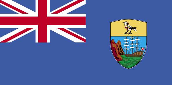
maplink
sh-map.gif
visapassenger
-1
largestcity
Jamestown
rankpopulation
222
人口
7 212
rankgni
215
gni
30000000
rankincomeorigin
78
rankincome
85
income
4286
nationalevent
Birthday of Queen ELIZABETH II
nationaleventfr
Anniversaire de la Reine ELIZABETH II
nationalholiday
Second Saturday in June (1926)
生日 年-月-日
1926-06-01 00:00:00
3
3
location
islands in the South Atlantic Ocean, about midway between South America and Africa
terrain
Saint Helena - rugged, volcanic; small scattered plateaus and plains (the other islands of the group have a volcanic origin)
naturalresources
fish
9
rgbback
16777215
todate
1
42
id
国家/地区
英语国家/地区名
Tokelau
法语国家/地区名
Tokelau
countryucasefr
TOKELAU
国家/地区名
西班牙语国家/地区名
Tokelau
意大利语国家/地区名
Il Tokelau
葡萄牙语国家/地区名
Tokelau
德语国家/地区名
Tokelau
countryfull
Tokelau
countrynm
Tokelau
国际编码2
TK
国际编码3
TKL
countrycodeisono
772
countrycodeirs
TL
countrycodeirsfr
TL
countrycodeirsmixt
TL
♂男性
18
6
51
75
currency
dollar
currencyisocode
NZD
currencyisocodefull
NZD 554
currencypxcode
NZD
currencysymbol
NZ$
currencysubdivision
100 cents
currencyregime
float
currencyvalue
0.6966
电话号码前缀
690
面积 km2
10
arealand
10
coastline
101
timezonedeltabegin
-12
flaglink
maplink
tokelau.gif
visapassenger
-1
rankpopulation
228
人口
1 800
rankincome
222
nationalevent
Waitangi Day (Treaty of Waitangi established British sovereignty over New Zealand)
nationaleventfr
Jour Waitangi
nationalholiday
6 February (1840)
生日 年-月-日
1840-02-06 00:00:00
7
1
location
Oceania, group of three atolls in the South Pacific Ocean, about one-half of the way from Hawaii to New Zealand
terrain
low-lying coral atolls enclosing large lagoons
naturalresources
NEGL
cooking
Oceania, group of three atolls in the South Pacific Ocean, about one-half of the way from Hawaii to New Zealand
9
rgbback
16777215
todate
1
43
id
国家/地区
英语国家/地区名
Tonga
法语国家/地区名
Tonga
countryucasefr
TONGA
国家/地区名
西班牙语国家/地区名
Tonga
意大利语国家/地区名
La Tonga
葡萄牙语国家/地区名
Tonga
德语国家/地区名
Tonga
countryfull
Tonga
countrynm
Tonga
国际编码2
TO
国际编码3
TON
countrycodeisono
776
countrycodeolympic
TGA
countrycodeirs
TN
countrycodeirsfr
TN
countrycodeirsmixt
TN
♀女性
12
4
202
languagesfr
Tongan, Anglais
160
currency
pa'anga
currencyfr
paanga
currencyisocode
TOP
currencyisocodefull
TOP 776
currencypxcode
TOP
currencysymbol
PT or T$
currencysubdivision
100 seniti
currencyregime
composite
currencyvalue
0.5262
首都
Nuku'alofa
capitalfr
Nukualofa
电话号码前缀
676
面积 km2
748
arealand
718
areawater
30
landarablerate
0.2361
landforestrate
0.055
coastline
419
summit
1 033 m.
timezonedeltabegin
13
flaglink
maplink
tocolor.gif
outlinemaplink
to.gif
visapassenger
-1
maincities
Neiafu, Pangai.
largestcity
Nuku' alofa
largestcitypopulation
40 000
rankpopulation
188
人口
102 000
rankgdp
181
gdp
163000000
rankgdpppp
162
gdpppp
710000000
rankgni
204
gni
152000000
rankincomeorigin
123
rankincome
135
income
1490
rankincomeppp
91
incomeppp
6910
lifeexpectation
69.2
natalityrate
0.02487
fecondity
3.71
mortalityrate
0.00545
mortalityrateinfantile
0.01299
growthrate
0.011
urbanization
0.53
nationalevent
Independence Day
nationaleventfr
Jour de l'Indépendance
nationalholiday
4 June (1970)
生日 年-月-日
1970-06-04 00:00:00
7
11
location
Oceania, archipelago in the South Pacific Ocean, about two-thirds of the way from Hawaii to New Zealand
terrain
most islands have limestone base formed from uplifted coral formation; others have limestone overlying volcanic base
naturalresources
fish, fertile soil
9
rgbback
16777215
todate
1
44
id
国家/地区
英语国家/地区名
Trust Territory of Pacific Islands
法语国家/地区名
Trust Territory of Pacific Islands
countryucasefr
TRUST TERRITORY OF PACIFIC ISLANDS
国家/地区名
西班牙语国家/地区名
Territorio de la confianza de las islas pacíficas
意大利语国家/地区名
Territorio di fiducia delle isole pacifiche
葡萄牙语国家/地区名
Território da confiança de consoles pacíficos
德语国家/地区名
Vertrauensgegend von pazifischen Inseln
countryfull
Trust Territory of Pacific Islands
countrynm
Trust Territory of Pacific Islands
国际编码2
UM
国际编码3
UMI
countrycodeisono
581
countrycodeirs
PS
countrycodeirsfr
PS
countrycodeirsmixt
UM
♀女性
17
7
51
1
currencypxcode
USD
首都
Koror
capitalfr
Koror
面积 km2
458
timezonedeltabegin
11
flaglink
maplink
trustpacific.gif
visapassenger
-1
largestcity
Koror
人口
16 071
rankincome
222
cooking
Pacific Islands, Trust Territory of the, former trust territory in the western Pacific Ocean that was administered by the United States. The stars in the flag represented the Mariana Islands, Marshall Islands, Ponape, Truk, Yap, and Palau.
9
rgbback
16777215
todate
1
45
id
国家/地区
英语国家/地区名
Turks and Caicos Islands
法语国家/地区名
Turks et Caicos (îles)
countryucasefr
TURKS ET CAICOS (ILES)
国家/地区名
西班牙语国家/地区名
Turcos e islas de Caicos
意大利语国家/地区名
Turchi ed isole del Caicos
葡萄牙语国家/地区名
Turks e consoles de Caicos
德语国家/地区名
Türken und Caicosinseln
countryfull
Turks and Caicos Islands
countrynm
Turks and Caicos Islands
国际编码2
TC
国际编码3
TCA
countrycodeisono
796
countrycodeirs
TK
countrycodeirsfr
TK
countrycodeirsmixt
TK
♀女性
12
6
51
6
currency
dollar
currencyfr
dollar des Caraïbes orientales
currencyisocode
USD
currencyisocodefull
USD 840
currencypxcode
USD
currencysymbol
$
currencysubdivision
100 cents
currencyregime
float
currencyvalue
1
首都
Grand Turk
capitalfr
Grand Turk
电话号码前缀
1-649
面积 km2
430
arealand
430
landarablerate
0.0233
coastline
389
timezonedeltabegin
-5
flaglink
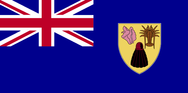
maplink
tccolor.gif
outlinemaplink
tc.gif
visapassenger
-1
largestcity
Grand Turk
rankpopulation
217
人口
17 502
rankgni
208
gni
120000000
rankincomeorigin
67
rankincome
71
income
7059
nationalevent
Constitution Day
nationaleventfr
Jour de la Constitution
nationalholiday
30 August (1976)
生日 年-月-日
1976-08-30 00:00:00
3
5
location
Caribbean, two island groups in the North Atlantic Ocean, southeast of The Bahamas, north of Haiti
terrain
low, flat limestone; extensive marshes and mangrove swamps
naturalresources
spiny lobster, conch
9
rgbback
16777215
todate
1
46
id
国家/地区
英语国家/地区名
Tuvalu
法语国家/地区名
Tuvalu
countryucasefr
TUVALU
国家/地区名
西班牙语国家/地区名
Tuvalu
意大利语国家/地区名
Tuvalu
葡萄牙语国家/地区名
Tuvalu
德语国家/地区名
Tuvalu
countrypy
tu3 wa3 lu3
countryfull
Tuvalu
countrynm
Tuvalu
国际编码2
TV
国际编码3
TUV
countrycodeisono
798
countrycodeolympic
TUV
countrycodeirs
TV
countrycodeirsfr
TV
countrycodeirsmixt
TV
♂男性
12
6
51
languagesfr
Anglais
10
currency
dollar
currencyfr
dollar australien
currencyisocode
AUD
currencyisocodefull
AUD 036
currencypxcode
AUD
currencysymbol
A$
currencysubdivision
100 cents
currencyregime
float
currencyvalue
0.7485
首都
Funafuti
capitalfr
Funafuti
电话号码前缀
688
面积 km2
26
arealand
26
coastline
24
summit
5 m.
timezonedeltabegin
12
flaglink
maplink
tvcolor.gif
outlinemaplink
tv.gif
visapassenger
-1
largestcity
Funafuti
rankpopulation
221
人口
10 838
rankgni
216
gni
20000000
rankincomeorigin
120
rankincome
129
income
1818
lifeexpectation
67.66
alphabetizationrate
0.55
natalityrate
0.02163
mortalityrate
0.00724
mortalityrateinfantile
0.02069
urbanization
0.532
nationalevent
Independence Day
nationaleventfr
Jour de l'Indépendance
nationalholiday
1 October (1978)
生日 年-月-日
1978-10-01 00:00:00
5
7
president
Reine Elisabeth II
location
Oceania, island group consisting of nine coral atolls in the South Pacific Ocean, about one-half of the way from Hawaii to Australia
terrain
very low-lying and narrow coral atolls
naturalresources
fish
9
rgbback
16777215
todate
1
47
id
国家/地区
英语国家/地区名
Vanuatu
法语国家/地区名
Vanuatu
countryucasefr
VANUATU
国家/地区名
西班牙语国家/地区名
Vanuatu
意大利语国家/地区名
Vanuatu
葡萄牙语国家/地区名
Vanuatu
德语国家/地区名
Vanuatu
countrypy
wa3 nu3 a1 tu2
countrylocal
Vanuatu
countryfull
Vanuatu
countrynm
Vanuatu
国际编码2
VU
国际编码3
VUT
countrycodeisono
548
countrycodeolympic
VAN
countrycodeirs
NH
countrycodeirsfr
NH
countrycodeirsmixt
NH
♂男性
16
6
51
languagesfr
Anglais, Français
116
currency
vatu
currencyfr
vatu
currencyisocode
VUV
currencyisocodefull
VUV 548
currencypxcode
VUV
currencysymbol
VT
currencysubdivision
100 centimes
currencyregime
composite
currencyvalue
0.00917
首都
Port-Vila
capitalfr
Port-Vila
电话号码前缀
678
面积 km2
14 763
arealand
12 200
landarablerate
0.0246
landforestrate
0.367
coastline
2528
summit
Mount Tabwemasana 1 880 m.
timezonedeltabegin
11
flaglink
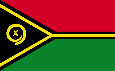
maplink
vucolor.gif
outlinemaplink
vu.gif
visapassenger
-1
maincities
Santo, Norsupo, Lamap, Isangel
largestcity
Port Vila
largestcitypopulation
23 000
rankpopulation
177
人口
210 000
rankgdp
175
gdp
283000000
rankgdpppp
164
gdpppp
619000000
rankgni
201
gni
248000000
rankincomeorigin
129
rankincome
141
income
1180
rankincomeppp
145
incomeppp
2900
lifeexpectation
62.1
alphabetizationrate
0.525
natalityrate
0.02367
fecondity
4.13
mortalityrate
0.00802
mortalityrateinfantile
0.05663
growthrate
0.01566
hdi
0.568
urbanization
0.247
nationalevent
Independence Day
nationaleventfr
Jour de l'Indépendance
nationalholiday
30 July (1980)
生日 年-月-日
1980-07-30 00:00:00
7
9
location
Oceania, group of islands in the South Pacific Ocean, about three-quarters of the way from Hawaii to Australia
terrain
mostly mountains of volcanic origin; narrow coastal plains
naturalresources
manganese, hardwood forests, fish
9
网站
rgbback
16777215
todate
1
48
id
国家/地区
英语国家/地区名
Virgin Islands (UK)
法语国家/地区名
Vierges/Britanniques (îles)
countryucasefr
VIERGES/BRITANNIQUES (ILES)
国家/地区名
西班牙语国家/地区名
Islas De la Virgen (Británicas)
意大利语国家/地区名
Le Isole Vergini (Britanniche)
葡萄牙语国家/地区名
Consoles Do Virgin (Britânicos)
德语国家/地区名
JungfraucInseln (Britisch)
countryfull
British Virgin Islands
countrynm
British Virgin Islands
国际编码2
VG
国际编码3
VGB
countrycodeisono
092
countrycodevehicle
BVI
countrycodeolympic
IVB
countrycodeirs
VI
countrycodeirsfr
VI
countrycodeirsmixt
VI
♀女性
12
6
51
22
currency
pound
currencyisocode
GBP
currencyisocodefull
GBP 826
currencypxcode
GBP
currencysymbol
£
currencysubdivision
100 pence
currencyregime
float
currencyvalue
1.8091
首都
Road Town
capitalfr
Road Town
电话号码前缀
1-284
面积 km2
153
arealand
153
landarablerate
0.2
landforestrate
0.2
coastline
80
timezonedeltabegin
-4
flaglink

maplink
vgcolor.gif
outlinemaplink
vg.gif
visapassenger
-1
largestcity
Road Town
rankpopulation
215
人口
20 353
rankgni
196
gni
270000000
rankincomeorigin
42
rankincome
42
income
13500
nationalevent
Territory Day
nationaleventfr
Jour du Territoire
nationalholiday
1 July
生日 年-月-日
2000-07-01 00:00:00
7
5
president
Reine Elizabeth II
location
Caribbean, between the Caribbean Sea and the North Atlantic Ocean, east of Puerto Rico
terrain
coral islands relatively flat; volcanic islands steep, hilly
naturalresources
NEGL
cooking
The British Virgin Islands are a group of over 50 islands and Cays located in the northeast Caribbean. They include Tortola, Virgin Gorda, Anegada, Jost Van Dyke, Great Camanoe, Guana Island, Peter Island, Salt Island, Beef Island, Cooper Island, Ginger Island, Norman Island, and many other small islands all clustered around Sir Francis Drake Channel. The Caribbean or the West Indies is a group of islands in the Caribbean Sea. ... Tortola is the largest and most populated of the British Virgin Islands. ... Huge boulders litter the beach at The Baths Virgin Gorda is the second-largest of the British Virgin Islands. ... Unlike the other British Virgin Islands, Anegada is a flat atoll. ... At roughly 8 square kilometers, Jost Van Dyke is the smallest of the four main islands of the British Virgin Islands, the northern portion of the archipelago of the Virgin Islands, located in the Atlantic Ocean and Caribbean Sea. ... Great Camanoe is a small island located just north of Beef Island and northeast of Tortola in the British Virgin Islands, a group of islands which forms part of the archipelago of the Virgin Islands, located in the Atlantic Ocean and Caribbean Sea. ... Norman Island is located at the southern tip of the British Virgin Islands archipelago. ...
9
rgbback
16777215
todate
1
49
id
国家/地区
英语国家/地区名
Wake Island
法语国家/地区名
Ile Wake
countryucasefr
ILE WAKE
国家/地区名
西班牙语国家/地区名
Isla De la Estela
意大利语国家/地区名
Isola Di Risveglio
葡萄牙语国家/地区名
Console Da Vigília
德语国家/地区名
SpurcInsel
countryfull
Wake Island
countrynm
Wake Island
国际编码2
UMI1
国际编码3
UMI1
countrycodeisono
581
countrycodeirs
WQ
countrycodeirsfr
WQ
countrycodeirsmixt
WQ
♀女性
17
7
57
6
currency
dollar
currencyisocode
USD
currencyisocodefull
USD 840
currencypxcode
USD
currencysymbol
$
currencysubdivision
100 cents
currencyregime
float
currencyvalue
1
面积 km2
6.50
arealand
6.50
coastline
19.3
timezonedeltabegin
12
flaglink
maplink
wake.gif
visapassenger
-1
rankincome
222
location
Oceania, atoll in the North Pacific Ocean, about two-thirds of the way from Hawaii to the Northern Mariana Islands
terrain
atoll of three coral islands built up on an underwater volcano; central lagoon is former crater, islands are part of the rim
naturalresources
none
cooking
Oceania, atoll in the North Pacific Ocean, about two-thirds of the way from Hawaii to the Northern Mariana Islands
9
rgbback
16777215
todate
1
50
id
国家/地区
英语国家/地区名
Wallis and Futuna
法语国家/地区名
Wallis et Futuna
countryucasefr
WALLIS ET FUTUNA
国家/地区名
西班牙语国家/地区名
Wallis y Futuna
意大利语国家/地区名
Wallis e Futuna
葡萄牙语国家/地区名
Wallis e Futuna
德语国家/地区名
Wallis und Futuna
countryfull
Wallis and Futuna
countrynm
Wallis and Futuna
国际编码2
WF
国际编码3
WLF
countrycodeisono
876
countrycodeirs
WF
countrycodeirsfr
WF
countrycodeirsmixt
WF
♂男性
15
6
57
2
currency
franc
currencyisocode
XPF
currencyisocodefull
XPF 953
currencypxcode
XPF
currencysubdivision
100 centimes
currencyregime
Euro (119.253)
currencyvalue
0.01025
首都
Mata-Utu
capitalfr
Mata-Utu
电话号码前缀
681
面积 km2
274
arealand
274
landarablerate
0.05
coastline
129
timezonedeltabegin
12
flaglink
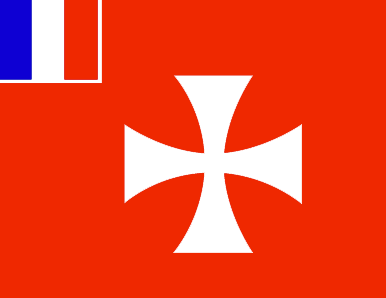
maplink
wallisf.gif
outlinemaplink
wf.gif
visapassenger
-1
largestcity
Mata-Utu
rankpopulation
218
人口
15 283
rankgni
211
gni
60000000
rankincomeorigin
87
rankincome
90
income
4000
nationalevent
Bastille Day
nationaleventfr
Jour de la prise de la Bastille
nationalholiday
14 July (1789)
生日 年-月-日
1789-07-14 00:00:00
6
10
location
Oceania, islands in the South Pacific Ocean, about two-thirds of the way from Hawaii to New Zealand
terrain
volcanic origin; low hills
naturalresources
NEGL
9
rgbback
16777215
todate
1
51
id
国家/地区
英语国家/地区名
Palau
法语国家/地区名
Palaos
countryucasefr
PALAOS
国家/地区名
countryfull
Palau
countrynm
Palau
国际编码2
PW
国际编码3
PLW
countrycodeisono
585
countrycodeolympic
PLW
countrycodeirs
PW
countrycodeirsfr
PW
countrycodeirsmixt
PW
♂男性
19
6
51
languagesfr
Anglais
6
currency
dollar
currencyfr
Dollar
currencyisocode
USD
currencyisocodefull
USD 840
currencypxcode
USD
currencysymbol
$
currencysubdivision
100 cents
currencyregime
float
currencyvalue
1
首都
Koror
capitalfr
Koror
电话号码前缀
680
面积 km2
494
arealand
458
landarablerate
0.2174
landforestrate
0.761
coastline
1519
summit
Mount Ngerchelchauus 242 m.
boundarycountries
Anies.
timezonedeltabegin
9
flaglink
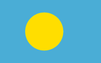
maplink
palau.jpg
maincities
Anies
largestcity
Koror
largestcitypopulation
12 000
rankpopulation
207
人口
20 000
rankgdp
182
gdp
126000000
rankgni
206
gni
130000000
rankincomeorigin
66
rankincome
73
income
6500
nationalevent
Constitution Day
nationaleventfr
Jour de la Constitution
nationalholiday
9 July (1979)
生日 年-月-日
1979-07-09 00:00:00
6
8
location
Oceania, group of islands in the North Pacific Ocean, southeast of the Philippines
terrain
varying geologically from the high, mountainous main island of Babelthuap to low, coral islands usually fringed by large barrier reefs
naturalresources
forests, minerals (especially gold), marine produc
9
rgbback
16777215
todate
1
52
id
国家/地区
英语国家/地区名
Jarvis Island
法语国家/地区名
Ile Jarvis
countryucasefr
ILE JARVIS
国家/地区名
countryfull
Jarvis Island
countrynm
Jarvis Island
国际编码2
UMI2
国际编码3
UMI2
countrycodeisono
581
countrycodeirs
UM
countrycodeirsfr
UM
countrycodeirsmixt
JAR
♀女性
17
7
51
languagesfr
Anglais
22
currencypxcode
USD
nationalityfr
Américaine
首都
Millersville
capitalfr
Millersville
面积 km2
4.50
arealand
4.50
coastline
8
timezonedeltabegin
-11
flaglink
maplink
dq-map.gif
largestcity
Millersville
rankincome
222
location
Oceania, island in the South Pacific Ocean, about half way between Hawaii and the Cook Islands
terrain
sandy, coral island surrounded by a narrow fringing reef
naturalresources
guano (deposits worked until late 1800s), terrestr
9
rgbback
16777215
todate
1
53
id
国家/地区
英语国家/地区名
Tristan da Cunha Island
法语国家/地区名
Tristan da Cunha
countryucasefr
TRISTAN DA CUNHA
国家/地区名
countryfull
Tristan da Cunha Island
countrynm
Tristan da Cunha Island
国际编码2
TDC
国际编码3
TDC
countrycodeisono
654
countrycodeirs
SH
countrycodeirsfr
SH
countrycodeirsmixt
TDC
♂男性
12
8
51
languagesfr
Anglais
22
currency
Livre Sterling
currencyfr
Livre Sterling
首都
Edingburgh
capitalfr
Edingburgh
电话号码前缀
290
面积 km2
65
arealand
65
flaglink
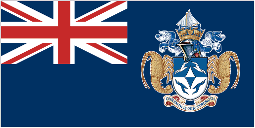
maplink
tristandc.gif
largestcity
Edingburgh
人口
310
rankincome
222
location
Îles situées dans lOcéan Atlantique Sud comprenant lÎle Tristan da Cunha (Tristan da Cunha Island), lÎle Gough (Gough Island), lÎle Inaccessible (Inaccessible Island) et lÎle Nightingale (Nightingale Island).
9
rgbback
16777215
todate
1
小注
Belongs to Saint Helena
提供反馈意见 (37)
37. 来访者 *.*.164.* - 2022-03-16 17:43:29
Buenas recomendaciones y todo lo que lleva el contenido de la web es increíble!
36. 来访者 *.*.222.* - 2022-02-09 12:45:33
Los materiales que se utilizan para realizar este tipo de prácticas están todos hechos de madera!
35. 来访者 *.*.225.* - 2022-01-24 16:55:06
Buenas ideas sabemos como podemos inspirarnos gracias a links así!
34. 来访者 *.*.32.* - 2022-01-19 19:32:41
Los sitios web de esta manera me inspiran a seguir trabajando duro!
33. 来访者 *.*.146.* - 2021-11-26 15:19:37
Excellent information on your content, thank you for taking the time to share with us.
节日 关闭
恭喜圣灵降临节: 星期一 五月二十日, ,您的亚洲之家将在11:30到0点之间营业,勿忘光临啊! 
爆起窗口 关闭