Indonesia 印度尼西亚 => A Country of Beautiful Wood

Indonesia 印度尼西亚 => A Country of Beautiful Wood

The Artisans

Indonesian Furniture Selection

The Objects

History of Indonesian Furniture

Indonesia 印度尼西亚 => A Country of Beautiful Wood

Updated 2023-11-09 09:24:11

Indonesia is a country on the continent Asia, her capital is Jakarta. Here is the hierarchy of the Indonesia administrative divisions: Indonesia is subdivided into provinces, that are at their turn subdivided into regencies (kabupaten), cities (kota), that are at their turn subdivided into districts, that are at their turn subdivided into towns and villages.

The names of countries/territories of the world are taught in English and Chinese. This collection of precious dry lands that shares the whole mankind includes not only the world's independent countries, but also specific areas that are not a UNUnited Nations: We the peoples...A stronger UN for a better world. member. Please visit the table of male and female genders of country names in French.

Countries/locations    Close
Indonesia | Countries/Territories | Regions of China | Provinces of China | Regions in France | French Departments | States/Provinces | Cities/Towns | Locations | World Continents | French AOP Wines

1

id
Country
Country
Saba
Country in French
Saba
countryucasefr
Saba
Country in Chinese
Country in Spanish
Saba
Country in Italian
Saba
Country in Portuguese
Saba
Country in Germain
Saba
ISO2
XC
ISO3
NL-BQ3
todate
1

2

id
Country
Country
Saint Barthelemy
Country in French
Saint Barthélemy
countryucasefr
Saint Barthelemy
Country in Chinese
Country in Spanish
Saint Barthelemy
Country in Italian
Saint Barthelemy
Country in Portuguese
Saint Barthelemy
Country in Germain
Saint Barthelemy
ISO2
BL
ISO3
BLM
todate
1

3

id
Country
Country
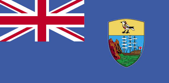
Saint Helena
Country in French
Sainte Hélène
countryucasefr
SAINTE HELENE
Country in Chinese
Country in Spanish
St. Helena
Country in Italian
La Sant'Elena
Country in Portuguese
St. Helena
Country in Germain
St. Helena
countryfull
Saint Helena
countrynm
Saint Helena
ISO2
SH
ISO3
SHN
countrycodeisono
654
countrycodeirs
SH
countrycodeirsfr
SH
countrycodeirsmixt
SH
12
6
51
89
currency
pound
currencyisocode
SHP
currencyisocodefull
SHP 654
currencypxcode
SHP
currencysymbol
£S
currencysubdivision
100 new pence
currencyregime
GBP (1.0)
currencyvalue
1.8345
Capital
Jamestown
capitalfr
Jamestown
Phone Prefix
290
Area km2
122
arealand
410
landarablerate
0.129
landforestrate
0.065
coastline
60
flaglink
maplink
sh-map.gif
visapassenger
-1
largestcity
Jamestown
rankpopulation
222
Population
7 212
rankgni
215
gni
30000000
rankincomeorigin
78
rankincome
85
income
4286
nationalevent
Birthday of Queen ELIZABETH II
nationaleventfr
Anniversaire de la Reine ELIZABETH II
nationalholiday
Second Saturday in June (1926)
Birthday yyyy-mm-dd
1926-06-01 00:00:00
3
3
location
islands in the South Atlantic Ocean, about midway between South America and Africa
terrain
Saint Helena - rugged, volcanic; small scattered plateaus and plains (the other islands of the group have a volcanic origin)
naturalresources
fish
9
rgbback
16777215
todate
1

4

id
Country
Country
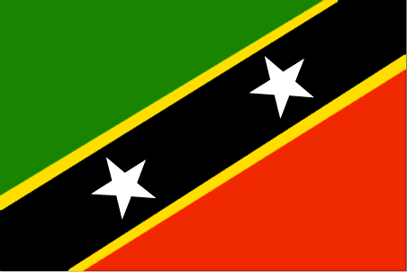
Saint Kitts and Nevis
Country in French
Saint-Christophe-et-Niévès
countryucasefr
SAINT-CHRISTOPHE-ET-NIEVES
Country in Chinese
Country in Spanish
St. Kitts y Nevis
Country in Italian
St Kitts e Nevis
Country in Portuguese
St. Kitts e Nevis
Country in Germain
Str. Kitts und Nevis
countrypy
sheng4 ji1 ci2 he2 ni2 wei2 si1
countrylocal
Saint Kitts and Nevis
countryfull
Saint Kitts and Nevis
countrynm
Saint Kitts and Nevis
ISO2
KN
ISO3
KNA
countrycodeisono
659
countrycodeolympic
SKN
countrycodeirs
SC
countrycodeirsfr
SC
countrycodeirsmixt
SC
♂Male
12
6
51
languagesfr
Anglais
35
currency
dollar
currencyfr
dollar des Caraïbes oriental
currencyisocode
XCD
currencyisocodefull
XCD 951
currencypxcode
XCD
currencysymbol
EC$
currencysubdivision
100 cents
currencyregime
US-$ (2.7)
currencyvalue
0.3745
Capital
Basseterre
capitalfr
Basseterre
Phone Prefix
1-869
Area km2
261
arealand
261
landarablerate
0.1667
landforestrate
0.111
coastline
135
summit
Mount Liamuiga 1 156 m.
timezonedeltabegin
-4
flaglink
maplink
kncolor.gif
outlinemaplink
kn.gif
visapassenger
-1
maincities
Charlestown, Newcastle, Sandy Point .
largestcity
Basse-Terre
largestcitypopulation
12 000
rankpopulation
202
Population
47 000
rankgdp
172
gdp
346000000
rankgdpppp
165
gdpppp
579000000
rankgni
196
gni
309000000
rankincomeorigin
65
rankincome
72
income
6630
rankincomeppp
70
incomeppp
10740
nationalevent
Independence Day
nationaleventfr
Jour de l'Indépendance
nationalholiday
19 September (1983)
Birthday yyyy-mm-dd
1983-09-19 00:00:00
10
12
location
Caribbean, islands in the Caribbean Sea, about one-third of the way from Puerto Rico to Trinidad and Tobago
terrain
volcanic with mountainous interiors
naturalresources
arable land
9
Web
rgbback
16777215
todate
1

5

id
Country
Country
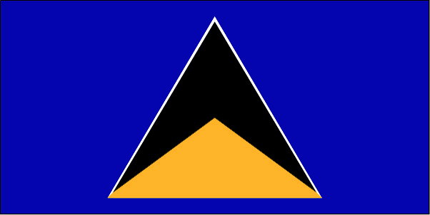
Saint Lucia
Country in French
Sainte-Lucie
countryucasefr
SAINTE-LUCIE
Country in Chinese
Country in Spanish
St. Lucia
Country in Italian
St Lucia
Country in Portuguese
St. Lucia
Country in Germain
Str. Lucia
countrypy
sheng4 lu2 xi1 ya4
countrylocal
Saint Lucia
countryfull
Saint Lucia
countrynm
Saint Lucia
ISO2
LC
ISO3
LCA
countrycodeisono
662
countrycodevehicle
WL
countrycodeolympic
LCA
countrycodeirs
ST
countrycodeirsfr
ST
countrycodeirsmixt
ST
♀Female
18
6
51
languagesfr
Anglais
35
currency
dollar
currencyfr
dollar des Caraïbes orientales
currencyisocode
XCD
currencyisocodefull
XCD 951
currencypxcode
XCD
currencysymbol
EC$
currencysubdivision
100 cents
currencyregime
US-$ (2.7)
currencyvalue
0.3745
Capital
Castries
capitalfr
Castries
Phone Prefix
1-758
Area km2
620
arealand
606
areawater
10
landarablerate
0.0492
landforestrate
0.148
coastline
158
summit
Mont Gimie 950 m.
timezonedeltabegin
-4
flaglink
maplink
lccolor.gif
outlinemaplink
lc.gif
visapassenger
-1
maincities
Vieux Fort, Dennery, Micoud, Soufrière.
largestcity
Castries
largestcitypopulation
53 000
rankpopulation
181
Population
161 000
rankgdp
165
gdp
693000000
rankgdpppp
158
gdpppp
917000000
rankgni
184
gni
650000000
rankincomeorigin
80
rankincome
88
income
4050
rankincomeppp
114
incomeppp
5310
lifeexpectation
73.34
alphabetizationrate
0.67
natalityrate
0.0205
fecondity
2.27
mortalityrate
0.00518
mortalityrateinfantile
0.01395
hdi
0.775
urbanization
0.38
nationalevent
Independence Day
nationaleventfr
Jour de l'Indépendance
nationalholiday
22 February (1979)
Birthday yyyy-mm-dd
1979-02-22 00:00:00
6
8
president
Reine Elisabeth II
location
Caribbean, island between the Caribbean Sea and North Atlantic Ocean, north of Trinidad and Tobago
terrain
volcanic and mountainous with some broad, fertile valleys
naturalresources
forests, sandy beaches, minerals (pumice), mineral
9
Web
rgbback
16777215
todate
1

6

id
Country
Country
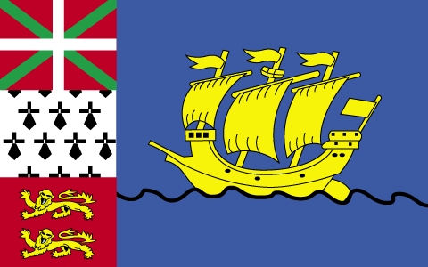
Saint Pierre and Miquelon
Country in French
St. Pierre et Miquelon
countryucasefr
ST. PIERRE ET MIQUELON
Country in Chinese
Country in Spanish
St. Pierre y Miquelon
Country in Italian
St Pierre e Miquelon
Country in Portuguese
St. Pierre e Miquelon
Country in Germain
Str. Pierre und Miquelon
countryfull
Saint Pierre and Miquelon
countrynm
Saint Pierre and Miquelon
ISO2
PM
ISO3
SPM
countrycodeisono
666
countrycodeirs
SB
countrycodeirsfr
SB
countrycodeirsmixt
SB
♂Male
15
6
57
2
currencyfr
euro
currencypxcode
EUR
currencysymbol
nationalityfr
Française
Capital
Saint-Pierre
capitalfr
Saint-Pierre
Phone Prefix
508
Area km2
242
arealand
242
landarablerate
0.1304
coastline
120
timezonedeltabegin
-3
flaglink
maplink
stpierremiq.gif
visapassenger
-1
largestcity
Saint-Pierre
rankpopulation
223
Population
6 896
rankgni
212
gni
50000000
rankincomeorigin
66
rankincome
70
income
7143
nationalevent
Bastille Day
nationaleventfr
Jour de la prise de la Bastille
nationalholiday
14 July (1789)
Birthday yyyy-mm-dd
1789-07-14 00:00:00
6
10
location
Northern North America, islands in the North Atlantic Ocean, south of Newfoundland (Canada)
terrain
mostly barren rock
naturalresources
fish, deepwater ports
3
rgbback
16777215
todate
1

7

id
Country
Country
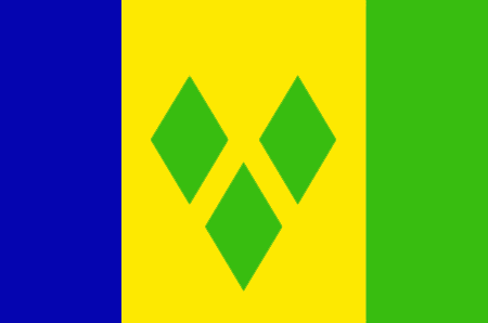
Saint Vincent and the Grenadines
Country in French
Saint-Vincent-et-les Grenadines
countryucasefr
SAINT-VINCENT-ET-LES GRENADINES
Country in Chinese
Country in Spanish
St. Vincent y el Grenadines
Country in Italian
St Vincent & il Grenadines
Country in Portuguese
St. Vincent & o Grenadines
Country in Germain
Str. Vincent u. das Grenadines
countrypy
sheng4 wen2 sen1 te4 he2 ge2 lin2 na4 ding1 si1
countrylocal
Saint Vincent and the Grenadines
countryfull
Saint Vincent and the Grenadines
countrynm
Saint Vincent and the Grenadines
ISO2
VC
ISO3
VCT
countrycodeisono
670
countrycodevehicle
WV
countrycodeolympic
VIN
countrycodeirs
VC
countrycodeirsfr
VC
countrycodeirsmixt
VC
18
6
51
languagesfr
Anglais
35
currency
dollar
currencyfr
dollar des Caraïbes orientales
currencyisocode
XCD
currencyisocodefull
XCD 951
currencypxcode
XCD
currencysymbol
EC$
currencysubdivision
100 cents
currencyregime
US-$ (2.7)
currencyvalue
0.3745
nationalityfr
Française
Capital
Kingstown
capitalfr
Kingstown
Phone Prefix
1-784
Area km2
389
arealand
389
landarablerate
0.1026
landforestrate
0.154
coastline
84
summit
Soufrière 1 234 m.
timezonedeltabegin
-4
flaglink
maplink
vccolor.gif
outlinemaplink
vc.gif
visapassenger
-1
maincities
Georgetown, Fancy, Chateaubelair, Layou.
largestcity
Kingstown
largestcitypopulation
27 000
rankpopulation
186
Population
109 000
rankgdp
171
gdp
371000000
rankgdpppp
163
gdpppp
668000000
rankgni
192
gni
361000000
rankincomeorigin
91
rankincome
101
income
3310
rankincomeppp
105
incomeppp
5870
lifeexpectation
73.35
alphabetizationrate
0.96
natalityrate
0.01677
fecondity
2.23
mortalityrate
0.00604
mortalityrateinfantile
0.01524
hdi
0.755
urbanization
0.56
nationalevent
Independence Day
nationaleventfr
Jour de l'Indépendance
nationalholiday
27 October (1979)
Birthday yyyy-mm-dd
1979-10-27 00:00:00
6
8
location
Caribbean, islands between the Caribbean Sea and North Atlantic Ocean, north of Trinidad and Tobago
terrain
volcanic, mountainous
naturalresources
hydropower, cropland
9
Web
rgbback
16777215
todate
1

8

id
Country
Country
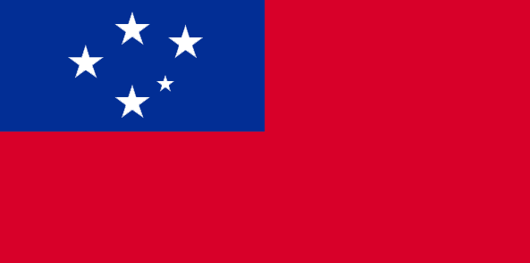
Samoa
Country in French
Samoa Occidental
countryucasefr
SAMOA OCCIDENTAL
Country in Chinese
Country in Spanish
Samoa (Occidental)
Country in Italian
La Samoa (Occidentale)
Country in Portuguese
Samoa (Ocidental)
Country in Germain
Samoa-Inseln (Westlich)
countrypy
sa4 mo2 ya4
countrylocal
Samoa
countryfull
Samoa
countrynm
Samoa
ISO2
WS
ISO3
WSM
countrycodeisono
882
countrycodevehicle
WS
countrycodeolympic
SAM
countrycodeirs
WS
countrycodeirsfr
WS
countrycodeirsmixt
WS
♂Male
12
6
185
languagesfr
Samoan, Anglais
117
currency
tala
currencyfr
dollar des Samoa
currencyisocode
WST
currencyisocodefull
WST 882
currencypxcode
WST
currencysymbol
WS$
currencysubdivision
100 sene
currencyregime
composite
currencyvalue
0.367
Capital
Apia
capitalfr
Apia
Phone Prefix
685
Area km2
2 860
arealand
2 934
areawater
10
landarablerate
0.1943
landforestrate
0.372
coastline
403
summit
Mauga Silisili 1 857 m.
timezonedeltabegin
-11
flaglink
maplink
wscolor.gif
outlinemaplink
ws.gif
visapassenger
-1
maincities
Satupaitea, Tuasivi, Salaiula, Siumu
largestcity
Apia
largestcitypopulation
33 000
rankpopulation
178
Population
178 000
rankgdp
176
gdp
268000000
rankgdpppp
156
gdpppp
1042000000
rankgni
199
gni
257000000
rankincomeorigin
124
rankincome
136
income
1440
rankincomeppp
108
incomeppp
5780
lifeexpectation
70.41
alphabetizationrate
0.9965
natalityrate
0.01569
fecondity
4.12
mortalityrate
0.00647
mortalityrateinfantile
0.02872
hdi
0.775
urbanization
0.377
nationalevent
Independence Day Celebration
nationaleventfr
Jour de l'Indépendance
nationalholiday
1 June (1962)
Birthday yyyy-mm-dd
1962-06-01 00:00:00
9
3
location
Oceania, group of islands in the South Pacific Ocean, about one-half of the way from Hawaii to New Zealand
terrain
narrow coastal plain with volcanic, rocky, rugged mountains in interior
naturalresources
hardwood forests, fish, hydropower
9
rgbback
16777215
todate
1

9

id
Country
Country
San Marino
Country in French
Saint-Marin
countryucasefr
SAINT-MARIN
Country in Chinese
Country in Spanish
San Marino
Country in Italian
San Marino
Country in Portuguese
San Marino
Country in Germain
San Marino
countrypy
sheng4 ma3 li4 nuo4
countrylocal
San Marino
countryfull
San Marino
countrynm
San Marino
ISO2
SM
ISO3
SMR
countrycodeisono
674
countrycodevehicle
RSM
countrycodeolympic
SMR
countrycodeirs
SM
countrycodeirsfr
SM
countrycodeirsmixt
SM
15
6
84
languagesfr
Italien
2
currency
euro
currencyfr
euro
currencyisocode
EUR
currencyisocodefull
EUR 978
currencypxcode
EUR
currencysymbol
currencysubdivision
100 cents
currencyregime
float
currencyvalue
1.2203
Capital
Saint-Marin
capitalfr
Saint-Marin
Phone Prefix
378
Area km2
62
arealand
61.20
landarablerate
0.1667
summit
Monte Titano 739 m.
boundarycountries
Italie.
timezonedeltabegin
1
flaglink
maplink
sm-map.gif
outlinemaplink
sm.gif
visapassenger
-1
maincities
Serravalle, Borgo Maggiore
largestcity
San Marino
largestcitypopulation
5 000
rankpopulation
206
Population
28 000
rankgdp
156
gdp
880000000
rankgni
178
gni
653000000
rankincomeorigin
15
rankincome
222
rankincomeppp
13
nationalevent
Founding of the Republic
nationaleventfr
Jour National
nationalholiday
3 September (301)
Birthday yyyy-mm-dd
1753-01-01 00:00:00
9
9
location
Southern Europe, an enclave in central Italy
terrain
rugged mountains
naturalresources
building stone
9
Web
rgbback
16777215
todate
1

10

id
Country
Country
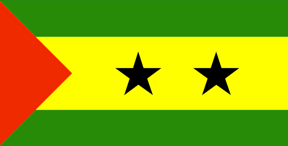
Sao Tome and Principe
Country in French
Sao Tomé-et-Principe
countryucasefr
SAO TOME-ET-PRINCIPE
Country in Chinese
Country in Spanish
Tomo de sao y Príncipe
Country in Italian
Tomo di sao ed il Principe
Country in Portuguese
Tome de sao e principe
Country in Germain
Saotome und principe
countrypy
sheng4 duo1 mei3 he2 pu3 lin2 xi1 bi3
countrylocal
São Tomé e Príncipe
countryfull
Sao Tome and Principe
countrynm
Sao Tome and Principe
ISO2
ST
ISO3
STP
countrycodeisono
678
countrycodeolympic
STP
countrycodeirs
TP
countrycodeirsfr
TP
countrycodeirsmixt
TP
♂Male
15
6
114
languagesfr
Portugais
2
currency
dobra
currencyfr
dobra
currencyisocode
STD
currencyisocodefull
STD 678
currencypxcode
STD
currencysymbol
Db
currencysubdivision
100 centimos [*]
currencyregime
m.float
currencyvalue
0.00011
Capital
Sao Tome
capitalfr
Sao Tomé
Phone Prefix
239
Area km2
963
arealand
1 001
landarablerate
0.02
landforestrate
0.283
coastline
209
summit
Pico de São Tomé 2 024 m.
flaglink
maplink
stcolor.gif
outlinemaplink
stout.gif
visapassenger
-1
maincities
Santo António, Porto Alegre.
largestcity
Sao Tome
largestcitypopulation
57 000
rankpopulation
182
Population
157 000
rankgdp
184
gdp
59000000
rankgni
208
gni
48000000
rankincomeorigin
183
rankincome
197
income
300
lifeexpectation
66.28
alphabetizationrate
0.574
natalityrate
0.04781
mortalityrate
0.00711
mortalityrateinfantile
0.04604
hdi
0.547
nationalevent
Independence Day
nationaleventfr
Jour de l'Indépendance
nationalholiday
12 July (1975)
Birthday yyyy-mm-dd
1975-07-12 00:00:00
2
4
location
Western Africa, islands in the Gulf of Guinea, straddling the Equator, west of Gabon
terrain
volcanic, mountainous
naturalresources
fish, hydropower
9
Web
rgbback
16777215
todate
1

11

id
Country
Country
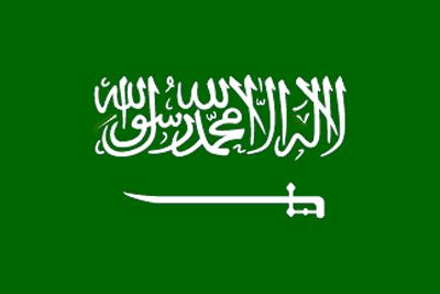
Saudi Arabia
Country in French
Arabie Saoudite
countryucasefr
ARABIE SAOUDITE
Country in Chinese
Country in Spanish
Arabia Saudi
Country in Italian
L'Arabia Saudi
Country in Portuguese
Arábia Saudi
Country in Germain
Saudi Arabien
countrypy
sha1 te4 a1 la1 bo2
countrylocal
Al Arabiyah as Suudiyah
countryfull
Saudi Arabia
countrynm
Saudi Arabia
ISO2
SA
ISO3
SAU
countrycodeisono
682
countrycodevehicle
SA
countrycodeolympic
KSA
countrycodeirs
SA
countrycodeirsfr
SA
countrycodeirsmixt
SA
countrycode
966
♀Female
1
3
3
languagesfr
Arabei
90
currency
riyal
currencyfr
riyal
currencyisocode
SAR
currencyisocodefull
SAR 682
currencypxcode
SAR
currencysymbol
SRls
currencysubdivision
100 halalat
currencyregime
US-$ (lim.flex.)
currencyvalue
0.2667
nationalityfr
Saoudienne
Capital
Riyadh
capitalfr
Riyad
Phone Prefix
966
Area km2
2 149 690
arealand
1 960 582
landarablerate
0.0172
landforestrate
0.007
coastline
2640
summit
Jabal al Hijaz 3 133 m.
boundarycountries
Jordanie, Irak, Koweït, Qatar, Oman, Yémen, Emirats Arabes Unis.
timezonedeltabegin
3
flaglink
maplink
sacolor.gif
outlinemaplink
saout.gif
visapassenger
-1
maincities
Jeddah, La Mecque, Medina, Dammam, At Ta'if, Al Hufuf, Haradh, Tabuk, Buraydah.
largestcity
Riyadh
largestcitypopulation
2 619 000
rankpopulation
46
Population
22 528 000
rankgdp
23
gdp
214748000000
rankgdpppp
27
gdpppp
297967000000
rankgni
21
gni
208089000000
rankincomeorigin
56
rankincome
60
income
9240
rankincomeppp
61
incomeppp
13230
lifeexpectation
68.73
alphabetizationrate
0.624
natalityrate
0.0372
mortalityrate
0.00579
mortalityrateinfantile
0.04794
nationalevent
Unification of the Kingdom
nationaleventfr
Unification du Royaume
nationalholiday
23 September (1932)
Birthday yyyy-mm-dd
1932-09-23 00:00:00
9
9
location
Middle East, bordering the Persian Gulf and the Red Sea, north of Yemen
terrain
mostly uninhabited, sandy desert
naturalresources
petroleum, natural gas, iron ore, gold, copper
9
Web
rgbback
16777215
todate
1

12

id
Country
Country
Senegal
Country in French
Sénégal
countryucasefr
SENEGAL
Country in Chinese
Country in Spanish
Senegal
Country in Italian
Il Senegal
Country in Portuguese
Senegal
Country in Germain
Senegal
countrypy
se4 nei4 jia1 er3
countrylocal
Senegal
countryfull
Senegal
countrynm
Senegal
ISO2
SN
ISO3
SEN
countrycodeisono
686
countrycodevehicle
SN
countrycodeolympic
SEN
countrycodeirs
SG
countrycodeirsfr
SG
countrycodeirsmixt
SE
countrycode
221
♂Male
15
6
57
languagesfr
Français
119
currency
franc
currencyfr
franc C.F.A.
currencyisocode
XOF
currencyisocodefull
XOF 952
currencypxcode
XOF
currencysymbol
CFAF
currencysubdivision
100 centimes
currencyregime
Euro (655.957)
currencyvalue
0.00186
nationalityfr
Sénégalaise
Capital
Dakar
capitalfr
Dakar
Phone Prefix
221
Area km2
196 192
arealand
192 000
areawater
4 190
landarablerate
0.1158
landforestrate
0.322
coastline
531
summit
Futa Jaldon Foothills 581 m.
boundarycountries
Mauritanie, Mali, Guinée Bissau, Guinée, Gambie.
flaglink
maplink
sncolor.gif
outlinemaplink
snout.gif
visapassenger
-1
maincities
Thiès, Kaolack, Ziguinchor, Saint Louis, Diourbel.
largestcity
Dakar
largestcitypopulation
1 708 000
rankpopulation
74
Population
10 240 000
rankgdp
107
gdp
6496000000
rankgdpppp
104
gdpppp
16875000000
rankgni
114
gni
5563000000
rankincomeorigin
159
rankincome
173
income
540
rankincomeppp
177
incomeppp
1620
lifeexpectation
56.37
alphabetizationrate
0.383
natalityrate
0.03623
mortalityrate
0.01088
mortalityrateinfantile
0.05757
hdi
0.423
nationalevent
Independence Day
nationaleventfr
Jour de l'Indépendance
nationalholiday
4 April (1960)
Birthday yyyy-mm-dd
1960-04-04 00:00:00
7
1
location
Western Africa, bordering the North Atlantic Ocean, between Guinea-Bissau and Mauritania
terrain
generally low, rolling, plains rising to foothills in southeast
naturalresources
fish, phosphates, iron ore
cooking
Farine de Bonfoufou.
9
Web
rgbback
16777215
todate
1
Notes
Farine de Bonfoufou.

13

id
Country
Country
Serbia
Country in French
Serbie
countryucasefr
SERBIE
Country in Chinese
Country in Spanish
Serbia
Country in Italian
La Serbia
Country in Portuguese
Serbia
Country in Germain
Serbien
countrypy
sai1 er3 wei2 ya4 ji2 meng2 te4 ni2 ge1 luo2
countrylocal
Srbija i Crna Gora
countryfull
Serbia and Montenegro
countrynm
Serbia
ISO2
RS
ISO3
SRB
countrycodeisono
688
countrycodeolympic
SRB
countrycodeirs
SR
countrycodeirsfr
SR
countrycodeirsmixt
SR
countrycode
381
♀Female
15
6
182
languagesfr
Serbe
91
currency
dinar
currencyfr
dinar
currencyisocode
YUM
currencyisocodefull
YUM 891
currencypxcode
CSD
currencysymbol
Din
currencysubdivision
100 paras
currencyvalue
0.01479
nationalityfr
Serbe
Capital
Belgrade
capitalfr
Belgrade
Phone Prefix
381
Area km2
102 200
arealand
102 136
areawater
214
landarablerate
0.3634
landforestrate
0.283
coastline
199
summit
Daravica 2 656 m.
boundarycountries
Albanie, Bosnie-Herzégovine, Bulgarie, Croatie, Hongrie, Macédoine, Roumanie.
timezonedeltabegin
1
flaglink
maplink
yi-map.gif
outlinemaplink
yu.gif
visapassenger
-1
maincities
Novi Sad, Niš, Subotica, Kragujevac, Zrenjanin, Pec, Podgorica, Pristina, Cacak, Kikinda, Sombor, Leskovac.
largestcity
Belgrade
largestcitypopulation
1 746 528
rankpopulation
87
Population
8 104 000
rankgdp
68
gdp
20729000000
rankgni
78
gni
15848000000
rankincomeorigin
114
rankincome
124
income
1910
lifeexpectation
74.22
alphabetizationrate
0.95
natalityrate
0.01268
mortalityrate
0.01069
mortalityrateinfantile
0.01637
nationalevent
National Day
nationaleventfr
Jour National
nationalholiday
27 April
Birthday yyyy-mm-dd
2000-04-17 00:00:00
7
5
location
Southeastern Europe, bordering the Adriatic Sea, between Albania and Bosnia and Herzegovina
terrain
extremely varied; to the north, rich fertile plains; to the east, limestone ranges and basins; to the southeast, ancient mountains and hills; to the southwest, extremely high shoreline with no islands off the coast
naturalresources
oil, gas, coal, antimony, copper, lead, zinc, nick
7
Web
rgbback
16777215
todate
1

14

id
Country
Country
Seychelles
Country in French
Seychelles
countryucasefr
SEYCHELLES
Country in Chinese
Country in Spanish
Seychelles
Country in Italian
Le Seychelles
Country in Portuguese
Seychelles
Country in Germain
Seychellen
countrypy
sai1 she2 er3
countrylocal
Seychelles
countryfull
Seychelles
countrynm
Seychelles
ISO2
SC
ISO3
SYC
countrycodeisono
690
countrycodevehicle
SY
countrycodeolympic
SEY
countrycodeirs
SE
countrycodeirsfr
SE
countrycodeirsmixt
SEY
♀Female
15
6
57
languagesfr
Français, Anglais
92
currency
rupee
currencyfr
roupie des Seychelles
currencyisocode
SCR
currencyisocodefull
SCR 690
currencypxcode
SCR
currencysymbol
SR
currencysubdivision
100 cents
currencyregime
SDR (7.2345)
currencyvalue
0.1924
nationalityfr
Seychelloises
Capital
Victoria
capitalfr
Victoria
Phone Prefix
248
Area km2
455
arealand
455
landarablerate
0.0222
landforestrate
0.667
coastline
491
summit
Morne Seychellois 905 m.
timezonedeltabegin
4
flaglink
maplink
sccolor.gif
outlinemaplink
scout.gif
visapassenger
-1
maincities
Anse Boileau, Cascade, Anse Royal.
largestcity
Victoria
largestcitypopulation
40 000
rankpopulation
191
Population
84 000
rankgdp
162
gdp
720000000
rankgni
187
gni
626000000
rankincomeorigin
62
rankincome
67
income
7490
lifeexpectation
72.95
alphabetizationrate
0.58
natalityrate
0.01655
fecondity
2.09
mortalityrate
0.00641
mortalityrateinfantile
0.01597
growthrate
0.01445
hdi
0.84
urbanization
0.6528
precipitation
2172
nationalevent
Constitution Day (National Day)
nationaleventfr
Jour de la Constitution (Jour National)
nationalholiday
18 June (1993)
Birthday yyyy-mm-dd
1993-06-18 00:00:00
10
10
location
Eastern Africa, group of islands in the Indian Ocean, northeast of Madagascar
terrain
Mahe Group is granitic, narrow coastal strip, rocky, hilly; others are coral, flat, elevated reefs
naturalresources
fish, copra, cinnamon trees
9
Web
rgbback
16777215
todate
1

15

id
Country
Country
Sicily
Country in French
Sicile
countryucasefr
SICILE
Country in Chinese
Country in Spanish
Sicily
Country in Italian
Sicilia
Country in Portuguese
Sicily
Country in Germain
Sicily
countrylocal
Sicilia
countryfull
Sicily
countrynm
Sicily
ISO2
ITAS
ISO3
ITAS
countrycodeisono
380
countrycodevehicle
I
countrycodeolympic
ITA
countrycodeirs
IT
countrycodeirsfr
IT
countrycodeirsmixt
SCL
countrycode
39
countrycodefr
39
♀Female
1
4
6
84
languagesfr
Italien
religions
Catholic, others
2
currency
Euro
currencyfr
Euro
currencyisocode
EUR
currencyisocodefull
EUR 978
currencypxcode
EUR
currencysymbol
currencysubdivision
100 cents
currencyregime
float
currencyvalue
1.2203
nationality
Italian
nationalityfr
Italienne
Capital
Palermo
capitalfr
Palerme
Phone Prefix
39
longtitude
38
latitude
13.5
Area km2
25 426
arealand
25 706
summit
Mt. Etna (an active volcano), rises 3 323m The central plateau slopes to coastal
timezonedeltabegin
1
flaglink
maplink
sicilymap.gif
outlinemaplink
sicilyout.gif
maincities
Palermo
largestcity
Palermo
largestcitypopulation
676 000
Population
5 200 000
location
Sicily is the largest island (25,426 sq. km.) in the Mediterranean; it is also the most important economically and has the richest heritage of history and art. Its geographical particularity lies in its compact but varied orographical structure, the uniformity of its rivers, the typically Mediterranean climate and the insularity which has helped Sicily to experience homogeneous historical development with originality of custom, art and culture. Together with the minor Aeolian islands (the Lipari), Ustica, Egadi, Pantelleria and the distant Pelagie, Sicily is the most extensive region in Italy, though it has only the fourth highest population. The population density is slightly higher than the national average. The island is bounded by the Tyrrhenian Sea to the north, the Ionian to the east and the Sicilian Sea to the south-west; the Strait of Messina separates it from Calabria.
terrain
Most of the island is a mountainous plateau. The highest point, Mt. Etna (an active volcano), rises to 10,902 ft. (3,323m). The central plateau slopes to coastal lowlands, fertile areas drained by many small rivers amd streams. Significant rivers include the Salso and Simeta.
7
rgbback
16777215
todate
1

16

id
Country
Country
Sierra Leone
Country in French
Sierra Leone
countryucasefr
SIERRA LEONE
Country in Chinese
Country in Spanish
Sierra Leone
Country in Italian
Sierra Leone
Country in Portuguese
Sierra Leone
Country in Germain
Sierra Leone
countrypy
sai1 la1 li4 ang2
countrylocal
Sierra Leone
countryfull
Sierra Leone
countrynm
Sierra Leone
ISO2
SL
ISO3
SLE
countrycodeisono
694
countrycodevehicle
WAL
countrycodeolympic
SLE
countrycodeirs
SL
countrycodeirsfr
SL
countrycodeirsmixt
SL
♂Male
19
6
51
languagesfr
Anglais
22
currency
leone
currencyfr
leone
currencyisocode
SLL
currencyisocodefull
SLL 694
currencypxcode
SLL
currencysymbol
Le
currencysubdivision
100 cents
currencyregime
float
currencyvalue
0.00043
Capital
Freetown
capitalfr
Freetown
Phone Prefix
232
Area km2
71 740
arealand
71 620
areawater
120
landarablerate
0.0676
landforestrate
0.147
coastline
402
summit
Loma Mansa 1 948 m.
boundarycountries
Guinée, Liberia.
flaglink
maplink
slcolor.gif
outlinemaplink
slout.gif
visapassenger
-1
maincities
Bo, Kenema, Makeni, Bonthe, Port Loko.
largestcity
Freetown
largestcitypopulation
699 000
rankpopulation
106
Population
5 337 000
rankgdp
158
gdp
793000000
rankgdpppp
150
gdpppp
2927000000
rankgni
177
gni
808000000
rankincomeorigin
201
rankincome
216
income
150
rankincomeppp
208
incomeppp
530
lifeexpectation
42.69
alphabetizationrate
0.3665
natalityrate
0.04334
mortalityrate
0.02062
mortalityrateinfantile
0.14524
hdi
0.275
urbanization
0.373
precipitation
2946
nationalevent
Independence Day
nationaleventfr
Jour de l'Indépendance
nationalholiday
27 April (1961)
Birthday yyyy-mm-dd
1961-04-27 00:00:00
8
2
location
Western Africa, bordering the North Atlantic Ocean, between Guinea and Liberia
terrain
coastal belt of mangrove swamps, wooded hill country, upland plateau, mountains in east
naturalresources
diamonds, titanium ore, bauxite, iron ore, gold, c
9
Web
Guinée, Liberia.
rgbback
16777215
todate
1

17

id
Country
Country
Singapore
Country in French
Singapour
countryucasefr
SINGAPOUR
Country in Chinese
Country in Spanish
Singapur
Country in Italian
Singapore
Country in Portuguese
Singapore
Country in Germain
Singapur
countrypy
xin1 jia1 po1
countrylocal
Singapore
countryfull
Singapore
countrynm
Singapore
ISO2
SG
ISO3
SGP
countrycodeisono
702
countrycodevehicle
SGP
countrycodeolympic
SIN
countrycodeirs
SN
countrycodeirsfr
SP
countrycodeirsmixt
SP
countrycode
65
16
4
126
languagesfr
Chinois, Malais, Anglais, Tamoul
93
currency
dollar
currencyfr
dollar de Singapour
currencyisocode
SGD
currencyisocodefull
SGD 702
currencypxcode
SGD
currencysymbol
S$
currencysubdivision
100 cents
currencyregime
m.float
currencyvalue
0.5968
nationalityfr
Singaporienne
Capital
Singapore
capitalfr
Singapour
Phone Prefix
65
Area km2
632.60
arealand
682.70
areawater
10
landarablerate
0.0164
landforestrate
0.033
coastline
193
summit
Bukit Timah 177 m.
timezonedeltabegin
8
zipcodelength
4
flaglink
maplink
sg.jpg
outlinemaplink
sgout.gif
maincities
Serangoon, Jurong, Nee Soon.
largestcity
Singapore
largestcitypopulation
3 327 000
rankpopulation
117
Population
4 250 000
rankgdp
38
gdp
91342000000
rankgdpppp
54
gdpppp
104046000000
rankgni
39
gni
90228000000
rankincomeorigin
29
rankincome
25
income
21230
rankincomeppp
30
incomeppp
24180
lifeexpectation
78.7
alphabetizationrate
0.937
natalityrate
0.0114
mortalityrate
0.0044
mortalityrateinfantile
0.0025
hdi
0.9
urbanization
1
precipitation
2150
nationalevent
Independence Day
nationaleventfr
Jour de l'Indépendance
nationalholiday
9 August (1965)
Birthday yyyy-mm-dd
1965-08-09 00:00:00
2
6
location
Southeastern Asia, islands between Malaysia and Indonesia
terrain
lowland; gently undulating central plateau contains water catchment area and nature preserve
naturalresources
fish, deepwater ports
cooking
Nouilles de Riz.
8
Web
rgbback
16777215
todate
1
Notes
Nouilles de Riz.

18

id
Country
Country
Sint Eustatius
Country in French
Sint Eustatius
countryucasefr
Sint Eustatius
Country in Chinese
Country in Spanish
Sint Eustatius
Country in Italian
Sint Eustatius
Country in Portuguese
Sint Eustatius
Country in Germain
Sint Eustatius
ISO2
XB
ISO3
NL-BQ2
todate
1

19

id
Country
Country
Sint Maarten (Dutch part)
Country in French
Sint Maarten (Dutch part)
countryucasefr
Sint Maarten (Dutch part)
Country in Chinese
Country in Spanish
Sint Maarten (Dutch part)
Country in Italian
Sint Maarten (Dutch part)
Country in Portuguese
Sint Maarten (Dutch part)
Country in Germain
Sint Maarten (Dutch part)
countrypy
He2 Lan2 Sheng4 Ma2 Ding1
countrylocal
Sint Maarten (Dutch part)
countryfull
Sint Maarten (Dutch part)
countrynm
Sint Maarten (Dutch part)
ISO2
SX
ISO3
SXM
rgbback
16777215
todate
1

20

id
Country
Country
Slovakia
Country in French
Slovaquie
countryucasefr
SLOVAQUIE
Country in Chinese
Country in Spanish
Eslovaquia
Country in Italian
La Slovacchia
Country in Portuguese
Slovakia
Country in Germain
Slowakei
countrypy
si1 luo4 fa2 ke4
countrylocal
Slovensko
countryfull
Slovakia
countrynm
Slovakia
ISO2
SK
ISO3
SVK
countrycodeisono
703
countrycodevehicle
SK
countrycodeolympic
SVK
countrycodeirs
LO
countrycodeirsfr
LO
countrycodeirsmixt
LO
♀Female
18
6
128
languagesfr
Slovaque
154
currency
koruna
currencyfr
couronne tchécoslovaque
currencyisocode
SKK
currencyisocodefull
SKK 703
currencypxcode
SKK
currencysymbol
Sk
currencysubdivision
100 halierov
currencyregime
float
currencyvalue
0.03126
nationalityfr
Slovaque
Capital
Bratislava
capitalfr
Bratislava
Phone Prefix
421
Area km2
49 032
arealand
48 800
areawater
45
landarablerate
0.3074
landforestrate
0.453
summit
Gerlachovsky Stit 2 654 m.
boundarycountries
Tchéquie, Pologne, Ukraine, Hongrie, Autriche.
timezonedeltabegin
1
flaglink
maplink
lo-map.gif
outlinemaplink
sk.gif
visapassenger
-1
maincities
Kosice, Nitra, Trnava, Banska Bytrica, Presov, Zilina.
largestcity
Bratislava
largestcitypopulation
471 000
rankpopulation
104
Population
5 390 000
rankgdp
59
gdp
32519000000
rankgdpppp
58
gdpppp
72730000000
rankgni
61
gni
26631000000
rankincomeorigin
73
rankincome
80
income
4940
rankincomeppp
59
incomeppp
13440
lifeexpectation
74.19
alphabetizationrate
0.97
natalityrate
0.01057
mortalityrate
0.00948
mortalityrateinfantile
0.00762
hdi
0.836
urbanization
0.576
precipitation
523
nationalevent
Constitution Day
nationaleventfr
Jour de la Constitution
nationalholiday
1 September (1992)
Birthday yyyy-mm-dd
1992-09-01 00:00:00
9
9
location
Central Europe, south of Poland
terrain
rugged mountains in the central and northern part and lowlands in the south
naturalresources
brown coal and lignite; small amounts of iron ore,
6
Web
rgbback
16777215
todate
1

21

id
Country
Country
Slovenia
Country in French
Slovénie
countryucasefr
SLOVENIE
Country in Chinese
Country in Spanish
Eslovenia
Country in Italian
La Slovenia
Country in Portuguese
Slovenia
Country in Germain
Slowenien
countrypy
si1 luo4 wen2 ni2 ya4
countrylocal
Slovenija
countryfull
Slovenia
countrynm
Slovenia
ISO2
SI
ISO3
SVN
countrycodeisono
705
countrycodevehicle
SLO
countrycodeolympic
SLO
countrycodeirs
SI
countrycodeirsfr
SI
countrycodeirsmixt
SI
♀Female
18
6
129
languagesfr
Slovène
2
currency
tolar
currencyfr
tolar
currencyisocode
SIT
currencyisocodefull
SIT 705
currencypxcode
SIT
currencysymbol
SlT
currencysubdivision
100 stotinov (stotins)
currencyregime
m.float
currencyvalue
0.0051
nationalityfr
Slovénienne
Capital
Ljubljana
capitalfr
Ljubljana
Phone Prefix
386
Area km2
20 251
arealand
20 151
areawater
122
landarablerate
0.1148
landforestrate
0.55
coastline
46.6
summit
Triglav 2 863 m.
boundarycountries
Italie, Autriche, Hongrie, Croatie.
timezonedeltabegin
1
flaglink
maplink
si-map.gif
outlinemaplink
si.gif
visapassenger
-1
maincities
Maribor, Koper, Kranj, Celje, Trbovlje, Jesenice.
largestcity
Ljubljana
largestcitypopulation
278 000
rankpopulation
142
Population
1 995 000
rankgdp
62
gdp
27749000000
rankgdpppp
75
gdpppp
38204000000
rankgni
65
gni
23777000000
rankincomeorigin
50
rankincome
50
income
11920
rankincomeppp
45
incomeppp
19100
lifeexpectation
75.73
alphabetizationrate
1
natalityrate
0.00919
mortalityrate
0.01024
mortalityrateinfantile
0.00438
hdi
0.881
urbanization
0.491
precipitation
1393
nationalevent
Independence Day/Statehood Day
nationaleventfr
Jour de l'Indépendance
nationalholiday
25 June (1991)
Birthday yyyy-mm-dd
1991-06-25 00:00:00
8
8
location
Central Europe, eastern Alps bordering the Adriatic Sea, between Austria and Croatia
terrain
a short coastal strip on the Adriatic, an alpine mountain region adjacent to Italy and Austria, mixed mountains and valleys with numerous rivers to the east
naturalresources
lignite coal, lead, zinc, mercury, uranium, silver
5
Web
rgbback
16777215
todate
1

22

id
Country
Country
Small states
Country in French
Small states
countryucasefr
Small states
Country in Chinese
Country in Spanish
Small states
Country in Italian
Small states
Country in Portuguese
Small states
Country in Germain
Small states
ISO2
SST
ISO3
SST
todate
1

23

id
Country
Country
Solomon Islands
Country in French
Salomon
countryucasefr
SALOMON
Country in Chinese
Country in Spanish
Islas De Solomon
Country in Italian
Isole Di Solomon
Country in Portuguese
Consoles De Solomon
Country in Germain
Inseln Solomon
countryfull
Solomon Islands
countrynm
Solomon Islands
ISO2
SB
ISO3
SLB
countrycodeisono
090
countrycodeolympic
SOL
countrycodeirs
BP
countrycodeirsfr
BP
countrycodeirsmixt
BP
18
6
51
languagesfr
Anglais
94
currency
dollar
currencyfr
dollar des Salomon
currencyisocode
SBD
currencyisocodefull
SBD 090
currencypxcode
SBD
currencysymbol
SI$
currencysubdivision
100 cents
currencyregime
composite
currencyvalue
0.1358
Capital
Honiara
capitalfr
Honiara
Phone Prefix
677
Area km2
28 450
arealand
27 540
areawater
910
landarablerate
0.015
landforestrate
0.888
coastline
5313
summit
Mount Makarakomburu 2 447 m.
timezonedeltabegin
11
flaglink
maplink
sbcolor.gif
outlinemaplink
sb.gif
visapassenger
-1
maincities
Kirakira, Auki, Tangarare, Gizo, Gateri.
largestcity
Honiara
largestcitypopulation
53 000
rankpopulation
163
Population
457 000
rankgdp
178
gdp
253000000
rankgdpppp
161
gdpppp
800000000
rankgni
200
gni
255000000
rankincomeorigin
158
rankincome
172
income
560
rankincomeppp
174
incomeppp
1710
lifeexpectation
72.38
alphabetizationrate
0.77
natalityrate
0.0316
fecondity
4.42
mortalityrate
0.00404
mortalityrateinfantile
0.02209
growthrate
0.02756
hdi
0.632
urbanization
0.202
precipitation
3290
nationalevent
Independence Day
nationaleventfr
Jour de l'Indépendance
nationalholiday
7 July (1978)
Birthday yyyy-mm-dd
1978-07-07 00:00:00
5
7
location
Oceania, group of islands in the South Pacific Ocean, east of Papua New Guinea
terrain
mostly rugged mountains with some low coral atolls
naturalresources
fish, forests, gold, bauxite, phosphates, lead, zi
9
rgbback
16777215
todate
1

24

id
Country
Country
Somalia
Country in French
Somalie
countryucasefr
SOMALIE
Country in Chinese
Country in Spanish
Somalia
Country in Italian
La Somalia
Country in Portuguese
Somália
Country in Germain
Somalia
countrypy
suo3 ma3 li3
countrylocal
Somalia
countryfull
Somalia
countrynm
Somalia
ISO2
SO
ISO3
SOM
countrycodeisono
706
countrycodevehicle
SO
countrycodeolympic
SOM
countrycodeirs
SO
countrycodeirsfr
SO
countrycodeirsmixt
SO
♀Female
2
187
languagesfr
Somali, Arabe
95
currency
shilling
currencyfr
shilling
currencyisocode
SOS
currencyisocodefull
SOS 706
currencypxcode
SOS
currencysymbol
So. Sh.
currencysubdivision
100 centesimi
currencyregime
float
currencyvalue
0.00033
nationalityfr
Somalienne
Capital
Mogadishu
capitalfr
Mogadiscio
Phone Prefix
252
Area km2
528 657
arealand
627 337
areawater
10 320
landarablerate
0.0166
landforestrate
0.12
coastline
3025
summit
Shimbiris 2 450 m.
boundarycountries
Kenya, Ethiopie, Somaliland.
timezonedeltabegin
3
flaglink
maplink
socolor.gif
outlinemaplink
soout.gif
visapassenger
-1
maincities
Baioa, Kisimayu, Merca, Gioher, Boromo.
largestcity
Mogadishu
largestcitypopulation
997 000
rankpopulation
79
Population
9 626 000
rankgni
158
gni
1350000000
rankincomeorigin
208
rankincome
213
income
180
lifeexpectation
47.71
alphabetizationrate
0.3765
natalityrate
0.04604
mortalityrate
0.0173
mortalityrateinfantile
0.11852
urbanization
0.279
nationalevent
Foundation of the Somali Republic
nationaleventfr
Fondation de la République du Somali
nationalholiday
1 July (1960)
Birthday yyyy-mm-dd
1960-07-01 00:00:00
7
1
location
Eastern Africa, bordering the Gulf of Aden and the Indian Ocean, east of Ethiopia
terrain
mostly flat to undulating plateau rising to hills in north
naturalresources
uranium and largely unexploited reserves of iron o
9
rgbback
16777215
todate
1

25

id
Country
Country
Somaliland
Country in French
Somaliland
countryucasefr
SOMALILAND
Country in Chinese
countryfull
Somaliland
countrynm
Somaliland
ISO2
SOM2
ISO3
SOM2
♂Male
187
languagesfr
Somali, Arabe
155
currency
Shilling
currencyfr
Shilling
Capital
Hargeisa
capitalfr
Hargeisa
Area km2
109 000
summit
Surad 2 408 m.
boundarycountries
Ethiopie, Somalie, Djibouti.
timezonedeltabegin
3
flaglink
maplink
somaliland.gif
maincities
Burao, Berbera.
largestcity
Hargeisa
Population
1 450 000
rankincome
222
9
rgbback
16777215
todate
1

26

id
Country
Country
South Africa
Country in French
Afrique du Sud
countryucasefr
AFRIQUE DU SUD
Country in Chinese
Country in Spanish
África Del sur
Country in Italian
L'Africa Del sud
Country in Portuguese
África Sul
Country in Germain
SüdcAfrika
countrypy
nan2 fei1
countrylocal
South Africa
countryfull
South Africa
countrynm
South Africa
ISO2
ZA
ISO3
ZAF
countrycodeisono
710
countrycodevehicle
ZA
countrycodeolympic
RSA
countrycodeirs
SF
countrycodeirsfr
SF
countrycodeirsmixt
SF
countrycode
27
♀Female
15
7
1
languagesfr
Afrikaans
96
currency
rand
currencyfr
rand
currencyisocode
ZAR
currencyisocodefull
ZAR 710
currencypxcode
ZAR
currencysymbol
R
currencysubdivision
100 cents
currencyregime
float
currencyvalue
0.1453
nationalityfr
Africaine du Sud
Capital
Pretoria
capitalfr
Pretoria
Phone Prefix
27
Area km2
1 219 912
arealand
1 219 912
landarablerate
0.1213
landforestrate
0.073
coastline
2798
summit
Injasuti 3 408 m.
boundarycountries
Namibie, Botswana, Zimbabwe, Mozambique, Swaziland, Lesotho.
timezonedeltabegin
2
flaglink
maplink
zacolor.gif
outlinemaplink
zaout.gif
visapassenger
-1
maincities
Cape Town (Le Cap), Johannesburg, Durban, Port Elizabeth, Umhlali, East London.
largestcity
Pretoria (administrative) Cape Town (legislative)
largestcitypopulation
2 727 000
rankpopulation
27
Population
45 829 000
rankgdp
29
gdp
159886000000
rankgdpppp
19
gdpppp
474137000000
rankgni
33
gni
125960000000
rankincomeorigin
94
rankincome
104
income
2750
rankincomeppp
76
incomeppp
10130
lifeexpectation
44.1
alphabetizationrate
0.8605
natalityrate
0.01909
fecondity
2.61
mortalityrate
0.0204
mortalityrateinfantile
0.06284
hdi
0.684
precipitation
520
nationalevent
Freedom Day
nationaleventfr
Jour de la Liberté
nationalholiday
27 April (1994)
Birthday yyyy-mm-dd
1994-04-27 00:00:00
1
11
location
Southern Africa, at the southern tip of the continent of Africa
terrain
vast interior plateau rimmed by rugged hills and narrow coastal plain
naturalresources
gold, chromium, antimony, coal, iron ore, manganes
cooking
Fruits Exotiques.
9
Web
rgbback
16777215
todate
1
Notes
Fruits Exotiques.

27

id
Country
Country
South America
Country in French
Amérique du Sud
countryucasefr
Amérique du Sud
Country in Chinese
countryfull
America
countrynm
America
ISO2
SAMR
ISO3
SAMR
♀Female
51
languagesfr
Anglais
religions
Catholic
1
currency
US Dollar
currencyfr
US Dollar
currencyisocode
US Dollar
currencypxcode
USD
currencysymbol
$
9
rgbback
16777215
todate
1

28

id
Country
Country
South Asia
Country in French
South Asia
countryucasefr
South Asia
Country in Chinese
Country in Spanish
South Asia
Country in Italian
South Asia
Country in Portuguese
South Asia
Country in Germain
South Asia
ISO2
SAS
ISO3
SAS
todate
1

29

id
Country
Country
South Asia (IDA & IBRD)
Country in French
South Asia (IDA & IBRD)
countryucasefr
South Asia (IDA & IBRD)
Country in Chinese
Country in Spanish
South Asia (IDA & IBRD)
Country in Italian
South Asia (IDA & IBRD)
Country in Portuguese
South Asia (IDA & IBRD)
Country in Germain
South Asia (IDA & IBRD)
ISO2
TSA
ISO3
TSA
todate
1

30

id
Country
Country
South Georgia and the South Sandwich Islands
Country in French
Georgie du Sud
countryucasefr
GEORGIE DU SUD
Country in Chinese
Country in Spanish
Georgia Del sur
Country in Italian
Georgia Del sud
Country in Portuguese
Geórgia Sul
Country in Germain
SüdcGeorgia
countryfull
South Georgia and the South Sandwich Islands
countrynm
South Georgia and the South Sandwich Islands
ISO2
GS
ISO3
SGS
countrycodeisono
239
countrycodeirs
SX
countrycodeirsfr
SX
countrycodeirsmixt
SX
♀Female
12
6
51
22
currencypxcode
GBP
nationalityfr
Georgienne
Capital
Grytviken
capitalfr
Grytviken
Area km2
4 066
arealand
3 903
timezonedeltabegin
-2
flaglink
maplink
sx-map.jpg
visapassenger
-1
largestcity
Grytviken
rankincome
222
nationalevent
Liberation Day
nationaleventfr
Jour de la Libération
nationalholiday
14 June (1982)
Birthday yyyy-mm-dd
1982-06-14 00:00:00
9
11
location
Southern South America, islands in the South Atlantic Ocean, east of the tip of South America
terrain
most of the islands, rising steeply from the sea, are rugged and mountainous; South Georgia is largely barren and has steep, glacier-covered mountains; the South Sandwich Islands are of volcanic origin with some active volcanoes
naturalresources
fish
cooking
A group of British-administered volcanic islands in the southern Atlantic Ocean east-southeast of Cape Horn. Part of the Falkland Islands Dependency, the islands were discovered in 1775.
7
rgbback
16777215
todate
1

31

id
Country
Country
South Sudan
Country in French
Sud-Soudan
countryucasefr
SUD-SOUDAN
Country in Chinese
Country in Spanish
Sudán
Country in Italian
Il Sudan
Country in Portuguese
Sudão
Country in Germain
Sudan
countrypy
su1 dan1
countrylocal
As-Sudan
countryfull
Sudan
countrynm
Sudan
ISO2
SS
ISO3
SSD
countrycodeisono
736
countrycodevehicle
SUD
countrycodeolympic
SUD
countrycodeirs
SS
countrycodeirsfr
SSD
countrycodeirsmixt
SU
♂Male
3
4
3
languagesfr
Arabe
156
currency
dinar
currencyfr
livre soudanaise
currencyisocode
SDP
currencyisocodefull
SDP 736
currencypxcode
SDP
currencysubdivision
100 piastres
currencyregime
m.float
currencyvalue
0.0004
nationalityfr
Soudanaise
Capital
Juba
capitalfr
Juba
Phone Prefix
249
Area km2
2 505 813
arealand
2 376 000
areawater
129 810
landarablerate
0.0703
landforestrate
0.259
coastline
853
summit
Kinyeti 3 187 m.
boundarycountries
Tchad, Libye, Egypte, Ethiopie, Erythrée, Ouganda, Kenya, Congo démocratique, Centrafrique.
timezonedeltabegin
2
flaglink
maplink
mapss.jpg
outlinemaplink
mapss.jpg
visapassenger
-1
maincities
Omdurman, Port Soudan, Wad Medani, El Obeid, Atbara, Kassala, Kosti.
largestcity
Juba
largestcitypopulation
2 249 000
rankpopulation
33
Population
33 546 000
rankgdp
75
gdp
17793000000
rankgdpppp
61
gdpppp
64088000000
rankgni
81
gni
15350000000
rankincomeorigin
167
rankincome
181
income
460
rankincomeppp
167
incomeppp
1760
lifeexpectation
57.73
alphabetizationrate
0.271
natalityrate
0.03648
mortalityrate
0.00959
mortalityrateinfantile
0.06559
nationalevent
Independence Day
nationaleventfr
Jour de l'Indépendance
nationalholiday
1 January (1956)
Birthday yyyy-mm-dd
2011-07-09 00:00:00
8
4
location
Northern Africa, bordering the Red Sea, between Egypt and Eritrea
terrain
generally flat, featureless plain; mountains in far south, northeast and west; desert dominates the north
naturalresources
petroleum; small reserves of iron ore, copper, chr
9
Web
rgbback
16777215
todate
1

32

id
Country
Country
Southern Ocean
Country in French
Océan du Sud
countryucasefr
OCEAN DU SUD
Country in Chinese
countryfull
Southern Ocean
countrynm
Southern Ocean
ISO2
SOO2
ISO3
SOO2
♂Male
108
1
currencypxcode
XDR
Area km2
20 327 000
coastline
17968
rankincome
222
location
body of water between 60 degrees south latitude and Antarctica
terrain
the Southern Ocean is deep, 4,000 to 5,000 meters over most of its extent with only limited areas of shallow water; the Antarctic continental shelf is generally narrow and unusually deep, its edge lying at depths of 400 to 800 meters (the global mean is 133 meters); the Antarctic icepack grows from an average minimum of 2.6 million square kilometers in March to about 18.8 million square kilometers in September, better than a sixfold increase in area; the Antarctic Circumpolar Current (21,000 km in length) moves perpetually eastward; it is the world's largest ocean current, transporting 130 million cubic meters of water per second - 100 times the flow of all the world's rivers
naturalresources
probable large and possible giant oil and gas fiel
cooking
includes Amundsen Sea, Bellingshausen Sea, part of the Drake Passage, Ross Sea, a small part of the Scotia Sea, Weddell Sea, and other tributary water bodies
9
rgbback
16777215
todate
1

33

id
Country
Country
Spain
Country in French
Espagne
countryucasefr
ESPAGNE
Country in Chinese
Country in Spanish
España
Country in Italian
La Spagna
Country in Portuguese
Spain
Country in Germain
Spanien
countrypy
xi1 ban1 ya2
countrylocal
España
countryfull
Spain
countrynm
Spain
ISO2
ES
ISO3
ESP
countrycodeisono
724
countrycodevehicle
E
countrycodeolympic
ESP
countrycodeirs
SP
countrycodeirsfr
ES
countrycodeirsmixt
ES
countrycode
34
countrycodefr
34
♀Female
1
11
7
131
languagesfr
Espagnol
2
currency
euro
currencyfr
Euro
currencyisocode
EUR
currencyisocodefull
EUR 978
currencypxcode
EUR
currencysymbol
currencysubdivision
100 cents
currencyregime
float
currencyvalue
1.2203
nationality
Spanish
nationalityfr
Espagnole
Capital
Madrid
capitalfr
Madrid
Phone Prefix
34
Area km2
504 750
arealand
499 542
areawater
5 240
landarablerate
0.286
landforestrate
0.288
coastline
4964
summit
Mulhacén 3 478 m.
boundarycountries
Portugal, France, Andorre, Maroc
timezonedeltabegin
1
zipcodelength
5
flaglink
maplink
sp-map.gif
outlinemaplink
es.gif
maincities
Barcelone, Valence, Seville, Saragosse, Málaga, Bilbao, Valladolid, Palma de Majorque.
largestcity
Madrid
largestcitypopulation
4 072 000
rankpopulation
29
Population
41 101 000
rankgdp
9
gdp
838652000000
rankgdpppp
13
gdpppp
920292000000
rankgni
9
gni
700475000000
rankincomeorigin
36
rankincome
31
income
17040
rankincomeppp
34
incomeppp
22150
lifeexpectation
79.37
alphabetizationrate
0.99
natalityrate
0.01011
mortalityrate
0.00955
mortalityrateinfantile
0.00448
hdi
0.918
precipitation
456
nationalevent
Hispanic Day
nationaleventfr
Jour Hispanique
nationalholiday
12 October
Birthday yyyy-mm-dd
2000-10-12 00:00:00
7
5
location
Southwestern Europe, bordering the Bay of Biscay, Mediterranean Sea, North Atlantic Ocean, and Pyrenees Mountains, southwest of France
terrain
large, flat to dissected plateau surrounded by rugged hills; Pyrenees in north
naturalresources
coal, lignite, iron ore, uranium, mercury, pyrites
cooking
Paëlla.
5
Web
rgbback
16777215
todate
1
Notes
Paëlla.

34

id
Country
Country
Spratly Islands
Country in French
Iles de Spratly
countryucasefr
ILES DE SPRATLY
Country in Chinese
Country in Spanish
Islas De Spratly
Country in Italian
Isole Di Spratly
Country in Portuguese
Consoles De Spratly
Country in Germain
Inseln Spratly
countryfull
Spratly Islands
countrynm
Spratly Islands
ISO2
CHNS
ISO3
CHNS
countrycodeisono
156
countrycodeolympic
CHN
countrycodeirs
PG
countrycodeirsfr
PG
countrycodeirsmixt
PG
♀Female
5
1
126
3
currencypxcode
CNY
Phone Prefix
86
Area km2
5
arealand
5
coastline
926
timezonedeltabegin
8
flaglink
maplink
pg-map.gif
visapassenger
-1
rankincome
222
location
Southeastern Asia, group of reefs and islands in the South China Sea, about two-thirds of the way from southern Vietnam to the southern Philippines
terrain
flat
naturalresources
fish, guano, undetermined oil and natural gas pote
cooking
Southeastern Asia, group of reefs and islands in the South China Sea, about two-thirds of the way from southern Vietnam to the southern Philippines
9
rgbback
16777215
todate
1

35

id
Country
Country
Sri Lanka
Country in French
Sri Lanka
countryucasefr
SRI LANKA
Country in Chinese
Country in Spanish
Sri Lanka
Country in Italian
Sri Lanka
Country in Portuguese
Sri Lanka
Country in Germain
Sri Lanka
countrypy
si1 li3 lan2 ka3
countrylocal
Sri Lanka
countryfull
Sri Lanka
countrynm
Sri Lanka
ISO2
LK
ISO3
LKA
countrycodeisono
144
countrycodevehicle
CL
countrycodeolympic
SRI
countrycodeirs
CE
countrycodeirsfr
CE
countrycodeirsmixt
CE
♂Male
15
6
188
languagesfr
Cinghalais
97
currency
rupee
currencyfr
roupie de Sri Lanka
currencyisocode
LKR
currencyisocodefull
LKR 144
currencypxcode
LKR
currencysymbol
SLRs
currencysubdivision
100 cents
currencyregime
m.float
currencyvalue
0.01001
nationalityfr
Sri Lankaise
Capital
Colombo
capitalfr
Colombo
Phone Prefix
94
Area km2
65 610
arealand
64 740
areawater
870
landarablerate
0.1343
landforestrate
0.3
coastline
1340
summit
Pidurutalagala 2 524 m.
timezonedeltabegin
5.5
flaglink
maplink
lkcolor.gif
outlinemaplink
lkout.gif
visapassenger
-1
maincities
Dehiwala, Jaffna, Moratuwa, Kandym Galle, Negombo, Trincomalee, Kotte.
largestcity
Colombo
largestcitypopulation
645 000
rankpopulation
50
Population
19 232 000
rankgdp
73
gdp
18237000000
rankgdpppp
59
gdpppp
72654000000
rankgni
74
gni
17825000000
rankincomeorigin
140
rankincome
152
income
930
rankincomeppp
136
incomeppp
3740
lifeexpectation
72.62
alphabetizationrate
0.884
natalityrate
0.01612
mortalityrate
0.00646
mortalityrateinfantile
0.01522
hdi
0.733
nationalevent
Independence Day
nationaleventfr
Jour de l'Indépendance
nationalholiday
4 February (1948)
Birthday yyyy-mm-dd
1948-02-04 00:00:00
4
12
location
Southern Asia, island in the Indian Ocean, south of India
terrain
mostly low, flat to rolling plain; mountains in south-central interior
naturalresources
limestone, graphite, mineral sands, gems, phosphat
cooking
Fruits de Mer
9
Web
rgbback
16777215
todate
1
Notes
Fruits de Mer

36

id
Country
Country
St. Martin (French part)
Country in French
St. Martin (French part)
countryucasefr
St. Martin (French part)
Country in Chinese
Country in Spanish
St. Martin (French part)
Country in Italian
St. Martin (French part)
Country in Portuguese
St. Martin (French part)
Country in Germain
St. Martin (French part)
countrypy
Fa3 Guo3 Sheng4 Ma2 Ding1
countrylocal
St. Martin (French part)
countryfull
St. Martin (French part)
countrynm
St. Martin (French part)
ISO2
MF
ISO3
MAF
rgbback
16777215
todate
1

37

id
Country
Country
Sub-Saharan Africa
Country in French
Sub-Saharan Africa
countryucasefr
Sub-Saharan Africa
Country in Chinese
Country in Spanish
Sub-Saharan Africa
Country in Italian
Sub-Saharan Africa
Country in Portuguese
Sub-Saharan Africa
Country in Germain
Sub-Saharan Africa
ISO2
SSF
ISO3
SSF
todate
1

38

id
Country
Country
Sub-Saharan Africa (excluding high income)
Country in French
Sub-Saharan Africa (excluding high income)
countryucasefr
Sub-Saharan Africa (excluding high income)
Country in Chinese
Country in Spanish
Sub-Saharan Africa (excluding high income)
Country in Italian
Sub-Saharan Africa (excluding high income)
Country in Portuguese
Sub-Saharan Africa (excluding high income)
Country in Germain
Sub-Saharan Africa (excluding high income)
ISO2
SSA
ISO3
SSA
todate
1

39

id
Country
Country
Sub-Saharan Africa (IDA & IBRD countries)
Country in French
Sub-Saharan Africa (IDA & IBRD countries)
countryucasefr
Sub-Saharan Africa (IDA & IBRD countries)
Country in Chinese
Country in Spanish
Sub-Saharan Africa (IDA & IBRD countries)
Country in Italian
Sub-Saharan Africa (IDA & IBRD countries)
Country in Portuguese
Sub-Saharan Africa (IDA & IBRD countries)
Country in Germain
Sub-Saharan Africa (IDA & IBRD countries)
ISO2
TSS
ISO3
TSS
todate
1

40

id
Country
Country
Sudan
Country in French
Soudan
countryucasefr
SOUDAN
Country in Chinese
Country in Spanish
Sudán
Country in Italian
Il Sudan
Country in Portuguese
Sudão
Country in Germain
Sudan
countrypy
su1 dan1
countrylocal
As-Sudan
countryfull
Sudan
countrynm
Sudan
ISO2
SD
ISO3
SDN
countrycodeisono
736
countrycodevehicle
SUD
countrycodeolympic
SUD
countrycodeirs
SU
countrycodeirsfr
SU
countrycodeirsmixt
SU
♂Male
3
4
3
languagesfr
Arabe
156
currency
dinar
currencyfr
livre soudanaise
currencyisocode
SDP
currencyisocodefull
SDP 736
currencypxcode
SDP
currencysubdivision
100 piastres
currencyregime
m.float
currencyvalue
0.0004
nationalityfr
Soudanaise
Capital
Khartoum
capitalfr
Khartoum
Phone Prefix
249
Area km2
2 505 813
arealand
2 376 000
areawater
129 810
landarablerate
0.0703
landforestrate
0.259
coastline
853
summit
Kinyeti 3 187 m.
boundarycountries
Tchad, Libye, Egypte, Ethiopie, Erythrée, Ouganda, Kenya, Congo démocratique, Centrafrique.
timezonedeltabegin
2
flaglink
maplink
sdcolor.gif
outlinemaplink
sdout.gif
visapassenger
-1
maincities
Omdurman, Port Soudan, Wad Medani, El Obeid, Atbara, Kassala, Kosti.
largestcity
Khartoum
largestcitypopulation
2 249 000
rankpopulation
33
Population
33 546 000
rankgdp
75
gdp
17793000000
rankgdpppp
61
gdpppp
64088000000
rankgni
81
gni
15350000000
rankincomeorigin
167
rankincome
181
income
460
rankincomeppp
167
incomeppp
1760
lifeexpectation
57.73
alphabetizationrate
0.271
natalityrate
0.03648
mortalityrate
0.00959
mortalityrateinfantile
0.06559
nationalevent
Independence Day
nationaleventfr
Jour de l'Indépendance
nationalholiday
1 January (1956)
Birthday yyyy-mm-dd
1956-01-01 00:00:00
2
8
location
Northern Africa, bordering the Red Sea, between Egypt and Eritrea
terrain
generally flat, featureless plain; mountains in far south, northeast and west; desert dominates the north
naturalresources
petroleum; small reserves of iron ore, copper, chr
9
Web
rgbback
16777215
todate
1

41

id
Country
Country
Suriname
Country in French
Suriname
countryucasefr
SURINAME
Country in Chinese
Country in Spanish
Suriname
Country in Italian
Il Surinam
Country in Portuguese
Surinam
Country in Germain
Surinam
countrypy
su1 li3 nan2
countrylocal
Suriname
countryfull
Suriname
countrynm
Suriname
ISO2
SR
ISO3
SUR
countrycodeisono
740
countrycodevehicle
SME
countrycodeolympic
SUR
countrycodeirs
NS
countrycodeirsfr
NS
countrycodeirsmixt
NS
♂Male
19
6
24
languagesfr
Néerlandais
100
currency
Dollar
currencyfr
Florin du Surinam
currencyisocode
SRD
currencyisocodefull
SRD 740
currencypxcode
SRD
currencysymbol
$Sur
currencysubdivision
100 cents
currencyregime
m.float
currencyvalue
0.39962
nationalityfr
Surinamienne
Capital
Paramaribo
capitalfr
Paramaribo
Phone Prefix
597
Area km2
163 265
arealand
161 470
areawater
1 800
landarablerate
0.0037
landforestrate
0.905
coastline
386
summit
Wilhelmina Gebergte 1 286 m.
boundarycountries
Guyana, Guyane, Brésil.
timezonedeltabegin
-3
flaglink
maplink
srcolor.gif
outlinemaplink
sr.gif
visapassenger
-1
maincities
Nieuw Nickerie, Marienburg, Moengo, Totness.
largestcity
Paramaribo
largestcitypopulation
112 000
rankpopulation
166
Population
438 000
rankgdp
152
gdp
1154000000
rankgni
173
gni
998000000
rankincomeorigin
101
rankincome
111
income
2280
lifeexpectation
69.1
alphabetizationrate
0.9425
natalityrate
0.01887
mortalityrate
0.00699
mortalityrateinfantile
0.02415
hdi
0.762
urbanization
0.748
nationalevent
Independence Day
nationaleventfr
Jour de l'Indépendance
nationalholiday
25 November (1975)
Birthday yyyy-mm-dd
1975-11-25 00:00:00
2
4
location
Northern South America, bordering the North Atlantic Ocean, between French Guiana and Guyana
terrain
mostly rolling hills; narrow coastal plain with swamps
naturalresources
timber, hydropower, fish, kaolin, shrimp, bauxite,
cooking
Fruits de Mer
9
Web
rgbback
16777215
todate
1
Notes
Fruits de Mer

42

id
Country
Country
Svalbard
Country in French
Svalbard
countryucasefr
SVALBARD
Country in Chinese
Country in Spanish
Svalbard
Country in Italian
Svalbard
Country in Portuguese
Svalbard
Country in Germain
Svalbard
countryfull
Svalbard
countrynm
Svalbard
ISO2
SJ
ISO3
SJM
countrycodeisono
744
countrycodeirs
SV
countrycodeirsfr
SV
countrycodeirsmixt
SV
♂Male
12
6
110
78
currency
krone (pl. kroner)
currencyisocode
NOK
currencyisocodefull
NOK 578
currencypxcode
NOK
currencysymbol
NKr
currencysubdivision
100 øre
currencyregime
float
currencyvalue
0.1546
Capital
Longyearbyen
capitalfr
Longyearbyen
Area km2
62 049
arealand
62 049
coastline
3587
timezonedeltabegin
1
flaglink
maplink
sv-map.gif
visapassenger
-1
largestcity
Longyearbyen
Population
2 756
rankincome
222
location
Northern Europe, islands between the Arctic Ocean, Barents Sea, Greenland Sea, and Norwegian Sea, north of Norway
terrain
wild, rugged mountains; much of high land ice covered; west coast clear of ice about one-half of the year; fjords along west and north coasts
naturalresources
coal, copper, iron ore, phosphate, zinc, wildlife,
cooking
Northern Europe, islands between the Arctic Ocean, Barents Sea, Greenland Sea, and Norwegian Sea, north of Norway
9
rgbback
16777215
todate
1

43

id
Country
Country
Swaziland
Country in French
Swaziland
countryucasefr
SWAZILAND
Country in Chinese
Country in Spanish
Swazilandia
Country in Italian
Lo Swaziland
Country in Portuguese
Suazilândia
Country in Germain
Swasiland
countrypy
shi3 wa3 ji4 lan2
countrylocal
Swaziland
countryfull
Swaziland
countrynm
Swaziland
ISO2
SZ
ISO3
SWZ
countrycodeisono
748
countrycodevehicle
SD
countrycodeolympic
SWZ
countrycodeirs
WZ
countrycodeirsfr
WZ
countrycodeirsmixt
WZ
♂Male
1
3
189
languagesfr
Siswati, Anglais
157
currency
lilangeni, pl., emalangeni
currencyfr
lilangeni
currencyisocode
SZL
currencyisocodefull
SZL 748
currencypxcode
SZL
currencysymbol
L, pl., E
currencysubdivision
100 cents
currencyregime
South African rand (1.0)
currencyvalue
0.1452
Capital
Mbabana
capitalfr
Mbabane
Phone Prefix
268
Area km2
17 363
arealand
17 203
areawater
160
landarablerate
0.0977
landforestrate
0.303
summit
Emlemle 1 862 m.
boundarycountries
Afrique du Sud, Mozambique.
timezonedeltabegin
2
flaglink
maplink
szcolor.gif
outlinemaplink
szout.gif
visapassenger
-1
maincities
Manzini, Big Bend, Mhlume, Nhlangano, Pigg's Peak, Stegi.
largestcity
Mbabane
largestcitypopulation
61 000
rankpopulation
151
Population
1 106 000
rankgdp
145
gdp
1845000000
rankgdpppp
139
gdpppp
5225000000
rankgni
160
gni
1496000000
rankincomeorigin
127
rankincome
139
income
1350
rankincomeppp
123
incomeppp
4850
lifeexpectation
37.54
alphabetizationrate
0.81
natalityrate
0.02855
mortalityrate
0.02306
mortalityrateinfantile
0.06835
hdi
0.547
urbanization
0.267
nationalevent
Independence Day
nationaleventfr
Jour de l'Indépendance
nationalholiday
6 September (1968)
Birthday yyyy-mm-dd
1968-09-06 00:00:00
5
9
location
Southern Africa, between Mozambique and South Africa
terrain
mostly mountains and hills; some moderately sloping plains
naturalresources
asbestos, coal, clay, cassiterite, hydropower, for
9
Web
rgbback
16777215
todate
1

44

id
Country
Country
Sweden
Country in French
Suède
countryucasefr
SUEDE
Country in Chinese
Country in Spanish
Suecia
Country in Italian
La Svezia
Country in Portuguese
Sweden
Country in Germain
Schweden
countrypy
rui4 dian3
countrylocal
Sverige
countryfull
Sweden
countrynm
Sweden
ISO2
SE
ISO3
SWE
countrycodeisono
752
countrycodevehicle
S
countrycodeolympic
SWE
countrycodeirs
SW
countrycodeirsfr
SW
countrycodeirsmixt
SW
countrycode
46
♀Female
1
12
6
152
languagesfr
Suédois
98
currency
krona (pl. kronor)
currencyfr
couronne suédoise
currencyisocode
SEK
currencyisocodefull
SEK 752
currencypxcode
SEK
currencysymbol
kr or Sk
currencysubdivision
100 ören
currencyregime
m.float
currencyvalue
0.1334
nationalityfr
Suédoise
Capital
Stockholm
capitalfr
Stockholm
Phone Prefix
46
Area km2
449 964
arealand
410 934
areawater
39 030
landarablerate
0.068
landforestrate
0.659
coastline
3218
summit
Kebnekaise 2 117 m.
boundarycountries
Norvège, Finlande.
timezonedeltabegin
1
flaglink
maplink
secolor.gif
outlinemaplink
se.gif
visapassenger
-1
maincities
Göteborg, Malmö, Uppsala, Orebro, Norrköping, Västerås, Linköping, Jönköping, Helsingborg, Borås.
largestcity
Stockholm
largestcitypopulation
1 545 000
rankpopulation
80
Population
8 956 000
rankgdp
19
gdp
301606000000
rankgdpppp
33
gdpppp
239576000000
rankgni
19
gni
258882000000
rankincomeorigin
11
rankincome
8
income
28910
rankincomeppp
26
incomeppp
26710
lifeexpectation
79.97
alphabetizationrate
0.99
natalityrate
0.00971
mortalityrate
0.01058
mortalityrateinfantile
0.00342
precipitation
539
nationalevent
Flag Day
nationaleventfr
Jour du Drapeau
nationalholiday
6 June
Birthday yyyy-mm-dd
2000-06-06 00:00:00
7
5
location
Northern Europe, bordering the Baltic Sea, Gulf of Bothnia, Kattegat, and Skagerrak, between Finland and Norway
terrain
mostly flat or gently rolling lowlands; mountains in west
naturalresources
zinc, iron ore, lead, copper, silver, timber, uran
cooking
Fruits de Mer
7
Web
rgbback
16777215
todate
1
Notes
Fruits de Mer

45

id
Country
Country
Switzerland
Country in French
Suisse
countryucasefr
SUISSE
Country in Chinese
Country in Spanish
Suiza
Country in Italian
La Svizzera
Country in Portuguese
Switzerland
Country in Germain
Die Schweiz
countrypy
rui4 shi4
countrylocal
Schweiz (German), Suisse (French), Svizzera (Italian)
countryfull
Switzerland
countrynm
Switzerland
ISO2
CH
ISO3
CHE
countrycodeisono
756
countrycodevehicle
CH
countrycodeolympic
SUI
countrycodeirs
SZ
countrycodeirsfr
CH
countrycodeirsmixt
CH
countrycode
41
♀Female
8
57
languagesfr
Allemand, Français, Italien, Romanche.
99
currency
franc
currencyfr
franc suisse
currencyisocode
CHF
currencyisocodefull
CHF 756
currencypxcode
CHF
currencysymbol
SwF
currencysubdivision
100 rappen/centimes
currencyregime
float
currencyvalue
0.7966
nationalityfr
Suisse
Capital
Bern
capitalfr
Berne
Phone Prefix
41
Area km2
41 290
arealand
39 770
areawater
1 520
landarablerate
0.1057
landforestrate
0.303
summit
Pointe Dufour 4 634 m.
boundarycountries
France, Allemagne, Autriche, Liechtenstein, Italie.
timezonedeltabegin
1
flaglink
maplink
sz-map.gif
outlinemaplink
ch.gif
visapassenger
-1
maincities
Zürich, Bâle, Genève, Lausanne, Winterthur, Lucerne, Saint Gall, Bienne, Thoune, Neuchâtel.
largestcity
Bern
rankpopulation
91
Population
7 350 000
rankgdp
17
gdp
320118000000
rankgdpppp
35
gdpppp
224557000000
rankgni
17
gni
298975000000
rankincomeorigin
4
rankincome
3
income
40680
rankincomeppp
7
incomeppp
32220
lifeexpectation
80.31
alphabetizationrate
1
natalityrate
0.00983
mortalityrate
0.00844
mortalityrateinfantile
0.00443
hdi
0.932
nationalevent
Founding of the Swiss Confederation
nationaleventfr
Fondation de la Confédération Helvétique
nationalholiday
1 August (1291)
Birthday yyyy-mm-dd
1753-01-01 00:00:00
9
9
location
Central Europe, east of France, north of Italy
terrain
mostly mountains (Alps in south, Jura in northwest) with a central plateau of rolling hills, plains, and large lakes
naturalresources
hydropower potential, timber, salt
cooking
Chocolat.
5
Web
rgbback
16777215
todate
1
Notes
Chocolat.

46

id
Country
Country
Syria
Country in French
Syrie
countryucasefr
SYRIE
Country in Chinese
Country in Spanish
Siria
Country in Italian
La Siria
Country in Portuguese
Syria
Country in Germain
Syrien
countrypy
xu4 li4 ya4
countrylocal
Suriyah
countryfull
Syria
countrynm
Syria
ISO2
SY
ISO3
SYR
countrycodeisono
760
countrycodevehicle
SYR
countrycodeolympic
SYR
countrycodeirs
SY
countrycodeirsfr
SY
countrycodeirsmixt
SY
♀Female
15
1
3
languagesfr
Arabe
101
currency
pound
currencyfr
livre syrienne
currencyisocode
SYP
currencyisocodefull
SYP 760
currencypxcode
SYP
currencysymbol
£S
currencysubdivision
100 piasters
currencyregime
US-$ (11.225)
currencyvalue
0.01926
nationalityfr
Syrienne
Capital
Damascus
capitalfr
Damas
Phone Prefix
963
Area km2
185 180
arealand
184 050
areawater
1 130
landarablerate
0.2596
landforestrate
0.025
coastline
193
summit
Jabal ash-Shaykh 2 814 m.
boundarycountries
Israël, Liban, Turquie, Irak, Jordanie.
timezonedeltabegin
2
flaglink
maplink
sycolor.gif
outlinemaplink
syout.gif
visapassenger
-1
maincities
Alep, Homs, Lattaquié, Hama, Deir es Zor, Raqqa, El Haseke, Tartoûs, Idlib, Deraa, Abu Kemal.
largestcity
Damascus
largestcitypopulation
2 036 000
rankpopulation
53
Population
17 384 000
rankgdp
67
gdp
21499000000
rankgdpppp
62
gdpppp
62165000000
rankgni
71
gni
20209000000
rankincomeorigin
130
rankincome
142
income
1160
rankincomeppp
138
incomeppp
3430
lifeexpectation
69.39
alphabetizationrate
0.645
natalityrate
0.02954
mortalityrate
0.00504
mortalityrateinfantile
0.03167
precipitation
143
nationalevent
Independence Day
nationaleventfr
Jour de l'Indépendance
nationalholiday
17 April (1946)
Birthday yyyy-mm-dd
1946-04-17 00:00:00
3
11
location
Middle East, bordering the Mediterranean Sea, between Lebanon and Turkey
terrain
primarily semiarid and desert plateau; narrow coastal plain; mountains in west
naturalresources
petroleum, phosphates, chrome and manganese ores,
9
rgbback
16777215
todate
1
A | B | C | D | E | F | G | H | I | J | K | L | M | N | O | P | Q | R | S | T | U | V | W | X | Y | Z
 

Give us feedback (37)

37. Visitor *.*.164.* - 2022-03-16 17:43:29
Buenas recomendaciones y todo lo que lleva el contenido de la web es increíble!
36. Visitor *.*.222.* - 2022-02-09 12:45:33
Los materiales que se utilizan para realizar este tipo de prácticas están todos hechos de madera!
35. Visitor *.*.225.* - 2022-01-24 16:55:06
Buenas ideas sabemos como podemos inspirarnos gracias a links así!
34. Visitor *.*.32.* - 2022-01-19 19:32:41
Los sitios web de esta manera me inspiran a seguir trabajando duro!
33. Visitor *.*.146.* - 2021-11-26 15:19:37
Excellent information on your content, thank you for taking the time to share with us.
Email Web

Please copy the string:
String to copy.

Asia Home™ > Indonesia > Saba 沙巴岛 => Indonesia 印度尼西亚 => A Country of Beautiful Wood | General Sales Conditions | Returns and refunding | Privacy Policy | FAQ
  

Want to come? | Call us 7/700 33 467 790 487 (Phone)

Popup Window    Close
Patience please...